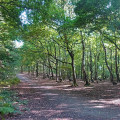
Final Push
Technical sheet
Creation:
Last update:
–
–
-
 Activity: Walking
 -
Distance: 18.58 km
-
Average duration: 5h 35
-
Difficulty: Not specified
-
-
Return to departure point: Yes
-
Vertical gain: + 82 m
-
Vertical drop: - 84 m
-
-
Highest point: 103 m
-
Lowest point: 49 m
-
Country: United Kingdom
-
District: Barnsley
-
Start/End: N 53.594652° / W 1.389738°
Waypoints
- S/E : km 0 - alt. 87 m - Start on Regina Crescent
- 2 : km 0.02 - alt. 86 m - Turn left
- 3 : km 0.06 - alt. 84 m - Turn right onto Clifton Gardens
- 4 : km 0.07 - alt. 83 m - Turn left onto Barnsley Road, A628
- 5 : km 0.81 - alt. 73 m - Keep right onto Barnsley Road
- 6 : km 0.84 - alt. 72 m - At roundabout, take exit 1 onto Southgate
- 7 : km 0.96 - alt. 79 m - Turn left onto Brierley Road
- 8 : km 1.02 - alt. 80 m - Turn right onto Beech Road
- 9 : km 1.06 - alt. 80 m - Turn left
- 10 : km 1.27 - alt. 79 m - Turn right onto High Street
- 11 : km 2.75 - alt. 60 m - Turn left
- 12 : km 2.99 - alt. 57 m - Turn left
- 13 : km 3.91 - alt. 52 m - Keep left
- 14 : km 4.17 - alt. 61 m - Turn right onto Lund Hill Lane, B6428
- 15 : km 4.46 - alt. 56 m - Turn right
- 16 : km 6.26 - alt. 66 m - Turn right onto Notton Lane
- 17 : km 6.49 - alt. 65 m - Turn left
- 18 : km 7.62 - alt. 55 m - Turn right onto Cold Hiendley Common Lane
- 19 : km 7.63 - alt. 55 m - Turn left
- 20 : km 7.65 - alt. 55 m - Turn left
- 21 : km 8.16 - alt. 54 m - Turn right
- 22 : km 8.17 - alt. 55 m - Turn right
- 23 : km 8.36 - alt. 62 m - Turn slight right
- 24 : km 8.92 - alt. 61 m - Turn right
- 25 : km 9.43 - alt. 64 m - Keep left onto Haw Park Lane
- 26 : km 9.73 - alt. 61 m - Turn left
- 27 : km 9.8 - alt. 61 m - Turn slight right
- 28 : km 9.81 - alt. 61 m - Keep left
- 29 : km 9.99 - alt. 59 m - Keep right onto Lakeside Walk
- 30 : km 11.34 - alt. 57 m - Turn right
- 31 : km 11.87 - alt. 61 m - Keep right
- 32 : km 14.46 - alt. 89 m - Turn right onto Cow Lane, B6428
- 33 : km 14.48 - alt. 89 m - Turn left
- 34 : km 14.64 - alt. 96 m - Turn right
- 35 : km 15.01 - alt. 94 m - Turn left onto Brier Lane
- 36 : km 15.87 - alt. 95 m - Keep left onto Brier Lane
- 37 : km 15.89 - alt. 95 m - At roundabout, take exit 1 onto George Street
- 38 : km 16.68 - alt. 73 m - Keep right onto Brierley Road
- 39 : km 18.09 - alt. 102 m - Turn right onto Cross Hill, A628
- S/E : km 18.58 - alt. 85 m
Other walks in the area
 Henswmorth Bypass to Anglers Country Park
Easy walk from Henswmorth Bypass to Anglers Country Park using mostly Wakefield Way.
 Anglers Country Park to Notton
Nice walk from Anglers Country Park to Notton passing by wood, hill and dam.
 The Wakefield Way
The Wakefield Way is a 70 mile walk around the Wakefield Metropolitan District. It takes the walker through attractive undulating countryside of fields and woodland, stretches of water, country estates, charming villages and unexpected views. The walk visits places of historical interest and sites of Wakefield’s industrial past.
 Notton and Newmillerdam Circular

This an easy, relatively flat circular walk south of Wakefield. It makes use of a disused railway line and the Newmillerdam Country Park - beautiful woodlands and rolling countryside.
 Notton to West Bretton Country Park
Lovely walk from Notton to West Bretton Country Park passing on some Wakefield Way section.
 Around Ackworth and Hessle
A circular walk around Ackworth. You'll pass The Dando Way, Brackenhill Quarries, Constitution Hill, Hessle Hall and Water Mill.
For more walks, use our search engine .
The GPS track and description are the property of the author. Do not copy them without permission.


