


 Country:
 City:
City:


Park in the car park opposite the town hall.
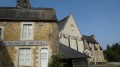
(S/E) Leave the car park by heading left to cross the Place de la Mairie and enter Rue Neuve. At the right-hand bend in Rue Neuve, continue straight ahead into Rue de l’Hormeau. You’ll see a beautiful property on the left, then another on the right after Ruelle du Port aux Vignerons.
Turn right just after the corner of the property and head towards the Sarthe.
(1) At the crossroads, note an information sign for the route indicating the actual starting point. Turn right to head towards the banks of the Sarthe through the gardens.
At the corner of Ruelle du Port aux Vignerons, continue along the riverside path that runs alongside the River Sarthe.
Carry on in this way until you reach the junction with Ruelle Louis Martin (the second alleyway).
(2) Carry on straight ahead along the path, which continues to follow the banks of the Sarthe. Further on, the path turns right onto a road that joins Rue du Port Joret.
When you reach it, turn left and follow Rue du Port Joret, then turn off onto a diagonal street leading to a road running parallel to the River Sarthe and Rue du Port Joret. Follow this road to the left for about fifty metres before turning right onto a gravel farm track that runs diagonally. There’s a lovely view of La Cadière on the left.
Shortly afterwards, the track turns southwards, veering to the right. Continue to the quarry and its large pond, which the track runs alongside on the western side.
(3) At the junction, turn right onto the road towards La Ganerie. The road winds its way and joins the D108.
Turn right and follow the D108 with care. You’ll reach Mon Idée after passing Lévèquerie on your left.
(4) Turn left onto the grassy, gravelly track leading to La Fassière. Continue along the gently ascending track. At the next crossroads, head right to join a road.
Turn left towards the hamlet of Les Cellières, where you’ll see a château on your right. (See the ‘During the walk’ section.)
In the hamlet, take in the stone houses. At the crossroads, turn left again onto a street which becomes a path after the last houses. You’ll see a well on the left-hand side at the right-angled bend in the road.
Continue along the stony path which passes two isolated houses before heading into the woods.
(5) Just after entering the woods, at a junction with a track on the right, turn right and continue along the edge of the woods on your right. About five hundred metres further on, turn right onto a better-maintained farm track. The track heads north towards a road.
Just before reaching this road, turn sharply left onto a track heading south-west, which leads to a junction with five roads and tracks known as Laroche-Planterose.
(6) Turn right to follow the road, which initially runs alongside a housing estate on the left-hand side. After a bend to the right, turn left, run alongside the property on the left-hand side and turn left again onto a track heading west.
A little further on, the track arrives near the hamlet of Planterose. Go round it on the right until you reach a T-junction.
Turn right and continue straight on until you reach an X-shaped crossroads at the hamlet of Le Bas Marais on the left (you’ll see a large farm to the west just before the crossroads).
(7) Ignore the path on the right and the one on the left, and carry on straight ahead. Further on, after a left-then-right turn, carefully cross a road and continue along the path heading due north.
A little further on, the track runs alongside a large plot of walnut trees on the right-hand side. The track gives way to a road.
Just past the shed, turn right onto a farm track, then onto a small shaded path, and continue to La Gourie.
(8) Turn right to follow aPR® path, pass alongside the Fellière estate and continue straight ahead along a grassy path until you reach a road. Turn left and carefully follow the road for barely a hundred metres, then turn right onto a gently sloping path that rejoins the X-shaped crossroads you passed earlier.
(7) Leave the two paths you took earlier and turn left onto thePR® path heading towards La Gandonnière, to the east. Continue along the road that has replaced the path, passing La Petite Gandonnière on your right.
(9) Just as the road bends to the left in front of the large farm at Sainte-Anne, take the track on the right which goes round the south side of the farm.
The track arrives at a place called Le Bas Lucé. Turn right onto the road leading towards La Cornillerie.
(10) When you reach the road known as Rue de la Vieille Cure, follow it down the gentle slope to the left (at an acute angle).
Just as the road begins to climb again, turn right onto a grassy path between two hedges. Follow it to La Lande Judas, just before the D108 road.
(11) At the junction with the D108, there is a wayside cross (in need of restoration). Turn left and follow the D108 road with care, passing the hamlet of La Croix (a solitary house), then turn right onto the first grassy track approximately three hundred and fifty metres after the solitary house. The path begins about thirty metres before Rue de la Poitevinière.
Follow it straight on until it joins Rue du Gravier. Turn left for about fifty metres, then right into Ruelle Louis Martin. Follow this until you reach the banks of the Sarthe.
(2) Turn left and follow the banks of the Sarthe along the same path you took on the way there.
When you reach Ruelle du Port aux Vignerons, turn left, follow it, then turn left again into Rue de l’Hourmeau. Continue straight on until you reach Rue Neuve, where you’ll come back to Place de la Mairie and the car park (S/E).


 Visorando Member
 Local authority
 Easy
Easy  Tourist office
