Pic Saint-Michel

A lovely winter hike through the undergrowth and along the forest edge. The Allières mountain hut is ideally situated for a drink before heading back to the car park.

Details

1030783
Creation:
Last update:
Last review:
  • Skiing
    Activity: Skiing
  • ↔
    Distance: 4.30 mi
  • ◔
    Duration according to the author: 3 hrs 
  • ▲
    Difficulty: Moderate

  • ⚐
    Back to start: Yes
  • ↗
    Ascent: + 2,195 ft
  • ↘
    Descent: - 2,188 ft

  • ▲
    Highest point: 6,355 ft
  • ▼
    Lowest point: 4,160 ft

Photos

Description of the walk

Park in the Les Barnets car park.

As this is a winter route, it does not necessarily follow the paths shown on the IGN map.

(S/E) Take the forest track that climbs gently towards the Chalet des Allières. Head due south to the refuge.

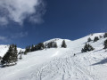
(1) Continue south for about 200 metres, then turn left into the forest. Follow the yellow markings on the signposted route until you emerge from the woods into the Vallon de Combe Oursière.

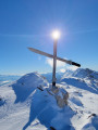
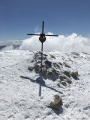
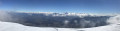
(2) Once out of the woods, head up the valley on the right (south-east) towards the summit. You’ll reach a small pass; continue up to the left – the summit cross is just a few metres away. From the summit, there’s a magnificent view of Grenoble, the Taillefer and the Belledonne.

(3) The return journey follows (more or less) the same route back to the car park (S/E).

Waypoints

  1. S/E : mi 0 - alt. 4,160 ft - Les Barnets car park - Furon (rivière)
  2. 1 : mi 0.83 - alt. 4,662 ft - Alliéres Mountain Hut - Refuge des Alliéres
  3. 2 : mi 1.43 - alt. 5,344 ft - Combe Oursière
  4. 3 : mi 2.25 - alt. 6,322 ft - Pic Saint-Michel (1,966 m) - Pic Saint Michel
  5. S/E : mi 4.3 - alt. 4,167 ft - Les Barnets car park

Notes

Please note: you must check the snow conditions before setting off.
The three essential items for snow safety are compulsory (avalanche transceiver, shovel and probe).

This route passes through multiple protected areas, which may be subject to special regulations:

Reviews and comments

5 / 5
Based on 2 reviews

Reliability of the description
5 / 5
Ease of following the route
5 / 5
Route interest
5 / 5
ECULLOIS JJ
ECULLOIS JJ ★

Overall rating : 5 / 5

Date of your route : Apr 04, 2026
Reliability of the description : ★★★★★ Very good
Ease of following the route : ★★★★★ Very good
Route interest : ★★★★★ Very good
Very busy route : Yes

A lovely walk through stunning scenery in glorious weather. Starting from the Barnets car park is particularly appealing as it allows you to ease into the walk gradually until you reach the Auberge des Allières (closed on 4 April – a shame...). After that, it’s steep all the way to Combe Oursière, but the view at this stage of the climb is well worth the effort: a magnificent landscape unfolds, allowing you to see all the way up to Pic St Michel. And what a view from the top!
It was very busy this Saturday, with ski tourers and cross-country skiers, snowshoe hikers, and joggers ...
The descent is brilliant as you can make your own tracks without getting in the way of other skiers, and the snow is lovely and powdery (around 1pm). The map on the app and your own route are very useful for staying on track and avoiding the slightly tricky terrain below the Combe Oursière ridge (steeper slopes and sometimes denser vegetation)
A lovely outing to recommend in good weather (the cross at the top hasn’t been replaced...)

Machine-translated

michel turca
michel turca

Overall rating : 5 / 5

Date of your route : Feb 11, 2021
Reliability of the description : ★★★★★ Very good
Ease of following the route : ★★★★★ Very good
Route interest : ★★★★★ Very good
Very busy route : Yes

The weather was lovely for this wonderful ski touring trip.
The area is truly beautiful. This hike is ideal for a first-time outing (weather permitting). The appeal of this hike lies in the wide choice of routes you can take. I must admit the guidebook wasn’t much use to me.
There are plenty of people on this mountain, but it’s not too crowded as there’s plenty of space to get your skis moving.
The peak is accessible on snowshoes. One of my mates had put them on so he could ski down on a monoski.
A lovely descent through the woods.

Machine-translated

For more walks, use our search engine .

The GPS track and description are the property of this route's author. Please do not copy them without permission.