


 Country:

 City:
City:


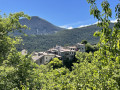
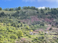
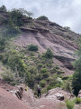
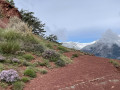
Park in the large car park behind the church in the village of La Croix-sur-Roudoule.
(S/E) From the car park, take the track heading off to the left, towards Léouvé. At marker 232, continue straight on along the track. Pass the Chapelle Saint-Arnoux, let the track curve to the right, and continue straight ahead on the path, then reach a telecoms mast at Saint-Sébastien.
(1) Continue down the slope, then climb slightly to reach the banks of the Roudoule River.
(2) Turn right onto the road, then, at marker 238, turn left to cross the river via the bridge. Follow the path which climbs to the hamlet of Léouvé, cutting across a few bends in the road.
(3) Then stay on the road, passing signposts 239 and 240. Shortly after this signpost, you’ll come to a path junction.
(4) Leave the road and take the path; after a long climb, you’ll reach marker 250 at the Col de Roua.
(5) Take the path on the right, heading due east, continue the climb, and arrive at Basse Mihubi.
(6) Continue straight ahead to complete the climb to Haute Mihubi, where marker 253 is located.
(7) Turn right and, via a series of ups and downs, reach the Torrent de Pra du Palud.
(8) Cross it, then continue along this undulating route to reach the Torrent d’Arlet.
(9) Ford the stream, then cross it again at a hairpin bend. Continue downhill, ford the Vallon des Tines, and reach the Vallon d’Inganel.
(10) Cross this stream, then turn right and head down the slope opposite to reach the Vallon du Serre Long.
(11) Complete the long descent, reaching the confluence of the Ruisseau de Bernette and the Vallon d’Albaréa.
(12) Begin the final ascent of this route to reach the Col du Mont junction, at marker 225.
(13) Turn 90° to the right onto the GR®510, marked in white and red. At the edge of the state-owned forest, reach a track junction.
(14) Keep to the right on the GR®, complete the descent to return to the car park at La Croix-sur-Roudoule (S/E).

 Visorando Member

 Moderate
 Association / Club / Walk leader
 Easy
Easy 
