


Vingio Parkas 5 Km
Details
Creation:
Last update:
–
–
-
 Activity: Walking
 -
 Distance: 3.13 mi
 -
 Average duration: 1h 30
 -
 Difficulty: Not specified
 -
-
 Back to start: Yes
 -
 Ascent: + 95 ft
 -
 Descent: - 95 ft
 -
-
 Highest point: 427 ft
 -
 Lowest point: 328 ft
-
 Start/End: N 54.690693° / E 25.241169°
 -


 Hour-by-hour weather


Waypoints
- S/E : mi 0 - alt. 331 ft - Continue onto Vingio parko tiltas
- 1 : mi 0.01 - alt. 328 ft - Turn left onto Taikos alÄ—ja
- 2 : mi 0.48 - alt. 364 ft - Turn right
- 3 : mi 0.49 - alt. 364 ft - Continue onto Sporto alÄ—ja
- 4 : mi 0.62 - alt. 367 ft - Turn right onto AvieÄių alÄ—ja
- 5 : mi 0.67 - alt. 351 ft - Continue
- 6 : mi 1.18 - alt. 351 ft - Turn slight left onto Taikos al.
- 7 : mi 1.78 - alt. 371 ft - Turn left
- 8 : mi 1.84 - alt. 381 ft - Turn sharp right onto Sporto alÄ—ja
- 9 : mi 2.13 - alt. 407 ft - Turn sharp right onto SaulÄ—tekio al.
- 10 : mi 2.14 - alt. 407 ft - Turn right onto Sporto alÄ—ja
- 11 : mi 2.47 - alt. 420 ft - Turn left onto Estrados alÄ—ja
- 12 : mi 2.54 - alt. 423 ft - Turn right onto Žibuoklių alėja
- S/E : mi 3.13 - alt. 331 ft
Other walks in the area
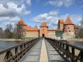
Trakai Island Castle, on the shores of Lake Galvė
 Visorando Member
 2.11 mi
+23 ft
-20 ft
1h 00
2.11 mi
+23 ft
-20 ft
1h 00
 Easy
Easy
On the shores of Lake Galvė, west of Vilnius, this circular route takes you around one of Lithuania’s most iconic sites: Trakai Island Castle, a red-brick Gothic fortress set on the water and connected to the mainland by long wooden footbridges. The route first heads up Karaimų Street, the historic heart of the Karaite community with its traditional wooden houses, before reaching the castle island and then a viewpoint offering a full view of the castle rising above the lake, before returning along the lakeshore. An easy stroll, combining heritage and water, ideal for a half-day in Trakai.
For more walks, use our search engine .
The GPS track and description are the property of this route's author. Please do not copy them without permission.

