


Tuesday 29th
Details
Creation:
Last update:
–
–
-
 Activity: Walking
 -
 Distance: 5.09 mi
 -
 Average duration: 2h 50
 -
 Difficulty: Not specified
 -
-
 Back to start: Yes
 -
 Ascent: + 564 ft
 -
 Descent: - 538 ft
 -
-
 Highest point: 1,171 ft
 -
 Lowest point: 659 ft
-
 Country:
United Kingdom
Country:
United Kingdom
-
 City:
Over Stowey
City:
Over Stowey -
 Start/End: N 51.136993° / W 3.19933°
 -


 Hour-by-hour weather


Waypoints
- S/E : mi 0 - alt. 1,024 ft - Start on Crowcombe Road
- 1 : mi 0.28 - alt. 1,007 ft - Keep left
- 2 : mi 0.45 - alt. 951 ft - Turn sharp left
- 3 : mi 0.86 - alt. 925 ft - Turn left
- 4 : mi 1 - alt. 866 ft - Keep right
- 5 : mi 1.3 - alt. 679 ft - Turn left
- 6 : mi 1.33 - alt. 669 ft - Keep right
- 7 : mi 1.35 - alt. 663 ft - Keep left
- 8 : mi 1.96 - alt. 938 ft - Turn right
- 9 : mi 2.17 - alt. 1,007 ft - Keep right
- 10 : mi 2.62 - alt. 1,017 ft - Keep left
- 11 : mi 2.62 - alt. 1,017 ft - Keep right
- 12 : mi 2.65 - alt. 1,007 ft - Keep right
- 13 : mi 2.84 - alt. 1,079 ft - Turn slight right
- 14 : mi 3.1 - alt. 1,024 ft - Keep left
- 15 : mi 3.23 - alt. 1,033 ft - Turn sharp left
- 16 : mi 3.26 - alt. 1,033 ft - Keep right
- 17 : mi 3.27 - alt. 1,033 ft - Turn right
- 18 : mi 3.6 - alt. 1,040 ft - Turn sharp left
- 19 : mi 3.8 - alt. 1,152 ft - Turn slight left
- 20 : mi 4.19 - alt. 1,168 ft - Keep left
- 21 : mi 4.23 - alt. 1,168 ft - Turn slight right
- 22 : mi 4.49 - alt. 1,099 ft - Turn slight left
- 23 : mi 4.5 - alt. 1,099 ft - Keep right
- 24 : mi 4.56 - alt. 1,089 ft - Turn sharp left
- 25 : mi 4.58 - alt. 1,086 ft - Turn sharp right
- 26 : mi 5.06 - alt. 1,030 ft - Turn slight left onto Crowcombe Road
- S/E : mi 5.09 - alt. 1,024 ft
Other walks in the area
Quantock Circular in Ramscombe Forest
 Association / Club / Walk leader
 3.82 mi
+525 ft
-531 ft
2h 15
3.82 mi
+525 ft
-531 ft
2h 15
 Moderate
 Departure from Over Stowey (Somerset)
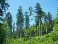
A circular walk through mixed woodland with some steep ascents.
Aisholt and Pepperhill Farm Circular
 4.92 mi
+689 ft
-705 ft
2h 50
4.92 mi
+689 ft
-705 ft
2h 50
 Easy
Departure from Over Stowey (Somerset)
Easy
Departure from Over Stowey (Somerset)
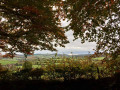
A circular walk through woodland and farmland with occasional lane walking, taking in part of the Quantock Greenway. There are fine views across The Somerset Levels and the Bristol Channel to the Mendips and Glastonbury Tor.
Plainfield to Wills Neck
 Visorando Member4.96 mi
+801 ft
-797 ft
3h 00
Moderate
Departure from Over Stowey (Somerset)
Visorando Member4.96 mi
+801 ft
-797 ft
3h 00
Moderate
Departure from Over Stowey (Somerset)
This walk in the Quantock Hills takes you to Wills Neck the highest point in this Area of Outsanding Natural Beauty. There is a sharp climb to start before you start to enjoy the extensive views.
Around & About Nether Stowey
 3.35 mi
+262 ft
-249 ft
1h 45
Not specified
Departure from Nether Stowey (Somerset)
3.35 mi
+262 ft
-249 ft
1h 45
Not specified
Departure from Nether Stowey (Somerset)
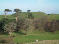
Starting from the centre of the village, this route makes a complete circuit of Nether Stowey with views over the village and the surrounding countryside and coast across to South Wales.
Nether Stowey and Fiddington
 5.12 mi
+180 ft
-180 ft
2h 30
Easy
Departure from Nether Stowey (Somerset)
5.12 mi
+180 ft
-180 ft
2h 30
Easy
Departure from Nether Stowey (Somerset)
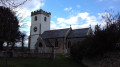
A circular walk through pastureland and country lanes to the tranquil village of Fiddington.
Nether Stowey to Holford and back
 8.01 mi
+1,316 ft
-1,296 ft
4h 50
Moderate
Departure from Nether Stowey (Somerset)
8.01 mi
+1,316 ft
-1,296 ft
4h 50
Moderate
Departure from Nether Stowey (Somerset)
A circular day walk to The Plough Inn at Holford over the Quantocks, taking in part of the Coleridge Way, Walford’s Gibbet and Holford Combe with fine views of the Somerset Coast. There are some lengthy climbs and descents. Can get muddy in places.
Through Nether Stowey, Friarn and Over Stowey
 3.56 mi
+518 ft
-502 ft
2h 05
Moderate
Departure from Nether Stowey (Somerset)
3.56 mi
+518 ft
-502 ft
2h 05
Moderate
Departure from Nether Stowey (Somerset)
A circular walk through pastureland, woodland and country lanes. Suitable for most weather conditions and seasons but stout footwear is essential. There are some stiles and two steep ascents.
For more walks, use our search engine .
The GPS track and description are the property of this route's author. Please do not copy them without permission.

