


Trailway
Details
Creation:
Last update:
–
–
-
 Activity: Walking
 -
 Distance: 14.24 mi
 -
 Average duration: 7h 05
 -
 Difficulty: Not specified
 -
-
 Back to start: Yes
 -
 Ascent: + 597 ft
 -
 Descent: - 574 ft
 -
-
 Highest point: 443 ft
 -
 Lowest point: 105 ft
-
 Country:
United Kingdom
Country:
United Kingdom
-
 City:
Blandford St. Mary
City:
Blandford St. Mary -
 Start/End: N 50.853579° / W 2.161696°
 -


 Hour-by-hour weather


Waypoints
- S/E : mi 0 - alt. 105 ft - Start on
- 1 : mi 0.17 - alt. 105 ft - Turn left
- 2 : mi 0.18 - alt. 105 ft - Turn left
- 3 : mi 0.19 - alt. 105 ft - Turn sharp right
- 4 : mi 0.22 - alt. 105 ft - Turn left
- 5 : mi 0.29 - alt. 108 ft - Turn left onto Blandford Bridge
- 6 : mi 0.44 - alt. 115 ft - Turn right onto New Road
- 7 : mi 0.6 - alt. 174 ft - Turn left
- 8 : mi 2.06 - alt. 358 ft - Turn slight right
- 9 : mi 2.84 - alt. 443 ft - Turn left onto Fair Mile Road
- 10 : mi 3.08 - alt. 423 ft - Turn right onto Lady Caroline's Drive
- 11 : mi 3.99 - alt. 384 ft - Turn left
- 12 : mi 5.12 - alt. 197 ft - Turn right
- 13 : mi 5.35 - alt. 207 ft - Keep right onto Ward's Drove
- 14 : mi 5.74 - alt. 200 ft - Turn right
- 15 : mi 6.14 - alt. 154 ft - Turn left onto Littleton Drove
- 16 : mi 6.16 - alt. 151 ft - Turn slight right
- 17 : mi 6.49 - alt. 135 ft - Turn left
- 18 : mi 6.49 - alt. 135 ft - Turn right
- 19 : mi 6.7 - alt. 128 ft - Turn right
- 20 : mi 6.85 - alt. 154 ft - Turn slight left
- 21 : mi 7.62 - alt. 253 ft - Turn left
- 22 : mi 8.08 - alt. 190 ft - Keep right
- 23 : mi 8.39 - alt. 299 ft - Turn left
- 24 : mi 8.4 - alt. 295 ft - Turn right
- 25 : mi 9.09 - alt. 295 ft - Turn left
- 26 : mi 11.07 - alt. 131 ft - Turn right
- 27 : mi 11.08 - alt. 135 ft - Turn sharp left
- 28 : mi 11.63 - alt. 115 ft - Keep left
- 29 : mi 12.26 - alt. 141 ft - Keep left
- 30 : mi 12.61 - alt. 151 ft - Keep left
- 31 : mi 13.44 - alt. 161 ft - Turn right onto Ward's Drove
- 32 : mi 13.63 - alt. 138 ft - Turn left onto Bournemouth Road, A350
- 33 : mi 13.8 - alt. 138 ft - Keep right onto Bournemouth Road, A350
- 34 : mi 13.82 - alt. 141 ft - At roundabout, take exit 3 onto Bournemouth Road
- 35 : mi 13.9 - alt. 135 ft - Keep right onto Bournemouth Road
- 36 : mi 13.91 - alt. 135 ft - At roundabout, take exit 2 onto Stour Park
- 37 : mi 13.96 - alt. 128 ft - At roundabout, take exit 2 onto Stour Park
- 38 : mi 13.98 - alt. 125 ft - Turn slight left onto Stour Park
- 39 : mi 14.11 - alt. 108 ft - Keep left
- 40 : mi 14.14 - alt. 108 ft - Turn right
- 41 : mi 14.16 - alt. 105 ft - Turn left
- S/E : mi 14.24 - alt. 105 ft
Other walks in the area
An exploratory ramble around Iwerne Minster
 Visorando Member3.62 mi
+240 ft
-233 ft
1h 50
Visorando Member3.62 mi
+240 ft
-233 ft
1h 50
 Easy
Easy
 Departure from Iwerne Minster (Dorset)
A gentle exploratory ramble along nearby footpaths with pleasant views. Nothing onerous.
Win Green & Tollard Royal
9.44 mi
+948 ft
-938 ft
5h 10
 Moderate
Departure from Donhead St. Mary (Wiltshire)
Moderate
Departure from Donhead St. Mary (Wiltshire)
A walk from Wiltshire's highest point and through the villages of Tollard Royal and Berwick St James
In Search of Kitt's Grave : in memory of Kay Chalk 1929 - 2019
9.14 mi
+666 ft
-669 ft
4h 45
Moderate
Departure from Martin (Hampshire)
A glorious walk in the hills between Martin Down and the Chalk Valley taking in Vernditch Chase, Marleycombe Hill, Church Bottom and Middleton Down Nature Reserve
Cerne Abbas circuit
3.07 mi
+459 ft
-453 ft
1h 50
Moderate
Departure from Cerne Abbas (Dorset)
A circular walk giving beautiful views over the surrounding countryside of rolling hills and meadows.
West Lulworth to Mupe Bay
3.86 mi
+856 ft
-866 ft
2h 30
 Difficult
Departure from West Lulworth (Dorset)
Difficult
Departure from West Lulworth (Dorset)
A wonderful peaceful walk to the hidden gem of Mupe Bay. Super coastal views and some nice hills too!
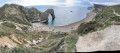
Lulworth Cove and Durdle Door
 2.07 mi
+505 ft
-502 ft
1h 25
Easy
Departure from West Lulworth (Dorset)
2.07 mi
+505 ft
-502 ft
1h 25
Easy
Departure from West Lulworth (Dorset)
Lulworth Cover and Durdle Door are two of the best known features of Dorset's Jurassic Coast. This short walk includes some uphill walking but the path is good and well graded.
For more walks, use our search engine .
The GPS track and description are the property of this route's author. Please do not copy them without permission.

