Tour of the Bois du Nouret in Pradelles-Cabardès

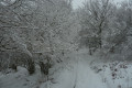
A short hike on the slopes of the Montagne Noire, very pleasant on snowshoes… and in any season.

Details

4517882
Creation:
Last update:
Last review:
  • Snowshoeing
    Activity: Snowshoeing
  • ↔
    Distance: 5.54 mi
  • ◔
    Duration according to the author: 3 hrs 
  • ▲
    Difficulty: Moderate

  • ⚐
    Back to start: Yes
  • ↗
    Ascent: + 758 ft
  • ↘
    Descent: - 778 ft

  • ▲
    Highest point: 3,448 ft
  • ▼
    Lowest point: 2,713 ft

Photos

Description of the walk

Park in the Grand’Rue car park near the church in Pradelles-Cabardès.

(S/E) With your back to the church, follow the Grand’Rue for just under a hundred metres, then turn right at the corner of a house to take a narrow path that leads to the Côte du Pech. Turn left and head for the D87, which climbs up to the Pic de Nore.

(1) Cross the road and follow the path opposite, which climbs through the woodland and passes close to the old ice houses.

(2) At the cross, carry on straight ahead across open ground on a relatively flat path, which is unshaded at first but then leads into the heart of the forest. After a descent, you’ll reach a forest track.

(3) Follow it straight on until you reach the first three-way junction. Keep to the right and walk for about 300 m.

(4) At this second three-way junction, leave the track and take a path diagonally to the right which climbs, marked ‘Pic de Nore’ on a small yellow sign. Note that it is often on this path that snow begins to appear or becomes quite deep, as it leads onto the north-western slope of the massif, which is more exposed to precipitation and receives less sunlight in winter.

The path climbs quite steeply at first, then becomes relatively flat or even slightly downhill until it reaches the stream.

(5) After the stream, the path climbs in two hairpin bends and then follows a ridge line to a flat area.

(6) At this point, turn right onto a path following the contour lines. Further on, the path descends at a slight angle and emerges at the foot of the Roc de Nouret at a junction of four paths.

(7) First turn right then left to begin the descent towards Pradelles, following the sign for “Cabane d’Hélène”.

(8) At the bottom, you’ll cross the RD87 again. Walk about twenty metres to the right, then take the small tarmac road that starts on the left with a hairpin bend and continues as a track. Keep to the right at the first junction, then turn sharply right at the second to head back towards the village.

(9) At the foot of the church, take a narrow path to the right between the houses to climb up to the church square. Continue straight on along the Grand’rue to return to the car park where you started (S/E).


Waypoints

  1. S/E : mi 0 - alt. 2,743 ft - Grand’Rue car park
  2. 1 : mi 0.16 - alt. 2,789 ft - D87
  3. 2 : mi 0.42 - alt. 2,897 ft - Cross
  4. 3 : mi 1.21 - alt. 2,844 ft - Forest track
  5. 4 : mi 2.09 - alt. 2,864 ft - Three-way junction, to the right
  6. 5 : mi 2.68 - alt. 2,949 ft - Rieu Cros
  7. 6 : mi 3.43 - alt. 3,442 ft - Fork in the road, turn right
  8. 7 : mi 3.87 - alt. 3,386 ft - Crossroads: turn right, then left
  9. 8 : mi 4.91 - alt. 2,848 ft - D87. Towards the - Arnette (rivière)
  10. 9 : mi 5.4 - alt. 2,713 ft - To the right, between the houses
  11. S/E : mi 5.54 - alt. 2,743 ft - Grand’Rue car park

Notes

This walk is suitable in all seasons, although some sections may be particularly wet.
If there is snow on all or part (north-facing slope) of the route, snowshoes are recommended. It is common for the south-facing village to have virtually no snow, whilst the second half of the route is covered in plenty.
This route is a slightly longer alternative to the ‘Tour de la Cabane d’Hélène’ marked in yellow and green.

(6) Alternative route: you reach the Pic de Nore by continuing the ascent to the left.

Worth a visit

At the start of the walk, you’ll pass close to the old ice houses: dug out and lined with stones, snow was piled up there to turn into ice, which was then transported to cafés in the major towns (Mazamet, Castres, Carcassonne, Toulouse) at a time when fridges didn’t exist.
At the end of the walk, during the final descent, you’ll pass by Hélène’s hut.

Reviews and comments

4.2 / 5
Based on 3 reviews

Reliability of the description
4.3 / 5
Ease of following the route
4 / 5
Route interest
4.3 / 5
ZITROERAILC
ZITROERAILC

Overall rating : 3.7 / 5

Date of your route : Oct 06, 2025
Reliability of the description : ★★★★☆ Good
Ease of following the route : ★★★☆☆ Average
Route interest : ★★★★☆ Good
Very busy route : No

Fortunately, we followed this route on the GPS, otherwise we would have made several mistakes.
The route is interesting with beautiful views. The path on the heights is very overgrown with ferns and broom, which leads us to believe that it is not very well used.

Machine-translated

rapid92
rapid92

Overall rating : 4.7 / 5

Date of your route : Nov 23, 2022
Reliability of the description : ★★★★★ Very good
Ease of following the route : ★★★★★ Very good
Route interest : ★★★★☆ Good
Very busy route : Yes

The little village of Labastide-en-Val is lovely for a walk – there’s a really beautiful viewpoint; I really enjoyed it

Machine-translated

PERRET Michel
PERRET Michel

Overall rating : 4.3 / 5

Date of your route : Jun 23, 2022
Reliability of the description : ★★★★☆ Good
Ease of following the route : ★★★★☆ Good
Route interest : ★★★★★ Very good
Very busy route : Yes

Machine-translated

For more walks, use our search engine .

The GPS track and description are the property of this route's author. Please do not copy them without permission.