


The Siabod Challenge
Details
Creation:
Last update:
–
–
-
 Activity: Walking
 -
 Distance: 22.51 mi
 -
 Average duration: 17h 00
 -
 Difficulty: Not specified
 -
-
 Back to start: Yes
 -
 Ascent: + 7,625 ft
 -
 Descent: - 7,608 ft
 -
-
 Highest point: 3,520 ft
 -
 Lowest point: 584 ft
-
 Country:
United Kingdom
Country:
United Kingdom
-
 Area: Snowdonia
 -
 City:
Capel Curig
City:
Capel Curig -
 Start/End: N 53.102156° / W 3.902245°
 -


 Hour-by-hour weather


Waypoints
- S/E : mi 0 - alt. 587 ft - Start on
- 1 : mi 0.01 - alt. 584 ft - Turn right
- 2 : mi 0.02 - alt. 584 ft - Turn right onto A5
- 3 : mi 0.52 - alt. 630 ft - Turn left onto A4086
- 4 : mi 0.53 - alt. 623 ft - Turn sharp right onto A4086
- 5 : mi 0.54 - alt. 630 ft - Turn left
- 6 : mi 0.55 - alt. 627 ft - Keep right
- 7 : mi 0.61 - alt. 646 ft - Keep right
- 8 : mi 0.73 - alt. 692 ft - Keep right
- 9 : mi 0.74 - alt. 696 ft - Keep left
- 10 : mi 0.74 - alt. 696 ft - Turn left
- 11 : mi 0.77 - alt. 712 ft - Keep right
- 12 : mi 4.32 - alt. 2,487 ft - Turn sharp left onto Miners' Track
- 13 : mi 4.34 - alt. 2,493 ft - Turn right
- 14 : mi 5.39 - alt. 2,982 ft - Keep left
- 15 : mi 7.91 - alt. 1,178 ft - Turn left onto Llanberis Pass, A4086
- 16 : mi 7.94 - alt. 1,178 ft - Turn right
- 17 : mi 7.96 - alt. 1,171 ft - Turn right
- 18 : mi 7.97 - alt. 1,168 ft - Turn right
- 19 : mi 8.01 - alt. 1,198 ft - Turn left
- 20 : mi 9 - alt. 1,864 ft - Turn slight right onto Pyg Track
- 21 : mi 10.56 - alt. 2,680 ft - Turn slight left onto Pyg Track
- 22 : mi 10.94 - alt. 3,241 ft - Turn left onto Llanberis Path
- 23 : mi 11.26 - alt. 3,491 ft - Turn left
- 24 : mi 11.28 - alt. 3,520 ft - Keep right
- 25 : mi 11.29 - alt. 3,520 ft - Turn slight left
- 26 : mi 11.32 - alt. 3,491 ft - Turn right onto Llanberis Path
- 27 : mi 11.63 - alt. 3,241 ft - Turn right onto Pyg Track
- 28 : mi 12.01 - alt. 2,680 ft - Turn right
- 29 : mi 12.18 - alt. 2,457 ft - Turn slight right onto Miners' Track
- 30 : mi 12.44 - alt. 1,991 ft - Turn slight left onto Miners' Track
- 31 : mi 15.43 - alt. 1,171 ft - Turn right
- 32 : mi 15.74 - alt. 951 ft - Keep left
- 33 : mi 16.35 - alt. 866 ft - Turn sharp right
- 34 : mi 16.35 - alt. 866 ft - Turn left onto Roman Road
- 35 : mi 16.38 - alt. 883 ft - Keep right
- 36 : mi 19.66 - alt. 2,844 ft - Turn left
- 37 : mi 19.67 - alt. 2,838 ft - Keep left
- 38 : mi 21.41 - alt. 981 ft - Keep left
- 39 : mi 21.57 - alt. 823 ft - Turn sharp right
- 40 : mi 22.2 - alt. 600 ft - Keep left
- 41 : mi 22.44 - alt. 587 ft - Turn right onto A5
- 42 : mi 22.49 - alt. 584 ft - Turn left
- 43 : mi 22.49 - alt. 584 ft - Turn left
- S/E : mi 22.51 - alt. 587 ft
Other walks in the area
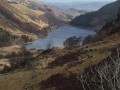
Crimpiau from Capel Curig
 Visorando Member
 3.77 mi
+945 ft
-955 ft
2h 35
3.77 mi
+945 ft
-955 ft
2h 35
 Moderate
 Departure from Capel Curig (Conwy)
The minor Snowdonia summit of Crimpiau provides an excellent walk from Capel Curig. The route crosses quite mountainous terrain and the view down Llyn Crafnant is one of the great panoramas in the area. Do make sure you are suitably equipped for this walk.
A circuit of Llyn Crafnant, near Trefriw
3.23 mi
+256 ft
-253 ft
1h 40
 Easy
Departure from Trefriw (Conwy)
Easy
Departure from Trefriw (Conwy)
This Snowdonia walk provides aeasy circuit of picturesque Llyn Tranant, a reservoir nestling in the Carneddau mountains. The route is easy to follow and provides some rugged scenery without to much effort. Ideal for a family walk and picnic.
Tryfan by the North Ridge from Ogwen Valley
2.13 mi
+1,880 ft
-1,880 ft
2h 35
 Difficult
Departure from Capel Curig (Conwy)
Difficult
Departure from Capel Curig (Conwy)
This challenging route to the summit of Tryfan is one the great walks and scrambles of Snowdonia. Starting from the Ogwen Valley, much of the ascent up Tryfan's north ridge involves the use of hands. In winter this route takes on a different character when ice and snow are present and should only be attempted by those experienced in winter mountaineering.
A Glyderau trio: Glyder Fach, Glyder Fawr and Tryfan
5.99 mi
+2,756 ft
-2,759 ft
5h 10
Difficult
Departure from Llandygai (Gwynedd)
This walk takes in the three key summits in the Glyders - Glyder Fach, Glyder Fawr and Tryfan. It also includes the Y Gribin ridge with its excellent opportunuties for scrambling. Do choose a fine day as the views are spectacular throughout.
A circuit of Llyn Idwal from Ogwen Cottage
2.60 mi
+328 ft
-328 ft
1h 30
Easy
Departure from Gwynedd
Llyn Idwal lies in a spectacular location under the Glyder Mountains in Snowdonia. This walk provides a mountain experience without too much effort walking through a rocky amphitheatre in the mountains.
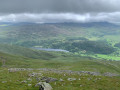
Snowdon and Y Lliwedd from Pen-y-pass
 6.93 mi
+2,717 ft
-2,713 ft
5h 35
6.93 mi
+2,717 ft
-2,713 ft
5h 35
 Very difficult
Departure from Beddgelert (Gwynedd)
Very difficult
Departure from Beddgelert (Gwynedd)
This Snowdonia walk starts from Pen-y-Pass and uses the Pyg Track towards the summit of Snowdon. The route then crosses Y Lliwedd to pick up the Miner's Track for the return to the start. Good navigational skills are essential when leaving Snowdon and because of this, the walk is recommended for experienced walkers only.
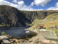
Melynllyn and Dulyn Reservoir from Llyn Eigiau parking
 5.61 mi
+974 ft
-981 ft
3h 25
Moderate
Departure from Caerhun (Conwy)
5.61 mi
+974 ft
-981 ft
3h 25
Moderate
Departure from Caerhun (Conwy)
This walk on the eastern side of the Carneddau mountains in Snowdonia offers a sense of solitude and excellent mountain scenery. The route is generally easy to follow although careful navigation is needed on the section from Dulyn Reservoir back to the start.
For more walks, use our search engine .
The GPS track and description are the property of this route's author. Please do not copy them without permission.

