The Sernhac tunnels

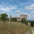
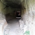
At Sernhac, south of Remoulins and Saint Bonnet du Gard, there are two tunnels that flank a small nice valley. The Perrotte and Cantarelles tunnels. Head through them to discover the chimneys by which men lowered equipment and raised the rubble during excavation. One can see traces of blows of pickaxes and holes for oil lamps. Today it is a quite popular place to find some shade and cool off for the villagers.

Technical sheet

103616
Creation:
Last update:
Last review:
  • Walking
    Activity: Walking
  • ↔
    Distance: 5.83 km
  • ◔
    Average duration: 2h 10 
  • ▲
    Difficulty: Easy

  • ⚐
    Return to departure point: Yes
  • ↗
    Vertical gain: + 167 m
  • ↘
    Vertical drop: - 165 m

  • ▲
    Highest point: 153 m
  • ▼
    Lowest point: 49 m

Photos

Description of the walk

Car park in Place de la Fontaine.

(S/E) Head towards the N86, cross it, pass the clock on the right heading along Rue de l’Hôtel de Ville. Then follow Rue de l’Église, go under the porch and head up the stepped path. After the fortified church, head right on a wide track (with views of St Bonnet) to the cross.

(1) In front of the cross veer right. After 600 m head up to the left between junipers and pines.

(2) Beneath Ferraud, continue straight towards Sernhac for a few metres to the Ferraud marker and head up to the left. Arrive on the ledge, cut across the trail and go straight (panoramic view). The trail descends into stiff gradient (take care) to a wall that we follow to the left.

(3) Continue left towards Chemin des Ronde and turn left off the path to cross the Perotte tunnel. On leaving the tunnel continue opposite, head down and then go up the stairs to reach the Cantarelles tunnel. Retrace your steps and reach Vallon marker on the right.

(4) Head to the right along the road in the direction of Dragonnet. Ignore Chemin des Olivettes on the right and continue straight to the village and the crossroads of Chemin des Anciens Combattants and Chemin des Déportés.

(5) Turn right and follow the GR6 to reach the Les Ormeaux and Sub Ferraud markings (2).
Head back to Saint-Bonnet by the path taken on the way out.

Waypoints

  1. S/E : km 0 - alt. 49 m - Place de la fontaine
  2. 1 : km 0.73 - alt. 93 m - Ferraud
  3. 2 : km 1.48 - alt. 113 m - Under Ferraud
  4. 3 : km 2.24 - alt. 81 m - Perrotte drovers' road
  5. 4 : km 2.84 - alt. 60 m - Le Vallon
  6. 5 : km 3.45 - alt. 71 m - Crossroads, Chemin de l'Aqueduc
  7. S/E : km 5.83 - alt. 49 m - Place de la fontaine

Practical information

The valley where the tunnel is located is an ideal place for a picnic. Maybe a little too busy for people looking for a little isolation in the high season, but ideal with children.

In the nearby area

To see on the way:
The washhouse, fountain and the fortified church of Saint-Bonnet. The Tunnels of Sernhac.

To see nearby:
Pont du Gard: Please note access to the Pont du Gard car park (on the right bank and left bank) costs 18 euros per vehicle no matter the time parked as of 2015.
The beautiful village of Castillon du Gard, the only town where you can see the Pont du Gard.

 Always stay careful and alert while following a route. Visorando and the author of this walk cannot be held responsible in the event of an accident during this route.

The GR® and PR® markings are the intellectual property of the Fédération Française de Randonnée Pédestre.

Reviews and comments

4.6 / 5
Based on 77 reviews

Reliability of the description
4.5 / 5
Clarity of route map
4.5 / 5
Route interest
4.7 / 5
REVIENDREZ
REVIENDREZ

Overall rating : 4.3 / 5

Date of walk : Jun 09, 2025
Reliability of the description : ★★★★☆ Good
Clarity of route map : ★★★★☆ Good
Route interest : ★★★★★ Very good
Busy trail : Yes

A short hike, but one that has everything a long hike has to offer!
A cool, shaded start, made remarkable by the fountain pools.
A magnificent hilltop village, a beautiful climb, a balcony trail with stunning views,
a steep descent (as indicated) that ends with a plunge into the Roman past.

Very pleasant with a light breeze accompanying us all the way.

Automatically translated

mallenches
mallenches

Overall rating : 5 / 5

Date of walk : Dec 01, 2024
Reliability of the description : ★★★★★ Very good
Clarity of route map : ★★★★★ Very good
Route interest : ★★★★★ Very good
Busy trail : Yes

easy and interesting circuit, correct signposting, to be recommended

Automatically translated

3852318198
3852318198

Overall rating : 4.3 / 5

Date of walk : Jun 10, 2024
Reliability of the description : ★★★★☆ Good
Clarity of route map : ★★★★☆ Good
Route interest : ★★★★★ Very good
Busy trail : Yes

GOOD TOUR BUT A BIT CONFUSING TO FIND THE TUNNELS

Automatically translated

michel.capval@gmail.com

Overall rating : 5 / 5

Date of walk : May 09, 2024
Reliability of the description : ★★★★★ Very good
Clarity of route map : ★★★★★ Very good
Route interest : ★★★★★ Very good
Busy trail : No

We set off from Serhnac and took the hike in reverse. The result is magnificent from every point of view. Made with children aged 9 and 14

Automatically translated

sylvie-chat
sylvie-chat

Overall rating : 5 / 5

Date of walk : Apr 04, 2024
Reliability of the description : ★★★★★ Very good
Clarity of route map : ★★★★★ Very good
Route interest : ★★★★★ Very good
Busy trail : No

very nice walk, i recommend it!
Followed the route with no problem using the app's GPS.

Automatically translated

jeancl84
jeancl84

Overall rating : 4.7 / 5

Date of walk : Apr 10, 2024
Reliability of the description : ★★★★★ Very good
Clarity of route map : ★★★★☆ Good
Route interest : ★★★★★ Very good
Busy trail : No

Hi, we did the route the wrong way round and despite following it in its entirety we walked 6.8 km?
The yellow markings are very good, but for octogenarians in good shape, it's quite sporty!
To be avoided in rainy weather.
very interesting

Automatically translated

jdl13
jdl13

Overall rating : 3 / 5

Date of walk : Mar 06, 2024
Reliability of the description : ★★☆☆☆ Disappointing
Clarity of route map : ★★☆☆☆ Disappointing
Route interest : ★★★★★ Very good
Busy trail : No

I can only confirm the previous opinion of 25 September 2023. The description is reliable up to point 2 where you reach a sign called "Sous Ferraud". The cairn is invisible because it is very small and completely overgrown. For the rest, it was impossible to find the paths that correspond to the loop. At point 2, we took the GR6 path up to the plateau and there was no other option but to descend to Sernhac along the GR6. It was impossible to find the path leading to point 3. In the end, a local hiker led us along unmarked paths to the Roman tunnel at Cantarelles. Then we found the Perrotte tunnel. In short, the loop from n°2 to n°4 is apparently impossible to find with the description, but the Roman site is remarkable and well worth the hike.

Automatically translated

IanCarlo30
IanCarlo30

Overall rating : 3 / 5

Date of walk : Sep 24, 2023
Reliability of the description : ★★☆☆☆ Disappointing
Clarity of route map : ★★☆☆☆ Disappointing
Route interest : ★★★★★ Very good
Busy trail : Yes

All I had was a description of the route, which no longer corresponded to the reality of the terrain and didn't allow me to do the route as indicated. Some of the hikers I met confirmed that the description was unreliable.

Automatically translated

J.Mounier
J.Mounier

Overall rating : 5 / 5

Date of walk : Dec 07, 2022
Reliability of the description : ★★★★★ Very good
Clarity of route map : ★★★★★ Very good
Route interest : ★★★★★ Very good
Busy trail : No

Very pleasant and well described route.
The picturesque village of St.Bonnet and the attraction of the Sernhac tunnels made this a very pleasant walk.

Automatically translated

nadmich
nadmich

Overall rating : 5 / 5

Date of walk : Nov 26, 2022
Reliability of the description : ★★★★★ Very good
Clarity of route map : ★★★★★ Very good
Route interest : ★★★★★ Very good
Busy trail : No

A very pretty, easy walk with some great views and the discovery of the 2 tunnels that tell us about the water route from Uzès to Nîmes in Roman times. Avoid the slightly slippery downhill section after rain.

Automatically translated

JL30
JL30

Overall rating : 5 / 5

Date of walk : Apr 30, 2022
Reliability of the description : ★★★★★ Very good
Clarity of route map : ★★★★★ Very good
Route interest : ★★★★★ Very good
Busy trail : No

I did this lovely walk on Sunday 1 May on a beautiful afternoon. After reading the comments about the steepness of the outward journey, I did the loop in the opposite direction, preferring to climb the steep slopes rather than descend them.... Thanks to the author of this beautiful walk. Jean-Louis

Automatically translated

sandrillon
sandrillon

Overall rating : 4.7 / 5

Date of walk : Feb 27, 2022
Reliability of the description : ★★★★★ Very good
Clarity of route map : ★★★★★ Very good
Route interest : ★★★★☆ Good
Busy trail : Yes

Hello
Quiet little hike, with a good climb and then a steep descent at the back, but not for long. Perfect for a refresher,
Bring good shoes.

Automatically translated

castillonaise
castillonaise

Overall rating : 4 / 5

Date of walk : Jan 31, 2022
Reliability of the description : ★★★★☆ Good
Clarity of route map : ★★★★☆ Good
Route interest : ★★★★☆ Good
Busy trail : No

The route is rated easy, but between points 2 and 3 there is a steep, stony climb and then a rather perilous descent.

Automatically translated

Izzza
Izzza
• Last modified:

Overall rating : 4 / 5

Date of walk : Jan 16, 2022
Reliability of the description : ★★★★☆ Good
Clarity of route map : ★★★★☆ Good
Route interest : ★★★★☆ Good
Busy trail : No

A pleasant historical walk, fun enough for children. Beware, the path is steep and rocky in places.

Automatically translated

KSQKMQ
KSQKMQ

Overall rating : 5 / 5

Date of walk : Nov 20, 2021
Reliability of the description : ★★★★★ Very good
Clarity of route map : ★★★★★ Very good
Route interest : ★★★★★ Very good
Busy trail : No

CLEAR

Automatically translated

Other walks in the area

For more walks, use our search engine .

The GPS track and description are the property of the author. Do not copy them without permission.