Park in the car park at the Place du Marché.
(S/E) Take Rue Bourg Riant and continue in the same direction along Avenue Danta Vittoria d'Alba. Pass the Grand Font wash-house on the right, in a small shady square.
(1) Turn left into Route de Misserand to reach the wash-house of the same name.
(2) Leave the road and turn left onto a path through a wooded area, before coming to a dead-end street. Turn right and continue along the track.
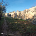
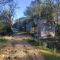
(3) Turn right and follow the remains of the Pont de la Lône aqueduct. Turn right onto a track and go straight on to the fork not far from the roundabout on the D19. Turn right onto Route de Misserand (D227).
(4) Go left, at the roundabout, cross the first road to your right, turn left, cross the road in front of you and follow the road for about 100 m.
(5) Turn right and follow the remains of the Pont Roupt aqueduct to the end. Follow the path as it bends to the left, skirting the arboretum before reaching a four-way junction.
(6) Turn right, following the white and red markings of the GR®6. Pass the Chapelle Saint-Pierre on your left and reach the crossroads at Bégude Saint-André, close to the D981.
(7) Turn left, then right at the next junction to return to the D981 at Bégude de Poulon.
(8) Cross the road with care, then turn left-right onto Chemin de la Bégude, which crosses the hamlet. Exit onto Chemin du Mouras, turn right, then left and pass the cemetery. Immediately afterwards, turn left onto Chemin de la Coopérative, as far as the crossroads. Turn right to reach the Font d'Isière wash-house.
(9) Turn left, then right, Rue de la Coste, and keep going until you reach the crossroads with Rue des Oliviers.
(10) Turn left into Chemin des Bracoules, join Chemin des Carrières and follow it left to the Pierre du Pont du Gard quarries.
(11) Continue straight ahead. Turn left at the Croix Sainte-Marie, then turn left onto Chemin du Puy de Mariargues and follow it to the end. Follow Route d'Argilliers to the right, and make a short detour to the right to see the water-wheel.
(12) Return to the road, keep right and turn right at the first crossroads. Ignore the Mas des Chèvres access road on the left, and go straight on to the four-way crossroads near the riding school.
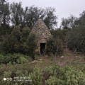
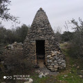
(13) Turn right for approx. 200 m, then left to reach a capitelle.
(14) Turn right, right again at a 90° angle and then left, also at 90°. Reach a crossroads near spot height 97 on the map.
(15) Turn left, then right, and follow the path in a straight line, passing two capitelles along the way. Exit Chemin du Mas de Séquier, turn left, then take the narrow path on the right before the quarry buildings. Join a wide white track.
(16) Turn left and follow this track, keeping the same direction, until you reach Rue de la Bergerie.
(17) Go straight ahead, then left on Rue de l'Aqueduc. Turn left on Rue du Murier, left again on Rue du Moulin à Vent and then right on Rue du Charron to reach the car park(S/E).


