


Spoke SFR 140724
Details
Creation:
Last update:
-
 Activity: Walking
 -
 Distance: 7.95 mi
 -
 Average duration: 3h 55
 -
 Difficulty: Not specified
 -
-
 Back to start: Yes
 -
 Ascent: + 276 ft
 -
 Descent: - 279 ft
 -
-
 Highest point: 436 ft
 -
 Lowest point: 299 ft
-
 Country:
United Kingdom
Country:
United Kingdom
-
 City:
Codicote
City:
Codicote -
 Start/End: N 51.848531° / W 0.221997°
 -


 Hour-by-hour weather


Waypoints
- S/E : mi 0 - alt. 335 ft
- 1 : mi 0 - alt. 335 ft - Turn sharp left
- 2 : mi 0.4 - alt. 312 ft - Turn left
- 3 : mi 0.61 - alt. 361 ft - Turn right onto Bury Lane
- 4 : mi 0.67 - alt. 361 ft - Turn sharp left
- 5 : mi 1.36 - alt. 358 ft - Turn left onto High Street
- 6 : mi 1.37 - alt. 358 ft - Turn left onto Whitwell Road
- 7 : mi 1.37 - alt. 358 ft - Turn right
- 8 : mi 2.31 - alt. 390 ft - Turn left onto Three Houses Lane
- 9 : mi 2.32 - alt. 390 ft - Make a U-turn onto Three Houses Lane
- 10 : mi 2.52 - alt. 400 ft - Turn sharp left
- 11 : mi 3.2 - alt. 427 ft - Turn left
- 12 : mi 3.2 - alt. 427 ft - Turn right
- 13 : mi 3.75 - alt. 344 ft - Turn right
- 14 : mi 4.01 - alt. 338 ft - Turn right
- 15 : mi 4.68 - alt. 351 ft - Turn right
- 16 : mi 4.9 - alt. 381 ft - Keep right
- 17 : mi 5.11 - alt. 377 ft - Turn sharp left
- 18 : mi 5.29 - alt. 410 ft - Keep right
- 19 : mi 5.76 - alt. 397 ft - Turn left onto Park Lane
- 20 : mi 5.98 - alt. 417 ft - Turn right
- 21 : mi 6.19 - alt. 404 ft - Turn right
- 22 : mi 6.47 - alt. 410 ft - Turn right
- 23 : mi 6.54 - alt. 410 ft - Turn right onto Slip Lane
- 24 : mi 6.59 - alt. 407 ft - Turn sharp left
- 25 : mi 6.85 - alt. 407 ft - Turn left onto Sally Deards Lane
- 26 : mi 6.92 - alt. 400 ft - Turn right
- 27 : mi 7.55 - alt. 312 ft - Turn sharp left
- 28 : mi 7.95 - alt. 335 ft - Turn sharp right onto Rabley Heath Road
- S/E : mi 7.95 - alt. 335 ft
Other walks in the area
Knebworth
 Visorando Member
 4.99 mi
+190 ft
-190 ft
2h 30
4.99 mi
+190 ft
-190 ft
2h 30
 Easy
Easy
 Departure from Knebworth (Hertfordshire)
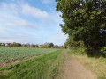
A walk around Knebworth taking in Rabley Heath nature reserve.
A short circular walk that includes a section through woodland of Rabley Heath Nature Reserve. Refreshments can be found at The Robin Hood and The Lytton Arms which has a large selection of real ales.
Kimpton Farmland and Nature, Chilterns
 Association / Club / Walk leader
 5.40 mi
+295 ft
-322 ft
2h 45
Easy
Departure from Kimpton (Hertfordshire)
5.40 mi
+295 ft
-322 ft
2h 45
Easy
Departure from Kimpton (Hertfordshire)
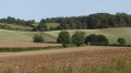
The parish of Kimpton is criss-crossed by an extensive of public rights of way, some of them dating from
pre-Roman times. This walk explores the farmland north of the village which is rich in wildlife and there are
outstanding views.
Ayot St Lawrence
 5.47 mi
+243 ft
-240 ft
2h 45
Easy
Departure from Kimpton (Hertfordshire)
5.47 mi
+243 ft
-240 ft
2h 45
Easy
Departure from Kimpton (Hertfordshire)
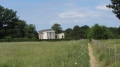
Explore the landscape and history of a special corner of Hertfordshire. Starts in Kimpton and includes two 12th century churches, a neoclassical church, a park designed by Capability Brown and the house of a famous playwright and author.
Cuckolds Cross and Whitwell from St Paul's Walden
 6.86 mi
+312 ft
-322 ft
3h 25
6.86 mi
+312 ft
-322 ft
3h 25
 Moderate
Departure from St Paul's Walden (Hertfordshire)
Moderate
Departure from St Paul's Walden (Hertfordshire)
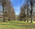
This Hertfordshire walk mainly uses old green lanes to go through a varied landscape of fields, woods and hedgerows to arrive at the Holt and then by footpaths to Cuckolds Cross. After that there is a section of larger arable fields where you join the Hertfordshire Way to reach Whitwell, an expanded village with an interesting older centre. The final leg passes through a rare breeds farm and The Bury, birthplace of the late Queen Mother.
Around St Pauls Walden
 5.86 mi
+295 ft
-289 ft
2h 55
Easy
Departure from Langley (Hertfordshire)
5.86 mi
+295 ft
-289 ft
2h 55
Easy
Departure from Langley (Hertfordshire)
A circuit around the village of St Paul’s Walden passing through some of the finest woodland in the North Chilterns and the picturesque parkland surrounding the grand houses of Stagenhoe and St Paul’s Walden Bury. The bluebells in Hitch Wood are spectacular in spring!
Preston and Hitch Wood, Chilterns
3.16 mi
+171 ft
-154 ft
1h 35
Moderate
Departure from Preston (Hertfordshire)
A short circuit from Preston village through Hitch Wood, one of the finest woods in the North Chilterns. Worth following for spectacular bluebells in spring or as a pre-pub leg stretch.
Preston and Breachwood Green
 7.28 mi
+413 ft
-430 ft
3h 40
Moderate
Departure from Preston (Hertfordshire)
7.28 mi
+413 ft
-430 ft
3h 40
Moderate
Departure from Preston (Hertfordshire)
A walk through delightful North Hertfordshire countryside featuring well cared-for historic villages and hamlets, linked by fields and woods. There are interesting buildings including a restored windmill.
Preston, Dead Woman's Lane and Wain Wood
 3.00 mi
+79 ft
-79 ft
1h 25
Easy
Departure from Preston (Hertfordshire)
3.00 mi
+79 ft
-79 ft
1h 25
Easy
Departure from Preston (Hertfordshire)
A short circular walk from Preston village via Dead Woman's Lane and Wain Wood. An easy route using scenic green lanes and good footpaths. Ideal as an evening stroll or to work up an appetite for lunch.
For more walks, use our search engine .
The GPS track and description are the property of this route's author. Please do not copy them without permission.

