




You can start anywhere in the town of Port Elizabeth or take a taxi to the nearest point on the trail. The starting point chosen here is on Back Street.
(S/E) Follow Back Street, which becomes Belmont Road further on. The small road with no pavement or shoulder winds its way between the houses.
(1) Leave the access road to Princess Margaret Bay on your right and stay on Belmont Road.
(2) Negotiate the left-hand bend, staying on the same road, and follow Friendship Bay.
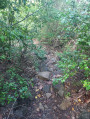
(3) Leave the road on the right and follow a small path that climbs quite steeply: there are a few signs indicating the start of the path, then the route is marked with white marks or arrows on the rocks. The trail begins in dry vegetation (tall grass). The path is clearly visible, and you just need to follow it to avoid taking a secondary path that would not lead to Ma Peggy. After that, you enter fairly dense vegetation, but the path is still clearly visible.
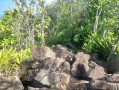
(4) Look for the small path that branches off to the right, which you will take on the way down: a rock with small cairns marks the start. Continue straight ahead. The end of the trail leading to the viewpoint consists of large rocks that you have to climb over and step over near cacti.
(5) Retrace your steps to the fork you spotted on the way up.
(4) Turn left. Keep a close eye on the trail as there are secondary paths. The path descends quite steeply, also with rocks. Sometimes you will need to use tree trunks or roots for support. The end of the small path ends at the entrance to private property (under construction in 2026). A sign shortly before indicates that you must turn right to avoid entering the property and thus reach the concrete road.
(6). Follow this road, which descends quite steeply before reaching Lower Bay Beach. Walk along this beach and join Lower Bay Road.
(7) Turn left to cross Princess Margaret Beach, then follow the coastal path called Princess Margaret Trail. You will come out on Front Street and return to the starting point on Back Street (S/E).
 Visorando Member
 Very difficult
