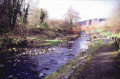
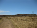
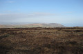
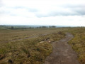
This walk takes you around the highest points of Slievenacloy Nature Reserve. Experience the wild heathland & awesome views over the Belfast Hills, the Sperrins & even Scotland! Much of this walk is accessible by all.
Start : Off the Ballycollin Road/ Flowbog Road, Slievenacloy Nature Reserve, Flowbog Rd, Lisburn (BT28 3TE)
(S/E) Walk West from the farmhouse following the surfaced track and the blue skylark waypoint markers. At the end of the lane is a viewpoint.
(1) From here turn right and walk North-East through the kissing gate into the field. Follow the fenceline North around the edge of the field until you reach a pedestrian gate.
(2) From this gate follow the fenceline to the left, by turning right (South-East), emerging through a kissing gate to a second viewpoint.
(3) From here, turn right and follow the surfaced track South-East, turning right back towards the farm buildings at the junction. (S/E)
Waypoints
S/E : mi 0 - alt. 909 ft - Slievenacloy Nature Reserve
1 : mi 0.35 - alt. 886 ft - Viewpoint 1
2 : mi 0.9 - alt. 971 ft - Pedestrian gate
3 : mi 1.17 - alt. 925 ft - Viewpoint 2
S/E : mi 1.4 - alt. 909 ft - Slievenacloy Nature Reserve
Notes
Start : Off the Ballycollin Road/ Flowbog Road, Slievenacloy Nature Reserve, Flowbog Rd, Lisburn (BT28 3TE)
Parking : Visitors should park where they can find a safe spot, for example across one of the double gates at the start of the path leading to the derelict farmhouse, leaving space for tractor access.
To open this route on your smartphone, you must have the Visorando app installed. If not, got to the Apple Store (iPhone) or Google Play Store (Android) to download the app.



 Country:
 City:


 Tourist office