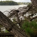
Saint-Suliac, North point

A lovely walk around the northern tip of Saint-Suliac. Do it whatever the weather!

Moderator's note as of 06/04/2021: Some modifications on the ground since the creation of this hike: see the comments at the bottom of this page.
Moderator's note a description of June 2022 in reverse order to this one is available here

Technical sheet

50634562
Creation:
Last update:
Last review:
  • Walking
    Activity: Walking
  • ↔
    Distance: 6.39 km
  • ◔
    Average duration: 1h 55 
  • ▲
    Difficulty: Easy

  • ⚐
    Return to departure point: No
  • ↗
    Vertical gain: + 46 m
  • ↘
    Vertical drop: - 51 m

  • ▲
    Highest point: 40 m
  • ▼
    Lowest point: 5 m

Description of the walk

_ Start _: At the top of Saint-Suliac (La Ville Neuve). Easy parking outside tourist season.

(S/E) Follow the road towards the ocean (west), leaving the houses on your left, then continue on the path in its continuation as far as La Vierge. The path bends slightly to the left.

(1) Go downhill under the chapel, turn right and follow the path with the Rance on your left, following the yellow markers. Walk along the coast, between beach and path depending on the tide, to the Pointe de Garel, then on the path only to the Pointe du Puits: ''an ideal place to take a break with a beautiful view.

(2) Continue North-East on the path to the fishponds. Walk along them to the beach, then along the beach to rejoin the path a little further on.

(3) Follow this path quickly to get past the smell of the sewage treatment plant... Return to the end of the bay, with a view of the old Beauchet tide mill.

(4) Continue right on the D117 through Saint-Suliac to the harbour.

(5). Take the dike on the right to the end and continue along the beach. A path leads up to the Vierge.

(1) Return to the car park, following the path in the opposite direction (S/E).

Waypoints

  1. S : km 0 - alt. 36 m - Top of Saint-Suliac(La Ville Neuve)
  2. 1 : km 0.43 - alt. 31 m - Downhill under the chapel - Rance (fleuve)
  3. 2 : km 2.06 - alt. 19 m - Pointe du Puits
  4. 3 : km 3.23 - alt. 7 m - Small way at the end of the beach
  5. 4 : km 4.82 - alt. 5 m - D117 road
  6. 5 : km 5.88 - alt. 7 m - Port de Saint-Suliac (Harbor)
  7. E : km 6.39 - alt. 31 m - Top of Saint-Suliac(La Ville Neuve)

Practical information

_ Start _: At the top of Saint-Suliac (La Ville Neuve). Easy parking outside tourist season.

_ Please note _: easy terrain, a bit of sand and a few passages near the water or with feet in the water at high tide... for the unwary (check tide times).
Already done with young children.

_ Equipment _: for big-wheeled baby carriages, a few difficult sections. Avoid small strollers.

_ Warning : Odours at the wastewater treatment plant, depending on wind direction.

In the nearby area

Other walks in the area

For more walks, use our search engine .

The GPS track and description are the property of the author. Do not copy them without permission.