


Pilgrim's Way Day 4 - Sevenoaks - Rochester
Details
Creation:
Last update:
–
–
-
 Activity: Walking
 -
 Distance: 21.56 mi
 -
 Average duration: 11h 20
 -
 Difficulty: Not specified
 -
-
 Back to start: No
 -
 Ascent: + 1,677 ft
 -
 Descent: - 1,883 ft
 -
-
 Highest point: 709 ft
 -
 Lowest point: 13 ft
-
 Country:
United Kingdom
Country:
United Kingdom
-
 City:
Sevenoaks
City:
Sevenoaks -
 Start: N 51.276835° / E 0.182006°
 -
 End: N 51.372446° / E 0.479831°
 -


 Hour-by-hour weather


Waypoints
- S : mi 0 - alt. 308 ft - Continue
- 1 : mi 0.05 - alt. 322 ft - Turn sharp left onto London Road, A224
- 2 : mi 0.44 - alt. 282 ft - Turn right
- 3 : mi 0.48 - alt. 282 ft - Continue onto Uplands Close
- 4 : mi 0.58 - alt. 308 ft - Turn right onto Uplands Way
- 5 : mi 0.74 - alt. 308 ft - Turn right onto Shoreham Lane
- 6 : mi 0.82 - alt. 299 ft - Turn left onto Church Field
- 7 : mi 0.84 - alt. 295 ft - Turn left
- 8 : mi 0.96 - alt. 249 ft - Turn right onto London Road, A25
- 9 : mi 1.01 - alt. 243 ft - Continue onto London Road, A224
- 10 : mi 1.25 - alt. 233 ft - Turn slight right
- 11 : mi 1.35 - alt. 230 ft - Turn slight right onto London Road, A224
- 12 : mi 1.72 - alt. 269 ft - Turn slight right
- 13 : mi 1.79 - alt. 272 ft - Turn right onto London Road, A224
- 14 : mi 2.17 - alt. 302 ft - Turn right onto London Road
- 15 : mi 2.31 - alt. 299 ft - Turn right
- 16 : mi 2.83 - alt. 312 ft - Continue onto Telston Lane
- 17 : mi 3.36 - alt. 223 ft - Turn right onto Pilgrims Way West, C296
- 18 : mi 3.56 - alt. 194 ft - Continue onto High Street
- 19 : mi 3.95 - alt. 220 ft - Continue onto West High Street
- 20 : mi 3.97 - alt. 220 ft - Turn slight left onto A225
- 21 : mi 4 - alt. 223 ft - Turn slight left onto Station Road, A225
- 22 : mi 4.29 - alt. 285 ft - Continue
- 23 : mi 4.33 - alt. 295 ft - Turn right onto Pilgrims Way East, C261
- 24 : mi 4.38 - alt. 315 ft - Turn left
- 25 : mi 4.44 - alt. 364 ft - Continue onto North Downs Way
- 26 : mi 5.06 - alt. 663 ft - Continue onto Birchin Cross Road, C289
- 27 : mi 5.16 - alt. 673 ft - Turn right onto North Downs Way
- 28 : mi 5.48 - alt. 676 ft - Turn right
- 29 : mi 5.55 - alt. 682 ft - Turn right onto North Downs Way
- 30 : mi 5.7 - alt. 630 ft - Continue
- 31 : mi 5.74 - alt. 571 ft - Turn sharp left onto North Downs Way
- 32 : mi 6 - alt. 643 ft - Continue
- 33 : mi 6.01 - alt. 646 ft - Turn slight right onto North Downs Way
- 34 : mi 6.87 - alt. 620 ft - Continue onto Cotman's Ash Lane
- 35 : mi 6.92 - alt. 646 ft - Turn right onto North Downs Way
- 36 : mi 8.14 - alt. 486 ft - Turn sharp left onto Pilgrims Way
- 37 : mi 9.68 - alt. 472 ft - Turn sharp right onto Battlefields
- 38 : mi 9.69 - alt. 472 ft - Turn right onto Pilgrims Way
- 39 : mi 10.11 - alt. 479 ft - Continue
- 40 : mi 10.16 - alt. 502 ft - Turn right onto Pilgrims Way
- 41 : mi 11.26 - alt. 453 ft - Turn slight left onto Hognore Lane
- 42 : mi 11.79 - alt. 686 ft - Turn right onto Vigo Hill, C22
- 43 : mi 11.9 - alt. 666 ft - Turn slight left
- 44 : mi 14.44 - alt. 351 ft - Turn left onto North Downs Way
- 45 : mi 14.79 - alt. 558 ft - Turn slight left onto Holly Hill
- 46 : mi 15.29 - alt. 574 ft - Turn slight left
- 47 : mi 16 - alt. 495 ft - Turn right onto North Downs Way
- 48 : mi 17.91 - alt. 285 ft - Continue
- 49 : mi 18.77 - alt. 89 ft - Turn slight right onto Upper Bush Road
- 50 : mi 18.8 - alt. 79 ft - Turn slight right
- 51 : mi 19.04 - alt. 49 ft - Turn right onto Bush Road
- 52 : mi 19.07 - alt. 46 ft - Turn left
- 53 : mi 19.84 - alt. 236 ft - Continue onto N
- 54 : mi 20 - alt. 220 ft - Turn right
- 55 : mi 20.38 - alt. 144 ft - Turn left onto Sundridge Hill, A228
- 56 : mi 20.4 - alt. 151 ft - Turn right
- E : mi 21.56 - alt. 105 ft
Other walks in the area
Shoreham Station (Kent) to Westmore Green
 Visorando Member11.21 mi
+1,020 ft
-541 ft
6h 05
Visorando Member11.21 mi
+1,020 ft
-541 ft
6h 05
 Moderate
Departure from Shoreham (Kent)
Moderate
Departure from Shoreham (Kent)
Follow Darent Valley Path across Darent Valley Golf Club. Join the North Downs Way & also soon rejoin the Darent Valley Path. At Dunton Green say goodbye to the Darent Valley Path for the last time. We divert from the North Downs Way to take in Chevening Church and Park. Follow the Pilgrims Way along narrow country lanes, then back onto the North Downs Way, before diverting along the Tandridge Border Path thru' Park Wood Golf Club and finish at Westmore Green.
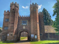
River Darent, Kent
 4.39 mi
+10 ft
-135 ft
2h 00
4.39 mi
+10 ft
-135 ft
2h 00
 Easy
Departure from Shoreham (Kent)
Easy
Departure from Shoreham (Kent)
The River Darent Walk from Shoreham to Eynsford is the ideal weekend walk. This easy and gentle stroll in the Kent countryside takes you from a walk alongside the River Darent, passing through corn and lavender fields, a Castle, a Farm Shop and even a Viaduct, with a meal in a local traditional British pub at the end.
Bore Place to Little Brown Jug Pub
 Tourism professional4.94 mi
+118 ft
-131 ft
2h 25
Easy
Departure from Chiddingstone (Kent)
Tourism professional4.94 mi
+118 ft
-131 ft
2h 25
Easy
Departure from Chiddingstone (Kent)
This is a circular walk but is described in two sections, so you can choose to just walk to or from the Little Brown Jug, rather than doing the whole loop. Nothing beats the promise of a cosy pub after a bracing walk in the Kent countryside. This gentle walk boasts the choice of two pubs within an hour on foot of Bore Place, using the network of public footpaths and bridleways. The walk takes in classic Low Weald landscape with its patchwork of arable fields and grazing pastures.
Bore Place - Green Trail
1.42 mi
+52 ft
-52 ft
0h 40
Easy
Departure from Chiddingstone (Kent)
The Bore Place farm walks weave their way through the fields and woodlands of the 500-acre organic dairy farm, offering panoramic views across this Area of Outstanding Natural Beauty. The trails start and finish at the Bore Place car park and are waymarked by colour-coded directional discs and tall oak posts with painted lines at the top.
Bore Place - Red Trail
2.73 mi
+184 ft
-167 ft
1h 25
Easy
Departure from Chiddingstone (Kent)
The Bore Place farm walks weave their way through the fields and woodlands of the 500-acre organic dairy farm, offering panoramic views across this Area of Outstanding Natural Beauty. The trails start and finish at the Bore Place car park and are waymarked by colour-coded directional discs and tall oak posts with painted lines at the top.
Bore Place - Blue Trail
1.34 mi
+75 ft
-92 ft
0h 40
Easy
Departure from Chiddingstone (Kent)
The Bore Place farm walks weave their way through the fields and woodlands of the 500-acre organic dairy farm, offering panoramic views across this Area of Outstanding Natural Beauty. The trails start and finish at the Bore Place car park and are waymarked by colour-coded directional discs and tall oak posts with painted lines at the top.
Bore Place to Bough Beech Reservoir
3.77 mi
+226 ft
-203 ft
1h 55
Easy
Departure from Chiddingstone (Kent)
This circular walk guides the keen wildlife watcher and enthusiast to some of the best local spots to see special species like the nightingale. The farmland of Bore Place extends almost to Bough Beech Reservoir where it meets the nature reserve. Well-connected areas of good habitat encourage plants, fungi and animals to survive and thrive.
Bore Place to Greensand Way
 7.57 mi
+486 ft
-502 ft
3h 55
Easy
Departure from Chiddingstone (Kent)
7.57 mi
+486 ft
-502 ft
3h 55
Easy
Departure from Chiddingstone (Kent)
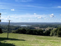
This circular walk leads you up onto the Greensand Way where breathtaking views await. From here it loops round, passing the picturesque 14th-century Wickhurst Manor through the village of Sevenoaks Weald and across rolling farmland before returning to the start point.
For more walks, use our search engine .
The GPS track and description are the property of this route's author. Please do not copy them without permission.

