Start: Start from Place du Champ de Foire, Anost (hiking map). Parking along the square, at the foot of the Maison des Galvachers (ecomuseum), or behind the square.
No waymarkers
(S/E) At the hiking map board, follow the sign for "AN4 Les Grelodots". Leaving the town hall on your left, go north up the Grande Rue des Galvachers and ignore the Rue de l'Église on your right.
Yellow, red and white markings
At the next junction (signposted), join the GR®13 and follow it to the left, Rue du Docteur Roy in the direction of Les Grelodots (written "Grelaudots" on the road sign).
(1) At the T-junction, note a sign opposite, in a private garden, reading "Les Grelodots" in the same format as the street signs in larger towns (this will be a landmark on the way back). Turn left down the street. At the "Stop at 150m" sign, turn right onto a downhill path. At the bottom, continue along the roadside and cross the bridge over the Ruisseau du Chênelet. After a few metres, at the end of the bend, leave the road and turn right onto a track that enters the woods (ignore a very steep path on the left).
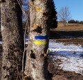
Yellow markings
(2) At the next fork in the path, leave the GR®°13 to the left and take the right-hand path under a canopy of young trees. Cross a stream (not shown on the IGN map) and turn left, following the stream on your left. Move away from the stream and climb up in the shade of the birch trees. At the T-junction, turn right onto a wider path in a fir grove. Ignore some trailheads to the right, then to the left, and descend to find the Ruisseau du Chênelet.
(3) Ford the stream and, at the crossroads immediately after, turn right. Follow a more or less level path through undergrowth, with a meadow on your right. At a fork, turn left, still with a meadow on your right. Ford a second stream. Go straight up between two hedges and come to a T-junction.
(4) Turn left and temporarily follow the red and white GR®°13 markings. After less than a hundred metres, leave the GR® and turn right onto a narrow, grassy path. Be careful, the start of this path is very discreet (red and white crosses on this path, yellow crosses on the GR® beyond the fork). A little further on, the path gives way to a wide track. Climb steeply and steadily, first North-North-West, then north, ignoring some side paths. Reach a junction with a forest track (white barrier on the left).
(5) Turn right (East). After a few hundred metres, leave the track and turn right onto a good path, still under fir trees. Keeping heading South-East, climb gently, go flat and then descend gently again. As the slope steepens, note a signpost on the right-hand side.
(6) Turn right onto the grassy path towards Notre-Dame d'Aillant and quickly reach the statue looking towards Anost (viewpoint). Retrace your steps to the crossroads.
(6) Turn right and continue steeply downhill. Turn right with the path, then left as you leave the woods. Follow a plot of future Christmas trees on your right. Cross the D2 road (take care) and continue along the track opposite. At the next junction, take the small road on the right, then ignore the street on the left. Cross the D2 again (with care) and continue straight ahead on the Chemin de la Croix de Joux (follow the red and white signs). At the fork in the road, ignore the cul-de-sac on the right and turn left.
No waymarkers
(7) At the crossroads, leave the signposted path and follow the D2 (busy road, to be avoided) and take the first right, Rue des Grelodots. Follow the street to Les Grelodots (signposted on the right).
Red yellow and white markings
(1) Turn left into Rue du Docteur Roy.
No waymarkers
At the next junction, turn right, then right again to return to Place du Champ de Foire(S/E).


