Monte Renoso

A lovely snowshoe hike starting from the Ghisoni ski resort in Corsica and leading to the summit of Monte Renoso.

Details

31044497
Creation:
Last update:
Last review:
  • Snowshoeing
    Activity: Snowshoeing
  • ↔
    Distance: 4.45 mi
  • ◔
    Duration according to the author: 4 hrs 
  • ▲
    Difficulty: Moderate

  • ⚐
    Back to start: Yes
  • ↗
    Ascent: + 2,221 ft
  • ↘
    Descent: - 2,221 ft

  • ▲
    Highest point: 7,707 ft
  • ▼
    Lowest point: 5,482 ft
  • ⚐ Country: France
  • ⚐ City: Ghisoni (20227)
  • ⚑
    Start/End: N 42.077272° / E 9.147233°
  • ❏
    IGN map(s): Ref. 4252OT, 4252OTR
  • Hour-by-hour weather

Photos

Description of the walk

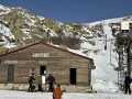
Parking is available in the car park at the top of the Ghisoni ski resort, near the ski lifts.

(S/E) Head south-west along the road.

(1) Head slightly to the right as you leave the ski area.

(2) Turn right and head up towards the south-west.

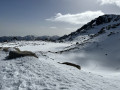
(3) Enjoy the view of Lake Bastani: a fairly sheltered spot suitable for a lunch break (on the way there or back). Continue in the same direction to reach the ridge. The climb is quite steep. Turn left.

(4) Carry on south.

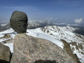
(5) Begin the final ascent to reach the summit of Monte Renoso (cross, sculpture, beautiful view).

(6) Descend via the same route.

(5) Turn slightly to the right to enjoy the view of Lake Bastani. However, it is not advisable to head towards the lake in winter, except perhaps on a ski tour. On the other hand, it is very pleasant for walking in summer.

(4) Return along the same route you took on the way up.

(3) You can veer slightly to the left if you’re wearing waterproof trousers and fancy trying a ‘sledging’ descent on your bottom. Otherwise, follow the tracks you took on the way up.

(2) Turn left and head back down to the car park (S/E).

Waypoints

  1. S/E : mi 0 - alt. 5,486 ft - Car park near the ski lifts
  2. 1 : mi 0.1 - alt. 5,509 ft - Exit at the ski area
  3. 2 : mi 0.3 - alt. 5,650 ft - Junction: A/ right – R/ left
  4. 3 : mi 1.39 - alt. 7,021 ft - View of the - Lac+de+Bastani
  5. 4 : mi 1.7 - alt. 7,385 ft - Junction between the ascent route and the descent detour
  6. 5 : mi 1.86 - alt. 7,372 ft - Final ascent
  7. 6 : mi 2.2 - alt. 7,707 ft - Summit of the - Monte Renoso
  8. S/E : mi 4.45 - alt. 5,486 ft - Car park near the ski lifts

Notes

In winter, snowshoes are essential and crampons are recommended for areas with less snow or for the descent, for example.

Reviews and comments

4.7 / 5
Based on 3 reviews

Reliability of the description
5 / 5
Ease of following the route
4.3 / 5
Route interest
4.7 / 5
Lerocher
Lerocher

Overall rating : 5 / 5

Date of your route : Aug 30, 2026
Reliability of the description : ★★★★★ Very good
Ease of following the route : ★★★★★ Very good
Route interest : ★★★★★ Very good
Very busy route : No

I always enjoy doing this walk, and this time the sky was beautifully clear.
There are no particular difficulties, with plenty of cairns and yellow markings.
You can veer off the ridge on the final ascent and rejoin it on the way down.
The view from the top is magnificent.

Machine-translated

Brudel73
Brudel73

Overall rating : 4.3 / 5

Date of your route : Sep 16, 2024
Reliability of the description : ★★★★★ Very good
Ease of following the route : ★★★★☆ Good
Route interest : ★★★★☆ Good
Very busy route : No

A lovely walk, not too long. There’s a large car park at the start. The ridge leading to the summit looks just like the moon. No trouble finding your way.

Machine-translated

Sebcheuss
Sebcheuss

Overall rating : 4.7 / 5

Date of your route : Jun 26, 2023
Reliability of the description : ★★★★★ Very good
Ease of following the route : ★★★★☆ Good
Route interest : ★★★★★ Very good
Very busy route : No

A superb walk with quite a few climbs, but it’s definitely worth it.
I followed the circular route but in the opposite direction, starting with the lake and climbing the section between points 3 and 5 instead of descending it. This section is really dangerous; if I were to do it again, I’d retrace my steps to avoid going that way.
A GPX map is essential – there are so many cairns everywhere that it’s easy to take a wrong turn.

Machine-translated

For more walks, use our search engine .

The GPS track and description are the property of this route's author. Please do not copy them without permission.