


 Country:


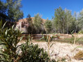
(S/E) Park in the car park just north of the Ait Oudinar campsite, then head south for about a hundred metres before turning right onto the street. After 150 metres, just as the street turns sharply to the left, take the wide path branching off to the right. This path runs between houses on the left and gardens on the right. Continue along this path for about 800 metres.
(1) Make a mental note of this spot, as it is here, on the left between two houses, that the return path will lead you at the end of the walk. Continue in the same direction for a further 900 metres or so along this path, which turns into a track and winds through gardens and orchards whilst following the stream.
(2) Cross the stream via a bridge made from a tree split lengthways, then join the road. Turn left and follow this road for about 1 km until you come to several large car parks on the left.
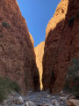
(3) Just past the last car park, turn left and head down through the trees towards the river. Cross to the other bank via a ford or a tree trunk, then head towards the entrance to the gorges visible in the distance.
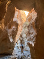
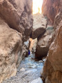
A wall/staircase will block the entrance to the gorges. Climb up and then back down these high steps, then continue into the canyon.
(4) Enter the canyon on the left and follow it. At one point, it will be blocked by a wall or flight of steps. Climb the high steps of this wall and descend in the same way on the other side to continue along the canyon. There are two tricky sections to negotiate (which will require the use of your hands) before you emerge from the canyon.
(5) After emerging from the steep-sided section of the canyon, a cairn marks a path that veers sharply left and climbs quite steeply, initially in switchbacks; the slope then becomes gentler and the path gradually fades away until it is no longer visible once you reach the summit.
Continue in the same direction, south-west then south, until you come to a faintly marked path, then alter your course towards south-south-west then south, gradually approaching a power line visible on the left. The path is still faintly marked on this rocky terrain but is nevertheless visible (don’t hesitate to look up into the distance to see it take shape more clearly). In any case, if you happen to stray from the path, the general direction to follow is south.
(6) Follow the now clearly defined path southwards, then, after a right-hand bend, southwards again and then south-southeast as you approach the power line, which is now clearly visible.
(7) Pass under the power line and follow the path as it gradually moves away from it.
(8) Now head down the zigzagging path to the houses visible below. Pass between two houses and head down towards the road you took at the start.
(1) Turn right for about 100 metres, then turn left towards the river, and then turn right onto a very pleasant path that runs alongside the river until you reach a small weir.
(9) Go down from the dam and continue for a few dozen metres, following the river until you come to a sort of dry canal on your right, cluttered with stones; follow this upstream for about 100 metres to rejoin the path you took at the start.
Follow it to the left, in the opposite direction to your outward journey, to return to the car park (S/E).


