Wind turbines at Bouloc

A lovely walk starting from Saint-Beauzély that takes you up to the heights of Lévezou, at the foot of the Bouloc wind turbines.

Details

53278
Creation:
Last update:
Last review:
  • Horse riding
    Activity: Horse riding
  • ↔
    Distance: 10.86 mi
  • ◔
    Duration according to the author: 4 hrs 
  • ▲
    Difficulty: Moderate

  • ⚐
    Back to start: Yes
  • ↗
    Ascent: + 1,785 ft
  • ↘
    Descent: - 1,785 ft

  • ▲
    Highest point: 3,583 ft
  • ▼
    Lowest point: 2,018 ft

Photos

Description of the walk

Start from the car park at the bottom of the village of Saint-Beauzély.

(S/E) Take the narrow streets above the car park, pass by the castle and walk for about 600 metres.

(1) Take the cobbled lane that climbs to the right. This turns into a track and climbs steeply through the woods and heather moors.

(2) Leave the main track on your right (km 1.6) and take the small path opposite. This leads to Comberoumal Priory. Join the D171 road.

(3) Follow it to the left for 300m, then turn onto the path on the right (GR®62) at the second hairpin bend. Follow theGR® to Estalane. Take a detour through the village.

(4) Continue up the D30 for 2 km.

(5) At the junction with two tracks on either side of the road, take the track on the right. At the next fork, turn left and rejoin theGR®62. Follow it to the foot of the wind turbines.

(6) Take the track on the right. Pass a path on the left, and turn left after 2 km. Continue along this track until you reach the road (Croix des Boudets).

(7) Take the path opposite that leads down towards Alaret. Follow the signposting for the Grand Tour des Monts et des Lacs du Lévezou (GR® de Pays with red and yellow markings).

(8) Walk through Alaret, past a livestock farm, and take the path on the right (GRP® markings). Follow the markings for 2 km (to the hamlet of Les Landes). Please note: you will need to open and close numerous gates.

(9) At the hamlet, turn right onto the small road and follow it to Saint-Beauzély; it leads to the top of the starting car park (S/E).

Waypoints

  1. S/E : mi 0 - alt. 2,018 ft - Car park at the bottom of the village. Close to the - Muze (ruisseau) - Affluent du Tarn
  2. 1 : mi 0.36 - alt. 2,198 ft - Cobbled lane on the right
  3. 2 : mi 1.04 - alt. 2,612 ft - Short footpath opposite
  4. 3 : mi 1.51 - alt. 2,628 ft - D171, turn left
  5. 4 : mi 3.04 - alt. 2,871 ft - Estalane
  6. 5 : mi 4.32 - alt. 3,258 ft - Path on the right
  7. 6 : mi 5.36 - alt. 3,573 ft - Wind turbines, on the right
  8. 7 : mi 7.58 - alt. 3,310 ft - Croix des Boudets, opposite
  9. 8 : mi 8.59 - alt. 2,943 ft - Alaret
  10. 9 : mi 10.26 - alt. 2,054 ft - Hameau des Landes
  11. S/E : mi 10.86 - alt. 2,018 ft - Car park at the bottom of the village

Notes

A large car park at the bottom of the village of Saint-Beauzély, with space for a van.
Plenty of watering points for horses along the route.
There are numerous gates to open and close along the route, particularly between Alaret and Les Landes.
A few slightly stony and ‘technical’ sections for untrained horses, but nothing insurmountable.
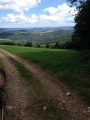
The trails are varied: through woodland, along pastures, and through conifer plantations with pleasant fords.

Places to see:
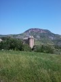
- The village of Saint-Beauzély and its 12th-century castle,
- The priory of Comberoumal,
- The bell tower at Estalane,
- The wind turbines at Bouloc,
and numerous viewpoints overlooking the Muze Valley, Azinières, the Causse Rouge and the Millau Viaduct.

Worth a visit

Saint-Léon, Micropolis.
The Lévezou Lakes.

Always be cautious and plan ahead when you're outdoors. Visorando and the author of this route cannot be held responsible for any accidents occurring on this route.

The GR® and PR® markings are the intellectual property of the Fédération Française de Randonnée Pédestre.

Reviews and comments

4.8 / 5
Based on 2 reviews

Reliability of the description
4.5 / 5
Ease of following the route
5 / 5
Route interest
5 / 5
jeanmipat
jeanmipat

Overall rating : 4.7 / 5

Date of your route : Oct 02, 2018
Reliability of the description : ★★★★☆ Good
Ease of following the route : ★★★★★ Very good
Route interest : ★★★★★ Very good

There are a few sections that need a good clear-out – lovely walk.

Machine-translated

grandin
grandin ★

Sorry to hear about that unpleasant experience. Let’s hope that efforts are made locally to maintain this path. But if, on top of that, barbed wire is blocking the GR, that’s not quite right. When you mention ‘jumping’, is that because you’re on horseback? Are there at least any designated crossings for pedestrians?

In any case, thank you for letting us know about these issues.

Machine-translated

VABRE Francis
VABRE Francis

We walked this route on 20 July 2018. The GR 62 between Estalane and Monteillat is completely impassable; although it is marked in red and white, it is overgrown with brambles and undergrowth, and you have to climb over barbed wire to get through to the neighbouring fields. It’s a shame, as this route would be lovely if there weren’t so many sections that are barely passable.

Machine-translated

Amandine A.
Amandine A.

Overall rating : 5 / 5

Date of your route : Aug 14, 2014
Reliability of the description : ★★★★★ Very good
Ease of following the route : ★★★★★ Very good
Route interest : ★★★★★ Very good

A superb walk, with a wide variety of trails and tourist attractions. The route description is very clear… Breathtaking views over the valleys… It’s true that you have to open the gates, which slows you down a bit, but it doesn’t spoil the route… I’d recommend it to everyone… Whether on horseback or on foot…

Machine-translated

For more walks, use our search engine .

The GPS track and description are the property of this route's author. Please do not copy them without permission.