


Leg 9: HWMMUC
Details
Creation:
Last update:
–
–
-
 Activity: Walking
 -
 Distance: 12.03 mi
 -
 Average duration: 5h 50
 -
 Difficulty: Not specified
 -
-
 Back to start: No
 -
 Ascent: + 361 ft
 -
 Descent: - 735 ft
 -
-
 Highest point: 571 ft
 -
 Lowest point: 148 ft
-
 Country:
United Kingdom
Country:
United Kingdom
-
 City:
Shaftesbury
City:
Shaftesbury -
 Start: N 51.00373° / W 2.208285°
 -
 End: N 50.919853° / W 2.312222°
 -


 Hour-by-hour weather


Waypoints
- S : mi 0 - alt. 571 ft - Start on
- 1 : mi 0.28 - alt. 459 ft - Turn right onto Foyle Hill
- 2 : mi 0.91 - alt. 276 ft - Keep left onto Dover Street
- 3 : mi 1.54 - alt. 259 ft - Turn right
- 4 : mi 1.9 - alt. 364 ft - Turn slight left
- 5 : mi 1.91 - alt. 364 ft - Keep right
- 6 : mi 1.92 - alt. 364 ft - Turn sharp right
- 7 : mi 1.97 - alt. 367 ft - Keep right
- 8 : mi 2.08 - alt. 390 ft - Turn left
- 9 : mi 2.56 - alt. 348 ft - Turn slight left
- 10 : mi 2.56 - alt. 348 ft - Turn right
- 11 : mi 3.58 - alt. 295 ft - Turn left
- 12 : mi 3.78 - alt. 269 ft - Turn right
- 13 : mi 4.1 - alt. 230 ft - Turn slight right
- 14 : mi 4.76 - alt. 197 ft - Turn right
- 15 : mi 5.07 - alt. 197 ft - Turn right
- 16 : mi 5.16 - alt. 197 ft - Turn left
- 17 : mi 5.38 - alt. 233 ft - Keep left onto Church Lane
- 18 : mi 5.68 - alt. 230 ft - Turn right onto Church Road
- 19 : mi 5.8 - alt. 230 ft - Turn left onto Shave Lane
- 20 : mi 6.04 - alt. 233 ft - Turn right onto B3092
- 21 : mi 6.05 - alt. 233 ft - Turn left
- 22 : mi 6.44 - alt. 213 ft - Keep right
- 23 : mi 7.11 - alt. 236 ft - Turn left onto Nash Lane
- 24 : mi 7.24 - alt. 217 ft - Turn right onto Pilwell
- 25 : mi 7.34 - alt. 220 ft - Turn right onto Burton Street
- 26 : mi 7.35 - alt. 220 ft - Turn left
- 27 : mi 7.75 - alt. 289 ft - Turn left onto Sackmore Lane
- 28 : mi 8.09 - alt. 240 ft - Turn right onto Walton Elm Hill, B3092
- 29 : mi 8.17 - alt. 256 ft - Turn right onto Carraway Lane
- 30 : mi 8.25 - alt. 262 ft - Turn right
- 31 : mi 8.31 - alt. 276 ft - Turn left
- 32 : mi 8.44 - alt. 253 ft - Turn sharp right
- 33 : mi 8.54 - alt. 276 ft - Turn left
- 34 : mi 8.68 - alt. 299 ft - Turn slight left
- 35 : mi 8.7 - alt. 299 ft - Turn sharp right onto Mowes Lane
- 36 : mi 8.7 - alt. 299 ft - Turn right
- 37 : mi 8.93 - alt. 282 ft - Turn slight left
- 38 : mi 9.47 - alt. 246 ft - Turn right onto Cutt Mill Lane
- 39 : mi 9.56 - alt. 200 ft - Turn left
- 40 : mi 10.21 - alt. 243 ft - Turn left onto Wood Lane
- 41 : mi 10.32 - alt. 256 ft - Turn sharp right onto Twinwood Lane
- 42 : mi 10.75 - alt. 164 ft - Keep right
- 43 : mi 10.89 - alt. 157 ft - Turn left
- 44 : mi 10.95 - alt. 187 ft - Keep right
- 45 : mi 11.35 - alt. 154 ft - Keep left
- 46 : mi 11.56 - alt. 187 ft - Turn right
- 47 : mi 11.95 - alt. 161 ft - Turn right
- 48 : mi 11.97 - alt. 167 ft - Turn left
- E : mi 12.03 - alt. 197 ft
Other walks in the area
Win Green & Tollard Royal
 Visorando Member9.44 mi
+948 ft
-938 ft
5h 10
Visorando Member9.44 mi
+948 ft
-938 ft
5h 10
 Moderate
Departure from Donhead St. Mary (Wiltshire)
Moderate
Departure from Donhead St. Mary (Wiltshire)
A walk from Wiltshire's highest point and through the villages of Tollard Royal and Berwick St James
An exploratory ramble around Iwerne Minster
3.62 mi
+240 ft
-233 ft
1h 50
 Easy
Departure from Iwerne Minster (Dorset)
Easy
Departure from Iwerne Minster (Dorset)
A gentle exploratory ramble along nearby footpaths with pleasant views. Nothing onerous.
In Search of Kitt's Grave : in memory of Kay Chalk 1929 - 2019
9.14 mi
+666 ft
-669 ft
4h 45
Moderate
Departure from Martin (Hampshire)
A glorious walk in the hills between Martin Down and the Chalk Valley taking in Vernditch Chase, Marleycombe Hill, Church Bottom and Middleton Down Nature Reserve
South Cadbury, Somerset
 9.04 mi
+719 ft
-722 ft
4h 45
Moderate
Departure from South Cadbury and Sutton Montis (Somerset)
9.04 mi
+719 ft
-722 ft
4h 45
Moderate
Departure from South Cadbury and Sutton Montis (Somerset)
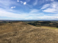
The walk follows the Corton Ridge and offers great views across the Somerset Levels and the Dorset Hills. It has great historic significance as Cadbury Castle is reputed to be Camelot King Arthur's Castle. You also cross the ancient medieval village of Whitcombe. It's an up and downer and can be boggy in wet weather. As an incentive there are two great pubs you can call in at!
Evercreech to Batcombe and back along the River Alham
 8.49 mi
+614 ft
-630 ft
4h 25
Easy
Departure from Evercreech (Somerset)
8.49 mi
+614 ft
-630 ft
4h 25
Easy
Departure from Evercreech (Somerset)
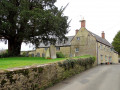
A thoroughly pleasant and not very arduous walk from Evercreech to Chesterblade, then to Batcombe and back along the River Alham. There are quite a few hills but none of them are very long and the total ascent of the walk is surprisingly modest.
Frome to Whatley and Nunney
 9.56 mi
+482 ft
-479 ft
4h 50
Moderate
Departure from Frome (Somerset)
9.56 mi
+482 ft
-479 ft
4h 50
Moderate
Departure from Frome (Somerset)
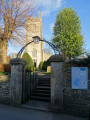
A circular walk from Frome to Whatley, then to Nunney along Nunney Combe and back to Frome via Critchill Farm.
It features the eastern end of the East Mendip Way.
For more walks, use our search engine .
The GPS track and description are the property of this route's author. Please do not copy them without permission.

