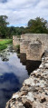
The La Roche Bridge as part of a circular route from Luzay

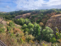
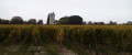
A very beautiful, easy walk. Before the circular route, the section shared by the outward and return journeys runs alongside the River Thouet. The circular route winds its way through woods, meadows and fields.

Details

n°109648436
Creation:
Last update:
Last review:
–
  • Walking
    Activity: Walking
  • ↔
    Distance: 5.11 mi
  • ◔
    Average duration: 2h 30 
  • ▲
    Difficulty: Easy

  • ⚐
    Back to start: Yes
  • ↗
    Ascent: + 177 ft
  • ↘
    Descent: - 180 ft

  • ▲
    Highest point: 295 ft
  • ▼
    Lowest point: 190 ft
  • ⚐ Country: France
  • ⚐ City: Luzay (79100)
  • ⚑
    Start/End: N 46.922872° / W 0.193214°
  • ❏
    IGN map(s): Ref. 1625SB
  • Hour-by-hour weather

Photos

Description of the walk

Park in the small square by Luzay Church.

Yellow signposts

(S/E) Head down towards the cemetery, the sports ground and the Roman Bridge.

(1) At the crossroads, take the path on the left and continue to the Roman Bridge.

(2) Immediately after crossing the bridge over the Thouaret, take the grassy path on the left until you reach a small road.

(3) Turn right onto Rue des Tilleuls to enter the village of La Coindrie.

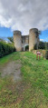
(4) Turn left onto Rue du Monastère and carry on to the ruins of the fortified monastery known as ‘Les Prisons’. Return to the road and cross the bridge on the left, heading towards the hamlet of La Gaptière. Carry on straight ahead.

(5) Head down the small road on the right towards the hamlet of Le Vieux Parnay.

(6) At the small crossroads, turn right to cross the small bridge over the River Thouaret once more, then follow the path on the left alongside the row of trees on your left-hand side. Walk up the path and, at the junction, turn right; stay on this path until you reach the road, where you should turn right and follow it for 100 metres.

(7) Turn right down the narrow path through the trees until you reach a very narrow road. Turn left onto this narrow road, Rue du Monastère.

(8) At the T-junction, take Rue des Tilleuls on the right until you reach a fork you passed on the way there.

(4) Carry on to the left along Rue des Tilleuls, going in the opposite direction to the outward route for 100 m, and continue to the left, still going in the opposite direction to the outward route, to rejoin our outward route as far as the car park (S/E).

Waypoints

  1. S/E : mi 0 - alt. 249 ft - Church Square
  2. 1 : mi 0.42 - alt. 236 ft - Junction for the outbound and return routes
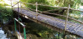
  3. 2 : mi 0.58 - alt. 217 ft - Roman Bridge at La Roche - Thouaret (rivière) - Affluent du Thouet
  4. 3 : mi 1.18 - alt. 236 ft - Junction for the outbound and return routes
  5. 4 : mi 1.27 - alt. 226 ft - Crossroads at the end of the circular loop
  6. 5 : mi 1.89 - alt. 279 ft - Turn right
  7. 6 : mi 2.42 - alt. 194 ft - Crossroads. Bridge on the right - Thouaret (rivière) - Affluent du Thouet
  8. 7 : mi 3.35 - alt. 289 ft - A short path to the right
  9. 8 : mi 3.67 - alt. 236 ft - Turn right onto Rue des Tilleuls
  10. S/E : mi 5.11 - alt. 249 ft - Church Square

Worth a visit

Roman Bridge at La Roche: a bridge built in the 12th or 13th century. It was restored by the local council in 1990.

La Coindrie Castle: the remains of a fortified monastery which is presented as a former prison, ‘Les prisons de Luzay’, but there is no evidence that it ever held a single prisoner...

Other walks in the area

For more walks, use our search engine .

The GPS track and description are the property of this route's author. Please do not copy them without permission.