

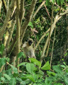

Pic Paradis in Saint-Martin

A short, gentle walk, starting from a tarmac road, followed by a short trail climb to reach some beautiful viewpoints at the summit of Pic Paradis.

Details

n°65601116
Creation:
Last update:
Last review:
  • Walking
    Activity: Walking
  • ↔
    Distance: 0.95 mi
  • ◔
    Average duration: 0h 40 
  • ▲
    Difficulty: Moderate

  • ⚐
    Back to start: Yes
  • ↗
    Ascent: + 269 ft
  • ↘
    Descent: - 269 ft

  • ▲
    Highest point: 1,362 ft
  • ▼
    Lowest point: 1,089 ft

Photos

Description of the walk

Park at the side of the small track, taking care not to block the way.

(S/E) Walk up the tarmac road.

(1) Turn left at the end of the road, following the ‘hike’ sign. The path climbs slightly – it may be slippery if it has rained – through lush greenery until you reach a junction.

(2) Turn right to reach a beautiful viewpoint on the south-eastern side.

(3) Return to the junction.

(2) Take the short climb opposite, which leads to the telecoms masts; following the fence on the left takes you to a south-west viewpoint.

(4) Retrace your steps and head straight on.

(5) Turn right.

(2) Carry on straight ahead to return to the road.

(1) Turn right and head back down to the car park (S/E).

Waypoints

  1. S/E : mi 0 - alt. 1,093 ft - Roadside parking
  2. 1 : mi 0.22 - alt. 1,194 ft - Path
  3. 2 : mi 0.32 - alt. 1,342 ft - Viewpoint junction and circular loop
  4. 3 : mi 0.35 - alt. 1,325 ft - Viewpoint
  5. 4 : mi 0.49 - alt. 1,352 ft - Antennae, viewpoint
  6. 5 : mi 0.59 - alt. 1,342 ft - Turn right at the fork
  7. S/E : mi 0.95 - alt. 1,093 ft - Roadside parking

Notes

Walking shoes recommended.

The same walk can be done starting from Lottery Farm (45-minute climb), where you’ll park and then follow a path from the site back to where you started (round trip). Not completed.

Worth a visit

Scenic views along the route.
Monkeys.
Birds.

Reviews and comments

4.7 / 5
Based on 1 review

Reliability of the description
5 / 5
Ease of following the route
5 / 5
Route interest
4 / 5
User 22095637

Overall rating : 4.7 / 5

Date of your route : Jul 13, 2026
Reliability of the description : ★★★★★ Very good
Ease of following the route : ★★★★★ Very good
Route interest : ★★★★☆ Good
Very busy route : No

We went on this hike in July 2026, leaving the car about 200 metres before the end of the tarmac road.
This turned out to be a very good idea, as we stumbled right into the middle of a family of green monkeys who seemed just as curious to watch us!
The climb is easy, along a partly wooded path; it was very hot at that time of year.
The viewpoint on the Cul de Sac side is very beautiful on a clear day; you can see Îlet Pinel and Île de Tintamarre.
When you retrace your steps, head ‘straight ahead’ from where you came (the viewpoint), but it doesn’t really matter as the viewpoint by the antennas and the path to the left at the junction both lead there – there’s no risk of getting lost!
It was very misty on the Marigot side; the view isn’t as pleasant and the spot next to the antennas isn’t exactly unforgettable, but given the minimal effort required, it’s well worth it for the first viewpoint (and the monkeys – keep a safe distance to leave them in peace and not alarm them too much, especially if they’re with their young).
Thanks for sharing this, and happy hiking to everyone!

Machine-translated

For more walks, use our search engine .

The GPS track and description are the property of this route's author. Please do not copy them without permission.

