


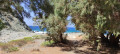
Picnic table at the end of the walk.
The historic Kroustac Forest


This is a well-signposted route (green and blue) through the forest. You’ll have the chance to admire large round stone cisterns and enjoy beautiful views of the mountains and the coast.
To get there, in the village of Kroustas, near the school, head towards the Kroustas Forest. After about 4.5 km along a small road, just past a picnic area, there is an information sign. Parking is available at the start of the walk.
Details
Creation:
Last update:
Last review:
–
–
-
 Activity: Walking
 -
 Distance: 2.96 mi
 -
 Average duration: 2h 00
 -
 Difficulty: Moderate
 -
-
 Back to start: Yes
 -
 Ascent: + 725 ft
 -
 Descent: - 751 ft
 -
-
 Highest point: 2,894 ft
 -
 Lowest point: 2,438 ft
-
 Country:
Greece
Country:
Greece
-
 Start/End: N 35.117145° / E 25.633264°
 -


 Hour-by-hour weather
Waypoints
- S/E : mi 0 - alt. 2,694 ft
- S/E : mi 2.96 - alt. 2,697 ft
Notes
Other walks in the area
Towards Mount Spathi, the highest peak in the Dikti Mountains, in southern Crete
 Visorando Member8.44 mi
+2,861 ft
-2,887 ft
6h 20
Visorando Member8.44 mi
+2,861 ft
-2,887 ft
6h 20
 Very difficult
 Departure from Greece
The hike is difficult and arduous over scree, with route markings that are very difficult to read: the cairns are too low, and the yellow markings (e4) are insufficient in some areas. You need to follow a map continuously.Very beautiful, contrasting landscape, sea visible in the distance after 1½ hours, superb long-haired goats.We did not climb the final section to Mount Spathi due to lack of time as it was getting dark at the end of October.Round trip hike.
Richtis Gorges from Exo Mouliana
 6.03 mi
+1,211 ft
-1,227 ft
3h 50
Moderate
Departure from Greece
6.03 mi
+1,211 ft
-1,227 ft
3h 50
Moderate
Departure from Greece
Hike through the Richtis Gorges near Sitia. It’s a lovely route along the gorges, featuring a waterfall where you can have a swim. Reasonable numbers of visitors given the time of year (late August). Suitable for children over 8 who are used to walking. There are small log bridges to help you get along the path.
For more walks, use our search engine .
The GPS track and description are the property of this route's author. Please do not copy them without permission.

