


 Country:
 City:


Set off from your place of residence, Rue du Bataillon de France, Compiègne, at the small car park opposite No. 92.
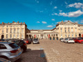
Depending on where you’re staying, you can also set off from the Imperial Palace or Compiègne railway station.
(S/E) On Rue du Bataillon de France, turn left and head towards the traffic lights.
(1) Turn right onto Rue Aubrelicque. At the next junction, turn right then left onto Rue Du Cayrol. At the T-junction, turn left onto Rue Augustin Thierry, then right onto Rue Charmolue.
(2) At the T-junction, turn left onto Rue de L’Estacade, then turn right straight away. Cross the small car park and, at the end, turn left onto the cycle path running alongside the River Oise.
(3) At the end of the cycle path, continue left onto Cours Guynemer. At the next junction, turn right onto Rue du Lieutenant René Ducloux.
(4) At the T-junction, turn right onto Avenue du Président Georges Clemenceau. Go through the tunnel and, once you’ve come out, continue left onto Rue d’Ulm and carry on to the next junction.
(5) Turn left onto Avenue Royale. Ride past the Palais Impérial and, at the Rond Royal, carry straight on along Avenue du Baron Roger de Soultrait.
(6) At the Carrefour Royal, turn right onto the7th lane, Route Tournante du Grand Parc, and immediately turn right onto the cycle path. Pass the Carrefour Gabriel whilst staying on the cycle path.
(7) Cross the D130, taking care of the traffic, and continue straight ahead on the cycle path, Route de la Mare aux Canes. Pass the Carrefour de l’Épinette and continue on the cycle path.
(8) At the Carrefour de Montmorency, continue along the cycle path, which veers to the left onto the Route de Larris. Pass the Carrefour du Saut du Cerf and continue straight ahead, still on the cycle path.
(9) At the Carrefour des Sept Morts, continue along the cycle path as it veers to the right onto Route de la Valette. Pass the Carrefour des Marais and, at the Carrefour du Cerf, turn left onto the cycle path (Route de la Belle Image) and continue to the next junction.
(10) Turn left onto Route Le Fossé Coulant.
(11) At the junction, take thesecond lane on the right to enter the village of Vieux-Moulin. In front of the church, turn left onto Rue Pillet Will, pass Rue du Général De Gaulle and then Rue des Bas Prés.
(12) At the T-junction, turn right onto Rue de Compiègne, then take thefirst left. Continue until you reach Route Le Fossé Coulant, which you took on the way out. Ride for about 300 m until you reach the junction you passed at the start of this circular route.
(10) Continue to the left to rejoin the cycle path and follow it to the junction with the D973.
Cross the D547 and then the D973, taking care to watch out for traffic, to reach the cycle path on the opposite side.
(13) At the T-junction, turn left and continue along the cycle path.
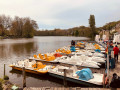
(14) At the end of the cycle path, turn right onto Rue le Champ Dolent. Go under the road bridge and enter the village of Pierrefonds. When you reach the junction with the D85, turn left onto Rue du Beaudon and follow the lake.
(15) At the end of the lake, turn right towards Place de l’Hôtel-de-Ville and you’ll soon reach the next junction.
(16) Turn left, then immediately right onto Rue Saint-Louis. At the end of this street, turn left onto Rue Napoléon.
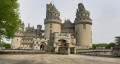
(17) Enter the castle grounds opposite, taking care of pedestrians. Cycle up to the esplanade, where you can park your bike in the designated spaces.
(18) Turn back towards the previous junction, taking care of pedestrians.
(17) At the exit gate of the castle grounds, continue straight on along Rue Napoléon. Ignore Rue Saint-Louis, then turn right onto Place de l’Hôtel-de-Ville. Continue to the next junction.
(16) Carry on straight ahead, following the route back in the opposite direction to the way out.
(15) At the T-junction, turn left onto Rue du Beaudon (D85), which runs alongside the lake. Continue for about 200 metres, then turn right onto Rue le Champ Dolent. Go under the road bridge.
(14) Just after the bridge, turn left onto the cycle path and carry on straight ahead along it.
(13) Leave the cycle path you took on the way there on your right and carry straight on. Pass the junctions at Étangs de Batigny and La Bécasse.
(19) At the Carrefour du Grand Écuyer, take thesecond lane on the left to continue along the cycle path. Pass the Carrefour du Grand Maître and arrive at the roundabout.
(20) Take thethird lane on the right, Rue des Meuniers.
(21) Enter the village of Saint-Jean-aux-Bois. At the next junction, carry on straight ahead, pass through the Porte Médiévale, then turn right onto Rue des Abbesses. At the end of this street, turn left to go round the Place de la Grande Cour. Exit via the Porte Médiévale.
(21) Carry on straight ahead along Rue des Meuniers, travelling in the opposite direction to the outward journey.
(20) When you reach the roundabout, take thefourth lane on the right to join the cycle path. Continue along this until you reach the junction with the D332. Cross the road, taking care of the traffic, and rejoin the cycle path on Route de la Pépinière.
(22) At the Carrefour de la Pépinière, continue by veering to the right onto Route de Jupiter du Grand Marais. Pass the Carrefour du Grand Marais. At the Carrefour de Jupiter, take thethird lane on the right onto the cycle path. At the Carrefour d’Atalante, take thefourth lane on the right onto the cycle path.
(23) At the Carrefour du Vol, take thesecond lane on the right onto Route du Moulin and continue along the cycle path. Pass the Moulin, three-way junction and Bordages junctions. The cycle path veers to the right onto Avenue de Marigny. Continue for approximately 300 to 400 metres and turn right onto the cycle path. Continue to the junction with the D332, known as Voie Communale Des Nations Unis.
(24) Cross the D332, taking care of the traffic, and carry on straight ahead along the cycle path. When you reach the junction with the D973, known as Avenue du1er Septembre, cross the D973, taking care of the traffic, and carry on straight ahead along the cycle path until you reach Carrefour Royal.
(6) At the Carrefour Royal, take the7th lane on the right onto Avenue du Baron Roger de Soultrait. At the Rond-point Royal, continue straight ahead along Avenue Royale and pass in front of the Imperial Palace.
(5) At the T-junction, turn right onto Rue d’Ulm. Go through the tunnel and, once you’ve emerged, continue along Avenue du Président Georges Clemenceau. Pass Rue Guillemain on your left.
(4) At the next junction, turn left onto Rue du Lieutenant René Ducloux, then right onto Rue du Bataillon de France. At the traffic lights, carry straight on to reach the finish line on Rue du Bataillon de France (S/E).


