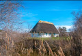
The sea wall from Mas Saint-Bertrand near the Salin de Giraud

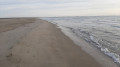
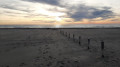
A short cycle ride along the sea wall, passing the Gacholle Lighthouse, then along the beach for a peaceful swim. You can spot flamingos all along the sea wall. Take hybrid bikes, which can also be hired on site.

Details

3495594
Creation:
Last update:
Last review:
  • Mountain biking
    Activity: Mountain biking
  • ↔
    Distance: 17.64 mi
  • ◔
    Duration according to the author: 3 hrs 
  • ▲
    Difficulty: Easy

  • ⚐
    Back to start: Yes
  • ↗
    Ascent: + 7 ft
  • ↘
    Descent: - 7 ft

  • ▲
    Highest point: 10 ft
  • ▼
    Lowest point: 0 ft
  • ⚐ Country: France
  • ⚐
    Area: Camargue
  • ⚐ City: Arles (13200|13280)
  • ⚑
    Start/End: N 43.448999° / E 4.661069°
  • ❏
    IGN map(s): Ref. 2944OT, 3044OT

  • ◶
    Type of surface:
  •  
     
     33% Road  67% Byway
  • ⇧
    Bike carrying: No
  • ▲
    Difficulty: Easy
  • Hour-by-hour weather

Photos

Description of the route

(S/E) Leave Mas Saint-Bertrand by turning right onto the D36C and following it for 1 km.

(1) Turn left onto the D36B, following signs for “digue à la mer”, then follow the tarmac road and continue along a dirt track. You may spot flamingos on both the right and left sides of the sea wall.

(2) Turn right before the barrier and continue along the dirt track/tarmac road until you reach a car park.

(3) Carry on straight ahead, passing through the barrier towards the Gacholle Lighthouse.

(4) You can stop at the Gacholle Lighthouse for a picnic. Wooden tables are available behind the lighthouse. Then continue along the path until you find a path leading down to the sea on the left.

(5) Turn left and head towards the sea. The path becomes sandy, but it is possible to cycle on the compacted sand. Once you reach the seashore, turn left and follow the coastline.
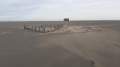
We’ve noticed that it’s easier to cycle on wet sand, where the waves break. You can swim in complete peace and quiet; only pedestrians and cyclists are allowed on this beach. Then carry on in the same direction until you come to wooden stakes driven into the sand, marking a path back towards the sea wall.

(6) Turn left to rejoin a dirt track once you’ve left the beach and the sand. Cycle along this track until you reach the car park you passed on the way out.

(3) Turn right onto the same path as on the way there to return to Mas Saint-Bertrand (S/E).

Waypoints

  1. S/E : mi 0 - alt. 7 ft - Mas Saint-Bertrand
  2. 1 : mi 0.52 - alt. 7 ft - Head for the sea wall
  3. 2 : mi 3.71 - alt. 3 ft - Barrier
  4. 3 : mi 5.59 - alt. 3 ft - Barrier
  5. 4 : mi 6.31 - alt. 7 ft - La Gacholle Lighthouse
  6. 5 : mi 7.58 - alt. 7 ft - Path leading to the seaside
  7. 6 : mi 10.4 - alt. 3 ft - Wooden posts
  8. S/E : mi 17.64 - alt. 7 ft - Mas Saint-Bertrand

Notes

There are no water points along the route. Take a hybrid bike, as it may get wet from salt-water spray whilst cycling along the coast. Remember to bring a packed lunch, swimming costume and towel for a swim during the ride.

Reviews and comments

4.6 / 5
Based on 3 reviews

Reliability of the description
4.7 / 5
Ease of following the route
4.7 / 5
Route interest
4.3 / 5
bernbla
bernbla

Overall rating : 4.7 / 5

Date of your route : Jan 19, 2025
Reliability of the description : ★★★★★ Very good
Ease of following the route : ★★★★★ Very good
Route interest : ★★★★☆ Good
Very busy route : No

Thank you for this route. It was a bit chilly this Sunday, so we skipped the picnic.
The stretch between the pond and the sea was tricky – the sand was very soft, making it impossible to cycle – but the seaside path was much easier to manage. It’s a walk best avoided in summer as there isn’t a single spot of shade.

Machine-translated

bs13
bs13

Hike taken on Sunday 28 February 2024 in cloudy weather! A lovely hike, and what’s more, it was the flamingos’ breeding season – absolutely magnificent: a shame there wasn’t quite enough light. I love the Camargue whatever the weather (except when it’s raining, mind you).
Highly recommended for the whole family, from 7 to 77. An 18-kilometre walk.

Machine-translated

PO25
PO25

Overall rating : 4 / 5

Date of your route : Jan 03, 2022
Reliability of the description : ★★★★☆ Good
Ease of following the route : ★★★★☆ Good
Route interest : ★★★★☆ Good
Very busy route : No

Hello,
We did the walk on foot, and as such, it was a bit long, especially along the sea wall on the way there and back.
It’s certainly not the most colourful time of year (the countryside was rather drab) nor the liveliest (few flamingos to be seen), despite the magnificent sunset we were treated to. We hadn’t realised at the start that the route was intended for cyclists, which is probably more suitable for long distances that can be a bit monotonous at times.
The break at the lighthouse is a welcome one.
The route description is reliable. However, take care on the section between points 6 and 7: as you walk up the beach, you’ll see two rows of posts, one behind the other. We followed the first one, but you need to be careful as you might otherwise end up along a small channel (on a poorly marked path) between the Dune de la Comtesse and the lagoon, which isn’t shown on the Visorando map (it is shown, but too high up, as it actually starts much earlier). You’ll then need to take off your shoes to cross the narrow stretch of water to reach the embankment, which has a proper path – this is easily done (the water is ankle-deep). Just a quick note on that.
Thank you for this suggestion!

Machine-translated

adechris
adechris

Overall rating : 5 / 5

Date of your route : Mar 15, 2021
Reliability of the description : ★★★★★ Very good
Ease of following the route : ★★★★★ Very good
Route interest : ★★★★★ Very good
Very busy route : No

Great!

Machine-translated

For more walks, use our search engine .

The GPS track and description are the property of this route's author. Please do not copy them without permission.