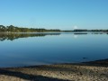
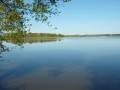
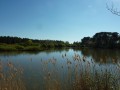
Bellebouche Pond and Vigneaux Pond

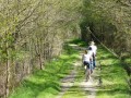
A family cycle ride (hybrid bikes) to explore some of the ponds in the Brenne.

Fiche technique

551981
Creation:
Last update:
Last review:
  • VTT
    Activité: VTT
  • ↔
    label_distance: 12.87 mi
  • ◔
    Durée de l'auteur: 2h 
  • ▲
    Difficulte: Facile

  • ⚐
    Retour point de depart: Oui
  • ↗
    label_elevation_gain: + 36 ft
  • ↘
    label_elevation_loss: - 39 ft

  • ▲
    label_highest_point: 394 ft
  • ▼
    label_lowest_point: 325 ft
  • ⚐ Pays: France
  • ⚐ Commune: Mézières-en-Brenne (36290)
  • ⚑
    Départ/Arrivée: N 46.798217° / E 1.305869°
  • ❏
    Carte(s) IGN: Ref. 2025SB, 2026SB

  • ◶
    Proportions chemins:
  •  
     
     
     33% Route  34% Carrossable  33% map_trail
  • ⇧
    Portage: Non renseigné
  • ▲
    Difficulté technique: Non renseigné
  • Météo détaillée heure par heure

Photos

Description of the route

Park in the car park at the Bellebouche leisure centre. Route No. 4.

(S/E) Head south along the path between the pond and the campsite. The path runs alongside the pond and may be damp in places. Turn left, then right.

(1) There is a viewing point overlooking the pond on the left. Turn back and carry on to the right to reach Route de Rosnay.

(2) Turn right onto the tarmac road.

(3) Cross the D21 (farm track) and carry on straight ahead until you reach the D14.

(4) Turn right onto the D14 (there is often more traffic on this road than on the previous one).

(5) At the junction, keep right onto the D14.

(6) Carry on to the right onto the D15.

(7) After about 600 metres, turn right onto the D14b

(8) After the Étang de Bignotoi, as you come out of the woods, turn right onto the tarmac road towards Les Vigneaux. Further on, the tarmac road gives way to a gravel track.

(9) Walk alongside the Étang des Vigneaux. Follow the track to the D21.

(10) Cross over to take the small road opposite. Follow this small road straight on until it joins the D925 at a place called La Grave.

(11) Turn right onto the grassy track (an old railway line). The track curves to the left and runs alongside the road before crossing the stream.

(12) 100 metres further on, turn right onto the path, then return to the path running alongside the road to get back to the leisure centre car park (S/E).


Points de passages

  1. D/A : mi 0 - alt. 361 ft - Car park at the leisure centre
  2. 1 : mi 1.17 - alt. 351 ft - Viewing area on the left
  3. 2 : mi 1.58 - alt. 367 ft - Route de Rosnay, on the right
  4. 3 : mi 1.89 - alt. 364 ft - Route Agricole – straight on
  5. 4 : mi 4.86 - alt. 374 ft - Junction with the D14 – turn right
  6. 5 : mi 5.64 - alt. 344 ft - Junction – turn right
  7. 6 : mi 6.25 - alt. 344 ft - Turn right onto the D15
  8. 7 : mi 6.6 - alt. 341 ft - D14b junction – turn right
  9. 8 : mi 7.56 - alt. 351 ft - Chemin des Vigneaux – on the right
  10. 9 : mi 8.58 - alt. 348 ft - Étang des Vigneaux
  11. 10 : mi 9.71 - alt. 344 ft - D21 – opposite
  12. 11 : mi 11.61 - alt. 328 ft - D925 junction – turn right
  13. 12 : mi 12.15 - alt. 335 ft - Turn right onto Route de Bellebouche - Yoson (rivière) - Affluent de la Claise
  14. D/A : mi 12.87 - alt. 361 ft - Car park at the leisure centre

Informations pratiques

Bar and restaurant at the Leisure Centre.

A proximite

Don’t forget to bring binoculars to spot birds on the various ponds.

Reviews and comments

4.5 / 5
Based on 2 reviews

Fiabilité de la description
5 / 5
Facilité à suivre l'itinéraire
5 / 5
Intérêt du circuit de randonnée
3.5 / 5
youmeyoyo
youmeyoyo
• Modifié le :

Note globale : 4.7 / 5

Date de la randonnée : Aug 21, 2019
Fiabilité de la description : ★★★★★ Tres bien
Facilité à suivre l'itinéraire : ★★★★★ Tres bien
Intérêt du circuit de randonnée : ★★★★☆ Bien

Hello.
We went on this cycle ride to see the ponds of La Brenne.
This ride is easy to do.
One slight drawback is that parking at Parc de Bellebouche costs €5 (during the summer). It’s best to park either near La Grave (point 11 on the map) or near Champ Michaud (point 2 on the map).
This ride is not recommended during the hunting season. There are a great many hunting hides along much of this route.
From April to early June, you should be able to spot a wide variety of birds, making this the best time of year to explore the area.

Kind regards

translation_auto

Pipounette37
Pipounette37

Note globale : 4.3 / 5

Date de la randonnée : Jul 29, 2019
Fiabilité de la description : ★★★★★ Tres bien
Facilité à suivre l'itinéraire : ★★★★★ Tres bien
Intérêt du circuit de randonnée : ★★★☆☆ Moyen

At the end of July, we didn’t see much – a heron and two egrets – but we enjoyed the route, which was very well explained, except that the last observation point was inaccessible because of a hornet’s nest, and this should have been pointed out well before we got there,
Thank you for this trail; we’ll be back in the area to try another one.

translation_auto

Gusciglio Salvatore
Gusciglio Salvatore
• Modifié le :

Hello,

I will be running both routes from 19 to 21 May 2018.

Thank you for your work.

Salvatore Gusciglio

translation_auto

For more walks, use our search engine .

Les descriptions et la trace GPS de ce circuit restent la propriété de leur auteur. Ne pas les copier sans son autorisation.