
Knocknadobar/Cnoc na dTobar pilgrim route

A challenging mountain walk over boggy ground and loose shale, following a series of whitewashed Stations of the Cross to the summit, where impressive panoramic views and a striking final cross reward the climb.

Details

105481979
Creation:
Last update:
Last review:
  • Walking
    Activity: Walking
  • ↔
    Distance: 5.41 mi
  • ◔
    Average duration: 4h 20 
  • ▲
    Difficulty: Moderate

  • ⚐
    Back to start: Yes
  • ↗
    Ascent: + 2,152 ft
  • ↘
    Descent: - 2,152 ft

  • ▲
    Highest point: 2,205 ft
  • ▼
    Lowest point: 52 ft

Photos

Description of the walk

The path to the peak is sporadically marked along your route, but it can be easy to miss the markers and go astray- I missed a few on the ascent, but as I was nearing the top and could see where I needed to move towards, it wasn't an issue.

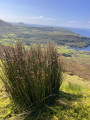
The route moves from boggy to dry, loose shale and would get quite mucky on a wet day. Lower on the mountain, cattle wander freely, whereas the farm animals you'll meet further up are sheep.

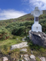
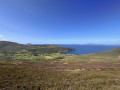
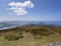
Along the route are large, whitewashed crosses marking the Stations of the Cross, and at the end of the route is a larger cross, marking your culmination. The views along the way are wonderful and particularly good from the top.

The descent is basically the same as your route up, but with the assistance of gravity, it takes less time. However, exercise caution- your legs will probably be tired at this stage and it is easy to slip and fall on the loose gravel. That said, when I was resting at the final cross, a runner jogged past me and ran back down the mountain, taking a much steeper route than I would have dared attempt!

Waypoints

  1. S/E : mi 0 - alt. 52 ft - Car park
  2. 1 : mi 0.14 - alt. 95 ft - Stile beside gate and first Station of the Cross
  3. 2 : mi 0.68 - alt. 436 ft - Cattle-proof gate
  4. 3 : mi 2.14 - alt. 1,749 ft - Pilgrim passport destination point
  5. 4 : mi 2.68 - alt. 2,205 ft - The final Celtic cross
  6. S/E : mi 5.41 - alt. 52 ft - Car park

Notes

The website for this 'Pilgrim Path' gives the location of the unsupervised car park for this walk, which is located approximately 4.5km from Cahersiveen, Co. Kerry. On the date I visited (22 Aug '26), the car park was almost full, so I would advise getting here early in fine weather. There is an 'honesty box' payment of €3.

According to the website, dogs are not permitted; as this is private land, please do not bring any with you.

For more walks, use our search engine .

The GPS track and description are the property of this route's author. Please do not copy them without permission.

