


 Country:
 City:


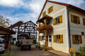
(S/E) The circular walk along the Kindinger Burgenweg starts at the small hiking car park on the St2230, south of the Altmühl on the outskirts of Kinding (coming from Kipfenberg).
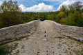
(1) From the car park, we first cross the road to the Stone Bridge, which is also known asthe ‘Roman Bridge’, although it was not built by the Romans but simply in the typical Roman architectural style. The bridge has only recently undergone extensive renovation and now serves as a footbridge and cycle path.
(2) Back at the car park, we keep to the path diagonally opposite the bridge and turn left, walking along the wide dirt track past the barns, slightly uphill to the edge of the wood. Here we come to the pretty Ottilien Chapel, which we pass on the left as we continue up the natural path into the wood (somewhat difficult to spot).
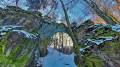
(3) The narrow path leads uphill through the mixed woodland to a junction, where a signpost marked ‘Klause’ points to the right. We follow the sign along a zigzagging path steeply uphill, past moss-covered boulders, to the cave known as Kindinger Klause, where early humans used to rest and spend the night. The cave isn’t particularly deep, so you won’t need a torch.
After exploring the cave, we walk the short distance back to the junction and continue along the lower of the two paths branching off to the right (the two paths to the right rejoin later). At the next junction, we turn left and follow the path along the mountainside through the forest.
(4) In a small clearing, there is a burial mound from the Bronze Age or Hallstatt period, with a picnic area and an information board. The path then curves gently to the right. At the next junction, we go straight on and, just under a kilometre further on, turn left at the T-junction.
The path curves to the right and continues along a narrow track across the wooded mountainside. At the next fork, we take the narrow path on the right and keep going straight on at the subsequent junctions. Shortly before another T-junction, the Kindinger Burgenweg turns sharply left.
(5) At the third junction on the left, we can take a detour to the Hubertusfelsen, the first former castle on the hilltop. The main route continues straight on. If you wish to take the detour, follow the narrow forest path to the left, turn right at the fork and, after about 300 metres, you’ll reach the Hubertusfelsen on the hillside. At the junction by the Hubertusfelsen, take the second path on the right back to the main route, which joins a tarmac road after a short distance.
We cross this and continue straight on along the opposite side. Hidden away on the right-hand side is a small picnic area. At the next fork, we keep to the left and, shortly afterwards, turn left onto the narrow path which leads us up the mountainside, high above the Altmühl Valley.
(6) About 600 m past the tarmac road, we reach a viewpoint with a cross and a bench. After that, the path descends relatively steeply and then climbs again to a picnic area, on the left-hand side of which lies the Felsentor.
(7) Before we head through the Felsentor towards Unteremmendorf, we first make a short detour to the Saufelsen, the third former castle in the group. The Saufelsen is situated about 200 m away, directly to the left of the path.
(8) Back at the picnic area, we head down into the valley this time. We descend the steps through the Felsentor, a natural gateway that once formed part of the entrance to the second castle complex and is now listed as one of Bavaria’s geotopes. Directly below the Felsentor, on the right-hand side, is a larger cave that can be entered (using a small ladder; a torch is advisable). On the left-hand side is a smaller cave.
We follow the natural path as it zigzags gently down to the road, which takes us round a bend into the centre of Unteremmendorf. The leat flows through the village towards the Altmühl. Where the road makes a slight bend to the right, we turn left and follow the wide dirt track straight on along the edge of the forest (keep left at the first fork, continuing along the edge of the forest).
(9) We walk past the Wellenbank to the Chapel of the Merciful Jesus. At the next junction, we turn left, then left again at the T-junction and immediately right. If we keep going straight on from here, we’ll arrive back at the Ottilien Chapel.
(S/E) At the Ottilien Chapel (2), we turn right and follow the same route as at the start of the walk back to the hiking car park and the Roman Bridge.

 Visorando Member
 Easy


