


 Country:
 City:
City:


Park in Alwinton. As you enter the village, there is some free parking opposite the Rose and Thistle, just before the left-hand bend in the road. If this is full, there is a National Trust car park in the village.
(S/E) From the parking, take the road in a southerly direction heading out of the village. Take the first turn on the left and follow the road to Clennell Hall Farm, passing a campsite which is on your right. Pass the farm by keeping to the road on the left and continue along the road, which eventually becomes a track. Pass over three bridges, then after a slightly steeper section, look out for a track on the left signposted Kidlandlee.
(1) Ignore the left turn and keep straight ahead, cross another bridge and arrive at a locked gate across the track.
(2) The gate has a small pedestrian gate on its right. This does not open fully, but you can squeeze your bike through. Continue along the track and look out for a sharp bend to the right, where the track heads uphill.
(3) Turn right and head uphill. The climb is just over a mile and is 10% in the middle, easing off towards the top, where it bends to the right and then back left, ignoring the adjoining tracks on each bend (check the map). The track sweeps north and northwest with views down onto the house at Milkhope. The track now snakes through the forest via a set of sweeping bends east and west. Ignore two adjoining tracks on the right as you approach the head of Cushat Cleugh.
(4) From the head of Cushat Cleugh, head downhill to a T-junction. Turn right, ascend and then contour the hillside to the head of another valley and then descend, passing some recent forestry work, to a junction.
(5) Turn sharply right and head uphill to curve around the head of the valley containing Lindhope Linn waterfall. Contour south and west around the flank of Wether Hill to another junction.
(6) Again, turn sharply right uphill to a second locked gate across the track.
(7) Bypass this on the left and continue uphill, then contour around the top of the next valley.
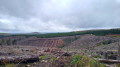
Note: this section has active forestry work, the track has been re-stoned in places with larger rock pieces, which makes the ride choppy.
On descending southwards from the head of the valley, there are sections where machinery has churned up the track, and after rain it can be muddy. These sections are short lived and you soon turn right and contour around the head of West Burn to turn left and descend in a south-southeast direction to a junction with Clennell Street, which is an old drovers' track.
(8) Clennell Street is ahead of you, so ignore the track which slants downhill on your right. Cycle straight ahead to pass the remains of a wooden stile on the right of the track. Continue, ignoring any tracks on the right or left, to where the path bends to the left and where Clennell Street becomes a grassy path through the forest on the right (check the map).
(9) Keep following the forest track, which takes a series of bends as it descends, again ignoring two tracks on the left which lead to Kidlandlee. If in doubt, always head downhill to arrive at (1)
(1) Turn right and follow the track and then the road back past Clennell Farm. At the junction with the main road, turn right a ride back into Alwinton and the parking (S/E).

