


Ilgas Hike
Details
Creation:
Last update:
–
–
-
 Activity: Walking
 -
 Distance: 6.55 mi
 -
 Average duration: 3h 10
 -
 Difficulty: Not specified
 -
-
 Back to start: No
 -
 Ascent: + 157 ft
 -
 Descent: - 98 ft
 -
-
 Highest point: 423 ft
 -
 Lowest point: 266 ft
-
 Start: N 54.114867° / E 24.299269°
 -
 End: N 54.113056° / E 24.345017°
 -


 Hour-by-hour weather


Waypoints
- S : mi 0 - alt. 266 ft
- E : mi 6.55 - alt. 325 ft
Other walks in the area
Zackagirio takas, amongst the pine forests and heritage sites of Marcinkonys
 Visorando Member
 8.86 mi
+328 ft
-344 ft
4h 20
8.86 mi
+328 ft
-344 ft
4h 20
 Moderate
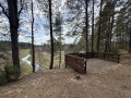
In the heart of Dzūkija National Park, the largest in Lithuania, this nature trail is a circular route that circles the village of Marcinkonys and its surroundings through a vast pine forest. The circular route begins with a string of ponds lined with wooden houses, then winds its way through the pines to a viewing point overlooking the meandering Grūda River. It then reaches the village and its remarkable wooden church with two towers, before crossing a sand dune situated right in the middle of the forest. The return journey takes you through a landscape of peat bogs and streams, bringing you close to unspoilt wilderness and the rich heritage of the region’s ethnographic villages.
For more walks, use our search engine .
The GPS track and description are the property of this route's author. Please do not copy them without permission.

