Country:
 City:
City:


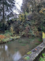
Park in the car park on Rue Longue behind the Nismes Tourist Office.
(S/E) Head towards the far end of the car park, past the Tourist Office’s waterwheel, cross a bridge, reach Rue de la Vieille Église and turn right towards Saint-Lambert’s Church. Cross Rue Bassidaine with care, cross the bridge over the Eau Noire, then turn left to enter Nismes’s municipal park.
(1) Turn left, cross another bridge to get closer to the bank of the Eau Noire.
Signposted with a red Rectangle and a white stripe
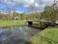
Follow the gravel path running alongside the stream, cross another bridge and then yet another further on, which leads onto a lawn.
(2) Cross the red, blue and green bridges in turn to go round the lake. Use the stepping stones to continue and reach a path on the left.
(3) Follow this path uphill to a T-junction. Turn left, then right a little further on; after a short climb, leave the Jardin d’O and join Rue des Juifs. Follow it to the right until you reach a tarmac path that climbs to the left.
Yellow Rectangle Markings
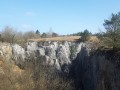
(4) Walk past a lodge, go up a few steps and begin the climb towards Les Abannets. When you reach the top of the hill, turn left at a T-junction and continue to a further crossroads. Turn left, heading towards a viewpoint overlooking Nismes: on your right, you’ll see the first limestone collapse.
(5) Turn back and quickly follow the path to the left which runs alongside the landslide. Cross the first path, continue straight ahead until you reach another stony path and follow it to the left. Walk alongside another landslide on your right and continue towards a wooden hut. Pass a path on your right just before reaching a car park, turn left and walk on for a few dozen metres: end of the Yellow Rectangle markings
(6) Head right into the forest and, after about 700–800 metres, you’ll reach a crossroads: on a tree behind you, there’s a Red Rectangle with a white bar marking.
(7) Turn left and follow the path, ignoring any cross-trails and firebreaks. Head down towards the Viroin and, before reaching the bottom of the descent, ignore the first path on the right.
(8) Take the next path on the right. Head towards a gate and turn at a right angle to the left, slightly downhill. Turn sharply to the right; further on, ignore a path on the left and continue straight ahead, staying on the track that follows the right bank of the Viroin. Pass at the foot of a rocky outcrop and reach a railway bridge accessed via a wooden staircase. You’ll see the Abannets tunnel on your right.
(9) Turn left. Caution: take care when tourist trains on the Trois Vallées Steam Railway are running, and cross the bridge keeping the tracks on your right. At the end of the bridge, go down a flight of steps on the left towards a path which you should follow to the right. Reach a T-junction at another bridge; turn left.
Marked with Yellow Diamonds.
(10) Take a path that leads back to the left. Climb slightly until you reach a junction. Turn right and follow the straight, steeply sloping path. At the top, on the Plateau des Cinques, you’ll reach the entrance to the site, marked by a tree trunk lying on the ground. Take the narrow path, which was probably an access route to a gate in the fortifications.
(11) Continue straight ahead to leave the site (again, a tree trunk lying on the ground). After a few dozen metres, look out for the old Prosper quarry on the right, which is home to a climbing site. Take great care when leaving the path to go and see the site. Continue on to reach a Fork in the road; take the right-hand fork and you’ll come out onto a wide forest track at a place called La Croix Sauvage.
(12) Turn right and you’ll very quickly reach a crossroads where you should follow the path on the left: this marks the end of the Yellow Diamond markings. You’ll reach another crossroads.
Blue Cross markings
Turn left and you’ll come out into an orchard. Follow the track and stay on the main path, ignoring any side paths and firebreaks, until you reach a fork in the road: end of the Blue Cross markings.
Red MTB markings: two circles topped by a Red Triangle
(14) Veer to the right to take a bend down a steep descent. Join a concrete road and follow it to the right. At the bottom of the descent, turn sharply left to follow the dirt track.
Yellow Cross markings
Climb gently before beginning a descent and reaching a fork in the path. Turn left towards La Roche Madoux (former quarry). Continue along the path until you reach a small country lane: end of the Yellow Cross markings.
Red Diamond markings.
(15) Cross carefully and enter the Tronsoy Nature Reserve via the path straight ahead. Follow the hillside to reach the Relais Verlaine.
(16) Turn left and follow Rue de Matagne-la-Petite slightly uphill. Just before the top of the hill, take the path on the right, until you reach a Fork in the road and a bench. Turn left, climb a short, steep section via a wooden staircase to reach a field, then continue to the right. Walk alongside a woodland and enjoy the beautiful views towards Treignes, with the hills overlooking the French Meuse in the distance. You’ll come to a steep, rocky descent which you should navigate with care. At the bottom of this descent, turn left and then immediately right to reach the Ruisseau des Fonds de Ri. Cross it via the footbridge and climb a wooden staircase to join a stony path.
(17) Follow this path to the right towards Treignes. Continue along Rue Trou Maillard (another former quarry), following it to the right before beginning the climb towards the village centre. Look out for, and follow, a narrow lane branching off to the right to reach Rue Eugène Defraire. Follow it carefully to the left to reach the church square in Treignes.
(18) Opposite the church, turn right onto Courte-Rue, which descends and joins Rue de Bruyère; follow this to the right until you reach a Fork in the road and the Saint-Roch Chapel. Turn right uphill to stay on Rue de Bruyère. Before reaching the N99, turn left and take a small path bordered on both sides by fences. Follow it to the first houses in Vierves-sur-Viroin, which you’ll reach via Rue Fontaine Saint-Joseph: end of the Red Diamond signposting.
(19) At No. 30, turn right onto Chemin de la Barytine. Further on, take the steep path climbing to the left, which leads to another track. Continue to the right until you reach a Fork in the road, then take the left-hand fork to the hamlet of Les Canons.
GR® white and red markings
You’ll emerge at a First World War memorial site adorned with cannons. There’s a lovely view of Vierves. Walk under the monument and continue for about fifty metres.
(20) There are two options at this point:
- to avoid the steep descent, for example in wet weather, carry on straight ahead and join Rue de la Gendarmerie via a path that branches off to the left a little further down. Follow this street to the left to reach Place Albert Ier and the church in Vierves,
- otherwise, follow the route shown on the map and turn left down the steep slope. At the bottom of this slope, turn left onto Rue Fontaine Saint-Joseph, then very quickly take the narrow lane on the right leading onto Rue de la Gendarmerie, which you should follow to the left. Turn quickly right then left to reach Place Albert Ier. Head towards the bandstand.
(21) On your right, take the steps leading to the Parc Communal. At the bottom of the steps, leave the park and head down to the right until you reach Rue du Centre. Follow it to the right and head down to the Viroin. Cross the bridge, then the railway line, and continue along Rue de la Chapelle to number 6.
(22) Take the path branching off to the right. Follow it, then head downhill alongside the railway line until you reach the woods. The path dips, climbs briefly and turns leftwards uphill. At the next fork in the road, near a wooden marker, continue along the path on the right. Pass the fitness trail stations, ignore all the paths coming from your left and keep the Viroin on your right. After a short climb, you’ll reach a junction of dirt tracks: this is where theGR® markings end.
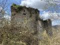
Blue Diamond markings.
(23) Ignore both the right-hand and left-hand branches and walk along the right-hand side of a rest area equipped with tables, benches and information boards. You’ll reach a T-junction; turn right onto Rue de la Bossette, cross a bridge and, after a slight climb, reach a crossroads. Turn right and continue downhill along Rue Cheraivoie until you reach the bridge over the railway line. Just after the bridge, take the path to the left and head towards the church at Olloy-sur-Viroin. You’ll reach the new bus shelter on the forecourt.
(24)Cross Rue Saint-Éloiwith care and continue along the path that runs alongside the railway line on your left. You’ll soon reach Rue des Frères Bouré; follow it to the left for a few metres, then turn left onto Rue de la Champagne, which climbs slightly.
GR® white and red markings
Reach the first fork in the road and take the left-hand branch. At the next fork in the road, leave the road and follow a dirt track to the right. Stay on this track until you reach a temporary timber storage area.
(25) Enter the woods and begin a climb alongside the Damier Ri stream. Pass two paths on your left, cross a marked hollow and reach a T-junction: end of theGR® markings.
(26) Turn right. Cross the stream and climb the path opposite. At the top, follow the narrow path that turns left, cross a track and reach the Roche Trouée campsite.
GR® white and red markings
(27) Leave the campsite on your right and continue straight ahead. Descend rapidly to the bottom of a small valley. Continue straight on, cross the stream and start climbing again immediately. You’ll reach a junction.
(28) Continue straight ahead: endof GR® markings.
Join a tarmac road and follow it downhill to the right until you reach the start of a wide forest track.
(29) Follow it to the left. Ignore a path branching off to the left and carry on for a few dozen metres.
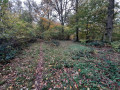
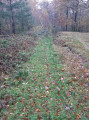
(30) Please note: the map is not accurate at this point and shows a path coming from the right which does not exist on the ground. Carry on straight ahead, passing a path on your left; when you reach a small clearing, take care not to follow the path on the right – which is clearly marked and leads slightly uphill – but take the very narrow, less clearly marked path that veers off to the left. Turn left to reach a junction marked by a boundary stone on the left. The photos accompanying this description help to illustrate this section.
(31) Continue straight on until you reach the edge of the woods and a housing estate on the right. Continue down the path, which turns into a road and joins a wide stony track starting on the left.
(32) Follow this path, passing two paths on the left in turn. At a bend to the right, similarly ignore two paths leading downhill to the left and go round a chalet on its left-hand side.
(33) At the next fork, turn sharply to the right. Continue along the path, passing two more paths on the left, and reach a third junction.
(34) Ignore the path on the right and continue straight ahead through the bushes. You’ll emerge at a dead end and arrive in the village of Petigny. Head left towards the village church via Rue Chéreulle, then Rue des Scoubalous, until you reach the church forecourt.
(35) Take the narrow lane on the right and emerge onto the N99. Cross carefully at the pedestrian crossing, turn left and then immediately right onto Rue du Baty. Cross the Eau Noire over the old bridge.
GR® signposting
(36) Take the dirt track on the right. Continue along the track on the left bank of the stream until you reach Rue du Calvaire. Carry on towards Nismes, then you’ll come to a steeply sloping street branching off to the left-rear.
(37) Turn left onto this street. Pass a path on your left at a sharp bend and complete the climb to reach a three-way junction.
(38) Take the path straight ahead. You’ll reach an area with a picnic table and a bench at Fondry Matricolo; follow the path that branches off to the right, running alongside further limestone collapses, until you reach a T-junction. Turn left and then right. Pass a steeply sloping path on your right.
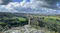
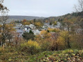
Before beginning the descent towards Nismes, follow the path to the right which leads to a beautiful view over the village.
(39) Turn back and continue the descent to the right. You’ll reach a flight of steps; at the bottom of the steps, turn right: the path leads to a house.
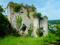
(40) Walk past the house on your left and take the steps running alongside the ruins of the old Church of Nismes, the fortified cemetery and the Château du Pont d’Avignon to come out onto Rue Saint-Antoine. Follow this road to the right. At the bottom of the slope, turn right, go down a few steps at the Maison des Baillis – which houses the Viroin-Hermton Nature Park Centre – and reach Rue d’Avignon.
(41) Take a short detour to the right to reach the site of the Eau Noire resurgence.
(42) Turn back.
(41) Turn right, then right again to cross the bridge over the Eau Noire and reach the car park (S/E).


 Visorando Member
 Moderate