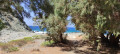
Toplou Gorges

A short walk (around 2 hours) to combine with a visit to the monastery. There is a small colony of Cretan date palms (Theophrastus palms) and some pretty caves carved into the rock. A lovely view of the sea at the end of the path.

Details

n°110744066
Creation:
Last update:
Last review:
–
  • Walking
    Activity: Walking
  • ↔
    Distance: 2.12 mi
  • ◔
    Average duration: 1h 20 
  • ▲
    Difficulty: Moderate

  • ⚐
    Back to start: Yes
  • ↗
    Ascent: + 400 ft
  • ↘
    Descent: - 397 ft

  • ▲
    Highest point: 538 ft
  • ▼
    Lowest point: 125 ft

Description of the walk

Park in the monastery car park. The start of the walk is 150 m from the car park. This is a well-signposted circular route.

(S/E) From the road, take the small path on the right. Head straight on and go through the wire-mesh gate. After a few metres, near a building below, the path begins to descend into the gorge. Follow the path through the gorge until you reach the fork marking the return route.

(1) Continue to the right towards the sea and follow the path to the end.

(2) Return along the same path as far as the fork.

(1) Turn right onto the path, which climbs quite steeply until you reach the plateau and the monastery car park (S/E).

Waypoints

  1. S/E : mi 0 - alt. 522 ft - Monastery car park
  2. 1 : mi 0.99 - alt. 272 ft - Return route junction
  3. 2 : mi 1.12 - alt. 125 ft - End of the path
  4. S/E : mi 2.12 - alt. 525 ft - Monastery car park

Notes

This route should be undertaken in dry weather.

Other walks in the area

For more walks, use our search engine .

The GPS track and description are the property of this route's author. Please do not copy them without permission.