Aigoual State Forest

A magnificent, very easy mountain bike ride with very gentle gradients, in the shade of the beech and pine trees of the Aigoual Forest.

Details

13242667
Creation:
Last update:
Last review:
  • Mountain biking
    Activity: Mountain biking
  • ↔
    Distance: 13.25 mi
  • ◔
    Duration according to the author: 2 hrs 
  • ▲
    Difficulty: Easy

  • ⚐
    Back to start: Yes
  • ↗
    Ascent: + 1,047 ft
  • ↘
    Descent: - 1,073 ft

  • ▲
    Highest point: 4,475 ft
  • ▼
    Lowest point: 3,842 ft
  • ⚐ Country: France
  • ⚐
  • ⚐ City: Valleraugue (30570)
  • ⚑
    Start/End: N 44.103062° / E 3.541113°
  • ❏
    IGN map(s): Ref. 2641ET

  • ◶
    Type of surface:
  •  
     
     25% Road  75% Byway
  • ⇧
    Bike carrying: No
  • ▲
    Difficulty: Easy
  • Hour-by-hour weather

Photos

Description of the route

Start from the Maison de l’Aigoual, at the Col de la Serreyrède.

(S/E) Take the D986 westwards for 300 m.

(1) Turn onto the track on the left.

(2) At the next bend to the left, at the Col de la Pierre Plantée, ignore the track leading off to the left at the back and carry on straight ahead.

(3) Cross the Trévezel at its source and carry on to the Col de Faubel, ignoring the paths branching off on either side.

(4) Cross the road and turn sharp right onto forest track no. 94, continuing to the next junction (stone wall).

(5) Turn left and continue to the next junction.

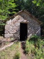
(6) Keep to the right; the track leads to a small stone house.

(7) Leave it on your left and carry on straight ahead.

(8) At the junction, in front of the stone marker, take the track on the left which turns back at 120°. Stay on the main track and follow it to the Col de Faubel.

(4) Turn right onto the tarmac road, which descends gently through the trees, and join the D986.

(9) Carry on to the left, ignore the D48n a few metres further on and continue on the D986a to the village of L’Espérou (some nice little restaurants).

(10) At the multi-way junction, turn left onto the D986 and head for the Maison de l’Aigoual (S/E).


Waypoints

  1. S/E : mi 0 - alt. 4,265 ft - Maison de l’Aigoual - Col de la Serreyrède (1299m)
  2. 1 : mi 0.14 - alt. 4,232 ft - Track on the left
  3. 2 : mi 0.49 - alt. 4,236 ft - To the left - Col de la Pierre Plantée (1286m)
  4. 3 : mi 0.74 - alt. 4,226 ft - Source of the - Trévezel (rivière)
  5. 4 : mi 2.45 - alt. 4,219 ft - Track immediately on the right - Col de Faubel
  6. 5 : mi 3.23 - alt. 3,983 ft - A wall of large stones; the track climbs to the left
  7. 6 : mi 4.72 - alt. 3,967 ft - Carry straight on, ignoring the track on the left
  8. 7 : mi 5.79 - alt. 3,845 ft - Small stone house on the left
  9. 8 : mi 6.62 - alt. 3,983 ft - Stone marker, on the left
  10. 9 : mi 11.63 - alt. 3,957 ft - D986a, on the left
  11. 10 : mi 12.29 - alt. 4,009 ft - D986 to the left - Col de l'Espérou(1329m)
  12. S/E : mi 13.25 - alt. 4,265 ft - Maison de l’Aigoual - Col de la Serreyrède (1299m)

Notes

An easy route for mountain bikes or e-MTBs. Very gentle gradients. Make sure you bring water as there are no accessible water points along the route.

Worth a visit

Enjoy the beech and pine trees and the very refreshing woodland, even in the heat of the day.

Reviews and comments

4.7 / 5
Based on 2 reviews

Reliability of the description
4.5 / 5
Ease of following the route
5 / 5
Route interest
4.5 / 5
User 23454996

Overall rating : 4.3 / 5

Date of your route : Aug 29, 2026
Reliability of the description : ★★★★☆ Good
Ease of following the route : ★★★★★ Very good
Route interest : ★★★★☆ Good
Very busy route : No

This cycle route isn’t as easy as it sounds – the path is steep, very stony and has a deceptive gradient almost all the way along. If you’re not used to cycling, I wouldn’t recommend it, especially with children. Apart from that, it was very pretty; you’re in the shade almost all the time, so do bring a jumper. The signposts are very reliable.

Machine-translated

Deerzed
Deerzed

Overall rating : 5 / 5

Date of your route : Sep 12, 2021
Reliability of the description : ★★★★★ Very good
Ease of following the route : ★★★★★ Very good
Route interest : ★★★★★ Very good
Very busy route : No

Hello,
I chose to start from L’Espérou to cut the road section in half, which is normally at the end of the route.
A very pleasant route with no technical difficulties, and plenty of spots for a picnic.
Thanks for sharing!

Machine-translated

For more walks, use our search engine .

The GPS track and description are the property of this route's author. Please do not copy them without permission.