


 Country:
 City:
City:


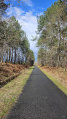
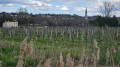
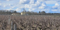
Start from the large car park in front of the stadium, in the centre of the village, near the Romanesque church of Léognan. There are plenty of parking spaces available, but please note that on Saturday mornings, when the market is on, finding a space can be more difficult.
(S/E) Head south-east along the edge of the large wooded car park, cross the small stream, the Eau Blanche, at the Pont de Naudet, and arrive at the entrance to the cemetery.
(1) Turn left onto theD651E3 (Avenue de Cadaujac), heading towards Cadaujac. Drive slightly uphill until you reach a roundabout.
(2) At the roundabout, go straight on, taking the3rd exit (D651). Pass Château Larrivet Haut-Brion (on your right), then Château Haut Bailly (on your left), and you’ll reach a four-way junction. Carry on straight ahead along Rue de la Liberté (D651E3) until you reach the entrance to Château de La Louvière (on your left).
(3) Continue along the departmental road and, at the next junction, follow the road to the right until you reach Château Carbonnieux (on your left).
(4) Carry on along the road until you reach the four-way junction at the entrance to Cadaujac, 150 m before the traffic lights.
(5) Turn right onto theD111E4 towards Martillac, passing Château Bouscaut (on your left). Drive through a residential area and continue along a road that climbs slightly until you reach a four-way junction.
(6) Turn right, pass Château Smith Haut Lafitte (on your right), and reach the end of the road of the same name.
(7) Turn left, where woodland and vineyards alternate, and carry on straight ahead until you reach a crossroad (D109).
(8) Turn left and head towards the village of Martillac, following the cycle path that runs alongside the D109. Go straight on atthe first roundabout onto the D214 (ignore the Route de Labrède on the right), do the same at the next one, and continue to thethird.
(9) Take thesecond exit onto the D214, Route de Massiot, towards Martillac centre. This road climbs steeply and leads to the church in the centre of the village.
(10) Leave the D214 and continue straight on towards La Brède. At the junction with a wayside cross, carry on straight ahead, pass Château Haut Nouchet (on your left) and join the D109.
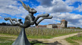
(11) . Turn left onto the cycle path. A few metres further on, follow the path to the left and leave the D109. Head into the vineyard, with a striking wine store of contemporary architecture on your right. Stay on the cycle path until you reach the first houses in the village of Labrède. At the junction, carry straight on along Allée Gaudiche until you reach the T-junction.
(12) Turn left onto Chemin Chante l’Oiseau, then, after about 300 metres, turn right (Avenue Charles Cantes) and head straight on as directly as possible (Allée du Haut de la Brède). Turn right onto Allée Alénor d’Aquitaine, then left (Chemin de Fourchet) until you reach a side street.
(13) Turn right onto Allée des Lettres Persanes and follow the Saucats stream until you reach the church in the centre of Labrède.
(14) With the church in front of you, turn left onto the D108, Avenue Charles de Gaulle, towards Langon; then, at the next roundabout, turn right onto a small dead-end road to reach the Labrède–Hostens cycle path.
(15) Take the cycle path on the right.
(16) At the junction with Avenue de Peyret (D220), continue along the cycle path opposite and join the next road.
(17) Leave the cycle path and turn left onto the small road. Pass through the hamlet of Les Cabanasses and arrive at a T-junction. Turn left and continue to the junction at the end of Chemin de la Pépinière.
(18) Take thesecond road on the right,the D220E1, towards Saint-Morillon. After a lovely descent, you’ll reach the end of it.
(19) Carry on to the right onto the D219, towards Cabanac. Pass Château Piron, then Château Claron, and arrive at a three-way junction a few metres after the Saint-Morillon town sign.
(20) Turn right onto Route de Gravette, towards Château Belon, and follow it to the end.
(21) Opposite, in the background behind a large vineyard, you’ll see Château Belon. Turn left and follow the road for about 700 metres, then take thesecond small road on the right, Chemin de la Veyrieyre.
(22) Follow this small road – the tarmac is in fair condition in places – until you reach the cycle path.
(23) Turn right and stay on the cycle path for about 3.3 km, until you reach thesecond junction with a road on the left.
(24) Turn left, then take the first right and follow this small road as it descends steeply for about 1.7 km. At the three-way junction, on a flat stretch before a wide right-hand bend, keep left and carry on until you reach Chemin de Moulin Pertus on the left at the end of a residential area.
(25) Take this track, following it whilst keeping the forest on your left at all times, and do not enter the housing estates. The road then bends sharply to the right before reaching the next junction (D108), beneath a high-voltage power line.
(26) Carry on straight ahead and, after about 300 m, turn sharply right at the three-way junction. Pass through the hamlet of Moras, keeping to the right at the three-way junction, and carry on straight ahead until the end of Avenue Adolphe de Mons.
(27) Turn left (D109), leaving the village of Labrède on your right. Follow the departmental road, rejoining the route you have already taken, then take the Route du Haut Nouchet on the right.
(11) Carry on straight ahead and leave the route you’ve already taken. Pass the multi-sports complex on your left and, just after the sign marking the entrance to the village of Martillac, you’ll come to a four-way junction.
(28) Turn left onto Rue de la Solitude, pass the Monastère de la Solitude, then the Domaine viticole de la Solitude, and carry on straight ahead until you reach the junction with a pumping station on your left.
(29) Continue to the right (D111) until you reach the roundabout at the new Léognan cemetery. From the entrance to the Montesquieu business park, take the cycle path running parallel to the D111.
(30) At the roundabout, turn left onto the cycle path towards Léognan. Follow this straight on until you reach the D651.
(31) Turn left towards Saucats and head up through the vineyards. Pass Château Pont Saint-Martin, Château Malartic-Lagravière, Château de France and Château Fieuzal. At the hamlet of Bonois, take the first road on the right, Chemin des Bougès.
(32) Take this road, which runs perpendicular to the D651, pass Château Mancèdre on your left and continue straight on (on your right in the vineyards is Château de France) until you reach the hamlet of Les Bougès.
(33) At the roundabout, turn right and follow the road to Château Haut Bergey, at the end of Chemin du Coquillat.
(34) Follow the cycle path to the left, running alongside the Haut Bergey estate, until you reach a large roundabout featuring a wooden wine vat.
(35) Take the cycle path on the right and ride past Château Gazin. Ignore the small road on the right, Chemin de Soubian, and continue to the next roundabout.
(36) Take the cycle path on the right to the village of Léognan; at the traffic lights, turn right onto the D651 and head for Léognan church (S/E).



