


 Country:
 City:
City:



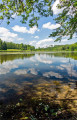
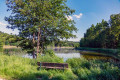
Start: The circular route begins at the walkers’ car park on Anhauser Straße in Burgwalden.
(S/E) From the car park, we walk along Anhauser Straße out of the village towards the north (signposted ‘Schwäbis-Allgäuer Weitwanderweg’). After just under 50 metres, before reaching the first pond, we turn right onto the path.
(1) We cross the Anhauser Bach and walk between two further ponds to the edge of the forest. Behind the first trees, the narrow path (unmarked) turns off to the left.
(2) It takes us on along the Bruckmahdweiher. At the end of the Bruckmahdweiher, we keep to the right at the fork, then turn left and follow the path.
(3) This soon takes us past a wetland area on the left-hand side, which forms the southern part of the Ödweiher. Beyond the Ödweiher, we cross the junction and continue straight ahead.
(4) We then continue to the right along the bank of the Tannetweiher through the woods.
(5) At the end of the pond, just past a bench, we come to a junction, which we cross straight ahead and continue along the narrow forest path. From here, the forest path becomes somewhat rough-going.
(6) It takes us through another wetland area by the Anhauser Bach.
(7) This stretches all the way to the Burlafinger Weiher. We walk past this too and, at its far end, come to a T-junction. Here, we turn left.
(8) After a good 100 m, we turn left again onto the wide gravel path along which the Schwäbisch-Allgäu Long-Distance Hiking Trail runs.
We follow the gravel path for about 800 m, then take the left-hand branch at the fork and immediately turn left again, walking southwards along the Tannetweiher (marking: Schwäbisch-Allgäuer-Weitwanderweg). We keep slightly to the left as we walk along the Tannetweiher and continue straight on behind the pond. The path takes us along the ridge slightly above the Ödweiher
(9) On the right-hand side is a sprawling golf course belonging to the Golfclub Augsburg e.V., which runs right up to the footpath. We go straight on at the next junction and continue through a small wooded area alongside the Bruckmahdweiher (signposted: Schwäbisch-Allgäuer-Weitwanderweg).
After a while, we come to Anhäuser Straße. We walk past the car park on the left and Gut Walden(10) on the right.
(11) We then follow Galgenbergstraße along the Schlossweiher. At the fork by a couple of small ponds, we turn left at the edge of the woodland and, at the next opportunity behind the ponds, turn left again, following the Schwäbisch-Allgäuer-Weitwanderweg. We cross the Anhauser Bach.
(12) Behind the Kotweiher on the right-hand side, we come across the Buchkopf spring, which is enclosed in stone.
We continue along the path through the wood. After about 700 m, we leave the Schwäbisch-Allgäuer-Weitwanderweg by turning left at the junction. After about 400 m, the woodland path ends at Attenhofer Straße, which leads us left back towards Burgwalden. We walk through the village, passing the Schlossweiher on the left and the Mühlweiher on the right, and turn right onto Anhauser Straße just before Gut Walden (10).
(S/E) This takes us back to the starting point, the car park on Anhauser Straße.




