


Eastbourne To Ditchling
Details
Creation:
Last update:
–
–
-
 Activity: Walking
 -
 Distance: 24.74 mi
 -
 Average duration: 13h 55
 -
 Difficulty: Not specified
 -
-
 Back to start: No
 -
 Ascent: + 2,946 ft
 -
 Descent: - 2,320 ft
 -
-
 Highest point: 801 ft
 -
 Lowest point: 0 ft
-
 Country:
United Kingdom
Country:
United Kingdom
-
 Area: South Downs
 -
 City:
Eastbourne
City:
Eastbourne -
 Start: N 50.797879° / E 0.250998°
 -
 End: N 50.902021° / W 0.107442°
 -


 Hour-by-hour weather


Waypoints
- S : mi 0 - alt. 144 ft - Continue onto Hockington Lane
- 1 : mi 0.04 - alt. 151 ft - Turn left onto Butts Lane
- 2 : mi 0.67 - alt. 574 ft - Turn right
- 3 : mi 2.28 - alt. 246 ft - Turn slight right onto Willingdon Lane
- 4 : mi 2.37 - alt. 230 ft - Turn right onto Jevington Road
- 5 : mi 2.38 - alt. 233 ft - Turn left onto Church Lane
- 6 : mi 2.49 - alt. 269 ft - Continue
- 7 : mi 5.81 - alt. 33 ft - Turn right onto High Street, C39
- 8 : mi 5.83 - alt. 36 ft - Turn left onto Star Lane
- 9 : mi 5.88 - alt. 39 ft - Turn slight left
- 10 : mi 5.89 - alt. 39 ft - Turn left onto Weavers Lane
- 11 : mi 5.9 - alt. 39 ft - Turn slight left onto Deans Road
- 12 : mi 5.91 - alt. 39 ft - Turn left onto Kings Ride
- 13 : mi 6.1 - alt. 121 ft - Continue
- 14 : mi 13.23 - alt. 85 ft - Turn right onto Lewes Road, C7
- 15 : mi 13.27 - alt. 92 ft - Turn left
- E : mi 24.75 - alt. 801 ft
Other walks in the area
Beachy Head & Eastbourne from East Dean
 Visorando Member6.29 mi
+676 ft
-804 ft
3h 30
Visorando Member6.29 mi
+676 ft
-804 ft
3h 30
 Moderate
Departure from East Dean and Friston (East Sussex)
Moderate
Departure from East Dean and Friston (East Sussex)
This linear walk from East Dean to Eastbourne includes many of the highlights along the East Sussex coast in this area. A frequent bus serrvice can be used to return to the start.
Eastbourne Loop - Seven Sisters and East Dean via the South Downs Way
12.56 mi
+1,778 ft
-1,778 ft
7h 20
 Difficult
Departure from Eastbourne (East Sussex)
Difficult
Departure from Eastbourne (East Sussex)
Loop starting from Eastbourne, going along the cliffs, passing by the Seven Sisters and coming back from the fields/forest.
You can start this walk from Eastbourne station, adding 3-4km to the total.
The Seven Sisters
 2.80 mi
+394 ft
-876 ft
1h 40
2.80 mi
+394 ft
-876 ft
1h 40
 Easy
Departure from Eastbourne (East Sussex)
Easy
Departure from Eastbourne (East Sussex)
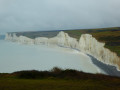
The walk starts at the Beachy Head car park (paying) and follows the cliff top path to Birling Gap, where the famous Seven Sisters begin, somewhat equivalent to the cliffs of the Opal Coast between Calais and Boulogne-sur-Mer. After passing the memorial dedicated to the Second World War bomber pilots, the landscape gradually opens up onto the cliffs with a first beautiful view of Beachy Head Lighthouse (offshore). The route continues to a second lighthouse, Belle Tout Lighthouse (private property) located at the top of a cliff. The next stage is the approach to Birling Gap with a superb view of the Seven Sisters. At Birling Gap, the observation tower overlooking the pebble beach has a staircase leading down to the cliffs, where you can see their unique rock formations up close. Be careful of the tides!
Alfriston, White Horse and Cuckmere
 5.10 mi
+144 ft
-144 ft
2h 30
Easy
Departure from Alfriston (East Sussex)
5.10 mi
+144 ft
-144 ft
2h 30
Easy
Departure from Alfriston (East Sussex)
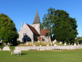
Alfriston is a beautiful village, with old houses and a lovely Common in front of its typical church. Clergy House was the first acquisition of the National Trust. This walk runs along the two river banks of Cuckmere River, via the White Horse, the horse is engraved with the chalk of a valley, and the return trip runs by a hill offering beautiful views.
Seven Sisters (East bank of the Cuckmere River)
 3.43 mi
+400 ft
-410 ft
1h 55
Easy
Departure from Cuckmere Valley (East Sussex)
3.43 mi
+400 ft
-410 ft
1h 55
Easy
Departure from Cuckmere Valley (East Sussex)
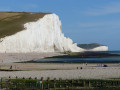
The Seven Sisters are magnificent white cliffs cut in half by the River Cuckmere, which ends its course towards the sea. Part of the Southdowns National Park, the site is protected. It is one of the most beautiful natural sites in South-East England. We walk among the sheep (many gates to pass) toward the cliffs to walk back along the meandering river.
Cuckmere Haven circular
 8.38 mi
+1,319 ft
-1,319 ft
5h 00
Moderate
Departure from Lewes (East Sussex)
8.38 mi
+1,319 ft
-1,319 ft
5h 00
Moderate
Departure from Lewes (East Sussex)
Beautiful out-and-back walk starting in Cuckmere Haven car park, taking in riverside, coastal path, village and forest
Seven Sisters From Seaford to Eastbourne
13.02 mi
+1,617 ft
-1,611 ft
7h 25
Difficult
Departure from Lewes (East Sussex)
Sea, Sun and … the Seven Sisters walk of course! When the weather is nice and the temperatures are rising, lace up your hiking boots (or trail runners, it’s summer after all), apply the sunscreen and get the brim out of the closet. It is time to enjoy a walk by the South Coast, and who knows, maybe even take a dip in the bright blue English Channel.
Charleston Farm & Firle Beacon from Firle
 4.63 mi
+653 ft
-627 ft
2h 40
Moderate
Departure from Firle (East Sussex)
4.63 mi
+653 ft
-627 ft
2h 40
Moderate
Departure from Firle (East Sussex)
This East Sussex walk takes you onto the South Downs for spectacular views north at Firle Beacon. The walk also offers the opportunity to visit Charlestown Farmhouse with its bohemian decor and associations with the Bloomsbury set. This walk has un challenging climb.
For more walks, use our search engine .
The GPS track and description are the property of this route's author. Please do not copy them without permission.

