Bazian, Riguepeu, Cazaux D’Angles, Pujos route

This route is designed for slow tourism by e-bike in the Gers, offering a safe cycling route along roads, cycle paths and public tracks through Bazian, Riguepeu, Cazaux d’Angles and the Ardennes, passing through the beautiful countryside and numerous historic sites and villages in the Gers. This route follows a short section of the European Route d’Artagnan, which runs from Lupiac to Maastricht.

Details

n°18012163
Creation:
Last update:
Last review:
  • Touring/Gravel
    Activity: Touring/Gravel
  • ↔
    Distance: 23.24 mi
  • ◔
    Duration according to the author: 4 hrs 
  • ▲
    Difficulty: Moderate

  • ⚐
    Back to start: Yes
  • ↗
    Ascent: + 1,604 ft
  • ↘
    Descent: - 1,604 ft

  • ▲
    Highest point: 758 ft
  • ▼
    Lowest point: 404 ft
  • ⚐ Country: France
  • ⚐ City: Lupiac (32290)
  • ⚑
    Start/End: N 43.680071° / E 0.223857°
  • ❏
    IGN map(s): Ref. 1743SB, 1843SB

  • ◶
    Type of surface:
  •  
     
     
    ■ 85% Road ■ 10% Byway ■ 5% Path
  • Hour-by-hour weather

Photos

Description of the route

The route starts at La Grande Borde in the commune of Lupiac.

(S/E) With your back to La Grande Borde, turn left towards the north-east, ride past Château Gignan and join the D37.

(1) Turn right onto the D37 and then immediately left onto the D274, heading north, for 3.5 km; after that, pass a pond on your left and take a road on your right (elevation 150).

(2) Turn right towards the east onto this small road. Look out for the ‘Route d’Artagnan’ signs. Follow this road until you reach a T-junction.

(3) Turn left onto the D1 (following the ‘Route d’Artagnan’ signs).

(4) After 300 m, turn right onto the farm track, following the signs for Route d’Artagnan. Pass between the buildings of Castets Farm and continue on to Domaine La Broca, where the road rejoins the main track. Carry on along this road until you reach a T-junction.

(5) Turn left and follow the D35 for 800 m until you reach a three-way junction.

(6) Turn right onto the small road, following the Route d’Artagnan signposts, heading east for 550 m until you reach the first path on the right.

(7) Follow this track and leave the Route d’Artagnan.

(8) Pass the Gallo-Roman pile known as La Montjoie on your right.

(9) At Petit Baradan, turn left onto a very narrow, steep road that climbs through a farmyard. Follow the road as it winds up the hill.

(10) Pass several farm buildings and, at Baradan, at the end of the road, continue along the track for 1.2 km.
Pass the Hargues du Bas farm, continue along the road for 70 m and reach a T-junction.

(11) Turn right onto the road heading south towards Tudelle. Join the D174.

(12) Turn left towards Bazian and stay on the D174 until you reach the village of Bazian. The road turns right as it passes through La Mouliaque, then continues up the hill. Take the turn-off to the village of Bazian on the left.

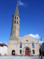
(13) Enter the village and walk round it anti-clockwise. Pass the cemetery on your right and follow the Chemin de Ronde, which turns left on the outskirts of the village. Walk between the old buildings, turn left again in the village centre and walk alongside Saint-André Church.
Carry on, keeping the church on your left and the cemetery ahead of you; turn right at the cemetery and immediately left after it.
Join the D174 and follow it eastwards for 100 m.

(14) Turn right onto the small road that climbs gently towards Sarlac. Ignore a turn-off to the right and carry on until the road turns left and then makes a 90° right-hand bend.

(15) Carry on along the track opposite and head towards the small wood. Follow it for a few metres and turn right. At the sharp left-hand bend, ignore the turn-off to Hajaou Farm and carry on straight ahead, climbing up the grassy track. Continue to the top of the hill, after passing some farm buildings in a field on the right.

(16) At the turn-off to the right for the hamlet of La Vergne, turn left, heading due east, onto the Chemin Rural de Saint-Yors à Riguepeu, staying on the path and ignoring the Degers farm on your right.

(17) Continue heading due east along the Chemin Rural de Saint-Yors to Riguepeu, descending past the buildings at Le Petit Jean until you reach a T-junction.

(18) Turn right onto the D34, towards Riguepeu.

(19) At the entrance to Riguepeu, turn left towards the mill, pass the town hall on your left and continue along this road towards the mill.

(20) At the mill, turn round and head back towards Riguepeu.

(19) At the T-junction, turn left onto the D34. Pass the stonemason’s yard on your left and continue for a further 150 metres.

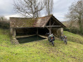
(21) A few metres before the left-hand bend and the bridge, turn right. Walk past a wash house on your left and stay on the road for 2.5 km as it climbs.

(22) Immediately after passing Carsicot, you’ll reach a small crossroads at the edge of a small wood. Ignore the sign for Hontrède opposite and turn right onto the widest road. Continue downhill, crossing the Mouliague stream.

(23) At the three-way junction, just after the Draoubat farm, ignore the sign for La Reibeillat and turn right. Pass the Pé de la Hont on your left and continue for a further 100 m.

(24) Turn left towards Courrèges.

(25) At Courrèges, the road ends. Carry on straight ahead along the track heading west for 800 m, rounding a bend and through the small wood until you reach a T-junction.

(26) Turn right onto the Chemin Rural de Lasserade and follow it for 800 m.

(27) Take thesecond left, following the road through Montgaillard, past the Chapelle Saint-Jean. Continue to the junction with the D35.

(28) Cross the D35, pass through Cazaux-d’Anglès and carry on to a T-junction with the Route de Belmont à Ardens (D1).

(29) Turn left onto the D1 for 50 m and turn immediately right behind the church, following a steep, grassy track. Pass the Lavoir Saint-Clair and continue down the grassy track for 50 m until you reach a T-junction.

(30) At the road, turn left towards Pujos.

(31) Keep Pujos and its chapel on your right and carry on until you reach a wide T-junction.

(32) Turn right onto Chemin du Pujos (local road) and arrive at La Grande Borde (S/E).

Waypoints

  1. S/E : mi 0 - alt. 594 ft - Grande Borde
  2. 1 : mi 0.55 - alt. 489 ft - D37. Right-left
  3. 2 : mi 2.62 - alt. 492 ft - Turn right onto Route d’Artagnan, towards the - Auzoue (rivière) - Affluent de la Gélise
  4. 3 : mi 3.49 - alt. 571 ft - Junction: turn left
  5. 4 : mi 3.68 - alt. 594 ft - Turn right onto Route d’Artagnan
  6. 5 : mi 4.99 - alt. 413 ft - Junction: turn left onto the D35
  7. 6 : mi 5.5 - alt. 430 ft - Junction, turn right
  8. 7 : mi 5.83 - alt. 427 ft - Junction, turn right
  9. 8 : mi 6.24 - alt. 423 ft - A Gallo-Roman pile known as the Montjoie
  10. 9 : mi 6.96 - alt. 443 ft - Junction: turn left
  11. 10 : mi 7.2 - alt. 591 ft - Continue along the single track
  12. 11 : mi 7.9 - alt. 728 ft - Junction, turn right
  13. 12 : mi 8.27 - alt. 659 ft - Crossroads with 4 roads; turn left
  14. 13 : mi 10.36 - alt. 551 ft - Turn left. Round-trip route around the village - Église Saint-André (Bazian)
  15. 14 : mi 10.74 - alt. 581 ft - Junction, turn right
  16. 15 : mi 11.09 - alt. 571 ft - Path opposite
  17. 16 : mi 11.9 - alt. 692 ft - Turn left onto the path
  18. 17 : mi 12.18 - alt. 646 ft - Small road
  19. 18 : mi 12.94 - alt. 446 ft - Junction: turn left
  20. 19 : mi 13.05 - alt. 446 ft - T-junction (out and back) at the mill
  21. 20 : mi 13.31 - alt. 446 ft - Riguepeu Mill near the - Osse (rivière)
  22. 21 : mi 13.77 - alt. 456 ft - Junction, turn right
  23. 22 : mi 15.26 - alt. 705 ft - Junction, turn right
  24. 23 : mi 15.84 - alt. 610 ft - Junction, turn right
  25. 24 : mi 16.48 - alt. 548 ft - Turn left at the fork
  26. 25 : mi 16.86 - alt. 686 ft - Continue along the track
  27. 26 : mi 17.4 - alt. 758 ft - Junction, turn right
  28. 27 : mi 17.92 - alt. 725 ft - Junction: turn left
  29. 28 : mi 19.25 - alt. 469 ft - Cross the D35, after the - Guiroue (rivière)
  30. 29 : mi 20.78 - alt. 650 ft - D1. Left-right. Towards the wash house
  31. 30 : mi 20.9 - alt. 597 ft - Junction: turn left
  32. 31 : mi 21.96 - alt. 673 ft - The chapel at Pujos, Sainte-Madeleine Church
  33. 32 : mi 22.21 - alt. 699 ft - Junction, turn right
  34. S/E : mi 23.24 - alt. 594 ft - Grande Borde

Notes

(S/E) Electric bikes can be hired at La Grande Borde (E-Velo Gers).

(9) Part of this route follows grassy tracks and footpaths. Make sure your bike is suitable for the terrain.
There is a very steep slope after (9); you may need to push your bike.

(18) There is a restaurant open for lunch in Riguepeu, but we recommend taking a packed lunch. There is a lovely picnic area in Bazian and plenty of spots along the trails.

Worth a visit

This route has been designed to explore the beautiful Gers countryside, including the hills, farmland, forests, lakes and villages. There will be few cars, but watch out for farm machinery, deer and wild boar, all of which can pose a danger to cyclists.

(8) You’ll see the Roman ruins known as the ‘Pile gallo-romaine de Montjoie’.

(13) Bazian is a lovely little village perched atop the hills. The Church of Saint-André is particularly worth a visit.

(20) The Moulin de Rigeupeu has been beautifully restored. The owner offers guided tours for a small fee.

(28) Cazaux d’Angles is another pretty little village; do take note of the interesting castle. It is not open to the public.

(30) In Ardens, you can visit the Lavoir Saint-Clair, recently restored to its former glory.

(31) The chapel at Pujos. The Church of Sainte-Madeleine

Reviews and comments

4.7 / 5
Based on 1 review

Reliability of the description
5 / 5
Ease of following the route
4 / 5
Route interest
5 / 5
labarbe claude
labarbe claude

Overall rating : 4.7 / 5

Date of your route : Feb 12, 2022
Reliability of the description : ★★★★★ Very good
Ease of following the route : ★★★★☆ Good
Route interest : ★★★★★ Very good
Very busy route : Yes

I didn’t do the whole circuit because some parts were too bumpy for me, but I really enjoyed BAZIAN and the surrounding area
I think I’ll go back there when the weather’s nice

Machine-translated

For more walks, use our search engine .

The GPS track and description are the property of this route's author. Please do not copy them without permission.