


From Valedichiesa to Lingua via Monte Fossa delle Felci


The route starts at the Valedichiesa bus stop and ends at the Lingua bus stop. The path is very poorly marked between Monte Fossa delle Felci and the Del Porri viewpoint: an alternative route may be worth considering. The GPS track is accurate for this section. There are plenty of steps on the descent and little shade.
Details
Creation:
Last update:
–
–
Last review:
–
–
-
 Activity: Walking
 -
 Distance: 5.32 mi
 -
 Average duration: 4h 20
 -
 Difficulty: Moderate
 -
-
 Back to start: No
 -
 Ascent: + 2,208 ft
 -
 Descent: - 3,136 ft
 -
-
 Highest point: 3,133 ft
 -
 Lowest point: 30 ft
 Country:
 City:
City:


Waypoints
- S : mi 0 - alt. 958 ft - Valdichiesa
- 1 : mi 2.54 - alt. 3,127 ft - Monte Fossa delle Felci
- E : mi 5.32 - alt. 33 ft - Lingua
Other walks in the area
Leni Cliffs Circular Walk
 Visorando Member2.87 mi
+807 ft
-817 ft
2h 00
Visorando Member2.87 mi
+807 ft
-817 ft
2h 00
 Easy
Easy
 Departure from Leni (Messina)
The starting point is at the beginning of the path, where you can park your scooter. If you’re coming by other means (car, etc.), you’ll need to walk a short distance along a small concrete road. The route forms a figure of 8 but can be completed as a single circular loop. It’s important to go all the way to the end of the circular loop, as that’s where the best views are!
The Lipari observatory with a view of Vulcano
 3.74 mi
+686 ft
-705 ft
2h 20
Moderate
Departure from Lipari (Italy)
3.74 mi
+686 ft
-705 ft
2h 20
Moderate
Departure from Lipari (Italy)
This walk, well known to locals, offers a unique view to the south, towards the island of Vulcano. The vegetation is in full bloom in May. The observatory is run by the Italian Institute of Geophysics and Volcanology and monitors Vulcano.
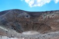
The Great Crater of Vulcano
 2.81 mi
+873 ft
-873 ft
2h 05
Moderate
Departure from Lipari (Italy)
2.81 mi
+873 ft
-873 ft
2h 05
Moderate
Departure from Lipari (Italy)
A beautiful walk in the Aeolian archipelago, north of Sicily. You climb up to the smoking crater of Vulcano and, at the top, enjoy an exceptional view of Vulcano, Lipari and the entire archipelago.
May 2024. According to two hikers, the crater is once again accessible at specific times (see photo). Thank you for this information and for the photo.
For more walks, use our search engine .
The GPS track and description are the property of this route's author. Please do not copy them without permission.

