Couhard, Montmain and Château du Petit Montjeu

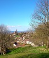
Lovely route starting from the Pierre de Couhard through a bucolic path leading to the Cascade de Brisecou. Lovely views over Autun and the historic quarter.

Technical sheet

123246
Creation:
Last update:
Last review:
  • Walking
    Activity: Walking
  • ↔
    Distance: 6.42 km
  • ◔
    Average duration: 2h 15 
  • ▲
    Difficulty: Moderate

  • ⚐
    Return to departure point: Yes
  • ↗
    Vertical gain: + 141 m
  • ↘
    Vertical drop: - 146 m

  • ▲
    Highest point: 524 m
  • ▼
    Lowest point: 373 m

Photos

Description of the walk

Start from the car park in front of the Pierre de Couhard (views over the town).
(S/E) Looking at the church, turn left onto the Chemin de la Cascade (GR®131-137), which runs behind the church. Follow a small stream through the undergrowth to the Cascade de Brisecou.

(1) Cross the small bridge and immediately turn right. Turn right again at the junction with the forest road, before joining the D120. Turn left for 200m, then take the forest road on the right.

(2) At the crossroads 100m further on, leave the GR® and turn right as far as the old Montmain farm. Turn left in front of the renovated building. Follow the undergrowth track for 150m, then turn right. Continue for 1km on a gentle slope, ignoring the paths leading up on the left.

(3) After a long left-hand bend, continue for 1.2km to the D256. Turn right again towards town. After the hairpin bend, pass a wooden cross and a detached house on your left.

(4) About 100 m before a group of houses on the right, take a small track on the left which leads downhill towards the Château du Petit Montjeu. This path crosses a grassy, wooded valley and joins the Chemin des Berlingots. Turn right, cross the D120 and turn left onto Rue du Faubourg Saint-Blaise, heading towards the town centre for 200m.

(5) Turn right onto Chemin de la Mine immediately after the château entrance. Follow the small stream for 900m, from where you can enjoy lovely views of the old town, before rejoining the road.

(6) At a cross, turn right, then immediately left into Rue de la Cascade. Finally, reach the Couhard church and the car park.(S/E)

Waypoints

  1. S/E : km 0 - alt. 397 m - Pierre de Couhard
  2. 1 : km 0.84 - alt. 411 m - Cascade de Brisecou (Autun)
  3. 2 : km 1.84 - alt. 505 m - Leaving the GR
  4. 3 : km 3.02 - alt. 514 m - Long left turn
  5. 4 : km 4.58 - alt. 437 m - To the left, path to a grassy valley
  6. 5 : km 5.1 - alt. 373 m - Chemin de la Mine. Near the - Tour des Ursulines
  7. 6 : km 5.98 - alt. 378 m - Left, Rue des Cascades
  8. S/E : km 6.42 - alt. 397 m - Pierre de Couhard

Practical information

Can be done on horseback or mountain bike.
Parking available at the Couhard village hall (near the pyramid).
Shelter available at the Montmain farm in a covered area for walkers.

In the nearby area

Community gardens in front of the starting car park.
Rock-climbing at the Brisecou waterfall.
Tennis court near Château du Petit Montjeu.

 Always stay careful and alert while following a route. Visorando and the author of this walk cannot be held responsible in the event of an accident during this route.

The GR® and PR® markings are the intellectual property of the Fédération Française de Randonnée Pédestre.

Reviews and comments

4.7 / 5
Based on 22 reviews

Reliability of the description
4.6 / 5
Clarity of route map
4.8 / 5
Route interest
4.8 / 5
Julien VR
Julien VR ★

Hi Garbiella,
Thanks for taking the time to rate and review!
I’m happy to hear that you had a nice time. =)
Kind regards,
Julien

Content Manager & User support

Gabriella Vekemans
Gabriella Vekemans

Overall rating : 5 / 5

Date of walk : May 04, 2025
Reliability of the description : ★★★★★ Very good
Clarity of route map : ★★★★★ Very good
Route interest : ★★★★★ Very good
Busy trail : No

Mooie wandeling in het bos..

pirouette60
pirouette60

Overall rating : 5 / 5

Date of walk : Apr 27, 2025
Reliability of the description : ★★★★★ Very good
Clarity of route map : ★★★★★ Very good
Route interest : ★★★★★ Very good
Busy trail : No

A pleasant, fairly short tour, but it's advisable to be in good shape - the section along the waterfall is really beautiful!

Automatically translated

Amélie veraprochre
Amélie veraprochre

Overall rating : 5 / 5

Date of walk : Dec 01, 2024
Reliability of the description : ★★★★★ Very good
Clarity of route map : ★★★★★ Very good
Route interest : ★★★★★ Very good
Busy trail : Yes

Great walk!

We cut off after the Auberge de Montmaint to return to Couhard and shorten the walk. This gave us a superb view of Autun and we passed through a botanical garden where the names of the trees are noted on a plaque. Very nice

Automatically translated

patrujmmf
patrujmmf

Overall rating : 4.7 / 5

Date of walk : Oct 15, 2024
Reliability of the description : ★★★★★ Very good
Clarity of route map : ★★★★★ Very good
Route interest : ★★★★☆ Good
Busy trail : No

Nice walk along the small canal and the waterfall, easy route to follow

Automatically translated

Marie France B.
Marie France B.

Overall rating : 5 / 5

Date of walk : Jul 07, 2024
Reliability of the description : ★★★★★ Very good
Clarity of route map : ★★★★★ Very good
Route interest : ★★★★★ Very good
Busy trail : No

Exceptional!

Automatically translated

Philipp
Philipp

Overall rating : 5 / 5

Date of walk : May 04, 2024
Reliability of the description : ★★★★★ Very good
Clarity of route map : ★★★★★ Very good
Route interest : ★★★★★ Very good
Busy trail : No

A very pleasant walk in fine weather. A beautiful waterfall and a wild river this spring.
A very pleasant return along a ditch that fed Autun in Roman times.

Automatically translated

FamilleSabi
FamilleSabi

Overall rating : 5 / 5

Date of walk : Apr 17, 2024
Reliability of the description : ★★★★★ Very good
Clarity of route map : ★★★★★ Very good
Route interest : ★★★★★ Very good
Busy trail : No

Magnificent hike, beautiful waterfall and magnificent views over the countryside and Autun.
Just 1 small orientation difficulty:
To the right just after the entrance to the château: although it says "private path", it is accessible.

Automatically translated

Henri RCC
Henri RCC
• Last modified:

Overall rating : 5 / 5

Date of walk : Feb 03, 2023
Reliability of the description : ★★★★★ Very good
Clarity of route map : ★★★★★ Very good
Route interest : ★★★★★ Very good
Busy trail : Yes

A very pleasant tour despite the gloomy weather and the hunting season. Beautiful waterfall, beautiful river and superb walk in the undergrowth. All that was missing was the sun!
According to my GARMIN watch, the circuit measures 7.63 km, which I covered in 2 hours and 4 minutes, taking the time to take photos. D+ 199 metres.

Automatically translated

Martin W
Martin W

Overall rating : 4 / 5

Date of walk : Jun 16, 2021
Reliability of the description : ★★★★☆ Good
Clarity of route map : ★★★★☆ Good
Route interest : ★★★★☆ Good
Busy trail : Yes

Good walk

Automatically translated

lionvs
lionvs
• Last modified:

Overall rating : 4.7 / 5

Date of walk : Aug 13, 2019
Reliability of the description : ★★★★☆ Good
Clarity of route map : ★★★★★ Very good
Route interest : ★★★★★ Very good

It was a good hike, and the map was very helpful in guiding us when we reached the town via Chemin des Berlingots.
Not much water at the waterfall...to be done in spring if you want to see a beautiful waterfall.
Very shady trail.
Lots of hazel trees at the end of the route.

Automatically translated

jojochamphuet
jojochamphuet
• Last modified:

Overall rating : 5 / 5

Date of walk : Aug 20, 2018
Reliability of the description : ★★★★★ Very good
Clarity of route map : ★★★★★ Very good
Route interest : ★★★★★ Very good

Lovely walk for a Sunday morning, a bit confusing before the Faubourg St Blaise, but we found our way around all the same.
Superb views over Autun.

Automatically translated

Jerade2107
Jerade2107

Overall rating : 4.7 / 5

Date of walk : Aug 16, 2018
Reliability of the description : ★★★★☆ Good
Clarity of route map : ★★★★★ Very good
Route interest : ★★★★★ Very good

Hello,

I took 1h29 for 8,05,kms (2 route errors on my part...)
It's true that towards the end it's a bit ambiguous as there are no street signs.
A pleasant route, with a few too many descents, but given that you've climbed up, you have to come down again... lol
Superb views in places
Do it again!

Automatically translated

grandin
grandin ★

Thank you for these clarifications Blackutopia

Automatically translated

Blackutopia
Blackutopia

Overall rating : 4.7 / 5

Date of walk : Jul 26, 2018
Reliability of the description : ★★★★☆ Good
Clarity of route map : ★★★★★ Very good
Route interest : ★★★★★ Very good

A very nice trail at the end of the route, a little complicated to find the streets as there are no signs indicating the names of the streets on the houses, but once you leave the forest road you have to take the path on the right and then follow the paths marked with a yellow line until you return to the starting point, which helps a little to find your way, in addition to the very detailed explanations.

Automatically translated

For more walks, use our search engine .

The GPS track and description are the property of the author. Do not copy them without permission.