


Consols To Porthminster Beach Via 'The Steeple'
Details
Creation:
Last update:
–
–
-
 Activity: Walking
 -
 Distance: 1.48 mi
 -
 Average duration: 0h 45
 -
 Difficulty: Not specified
 -
-
 Back to start: No
 -
 Ascent: + 115 ft
 -
 Descent: - 486 ft
 -
-
 Highest point: 551 ft
 -
 Lowest point: 66 ft
-
 Country:
United Kingdom
Country:
United Kingdom
-
 City:
St. Ives
City:
St. Ives -
 Start: N 50.197733° / W 5.487961°
 -
 End: N 50.20754° / W 5.47495°
 -


 Hour-by-hour weather


Waypoints
- S : mi 0 - alt. 436 ft
- 1 : mi 1.27 - alt. 213 ft - Turn right
- 2 : mi 1.31 - alt. 177 ft - Turn left onto Hain Walk
- 3 : mi 1.37 - alt. 148 ft - Turn slight right
- E : mi 1.48 - alt. 66 ft
Other walks in the area
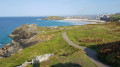
Hellesveor cliff and The Island from St Ives
 Visorando Member
 4.35 mi
+466 ft
-469 ft
2h 25
4.35 mi
+466 ft
-469 ft
2h 25
 Easy
Departure from St. Ives (Cornwall)
Easy
Departure from St. Ives (Cornwall)
This circular walk provides a way to approach St Ives by the coast, walking along cliffs and Porthmeor Beach, then reaching St Ives Head including the gorgeous viewpoint from St Nicholas Chapel. You finally walk around the harbour.
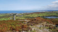
Rosewall Hill
 1.53 mi
+180 ft
-177 ft
0h 50
Easy
Departure from St. Ives (Cornwall)
1.53 mi
+180 ft
-177 ft
0h 50
Easy
Departure from St. Ives (Cornwall)
This short and easy walk leads to a nice viewpoint walking around the remains of past mining activities.
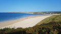
Carbis Bay and Porthminster Point from Lelant Church
 5.32 mi
+659 ft
-650 ft
3h 00
5.32 mi
+659 ft
-650 ft
3h 00
 Moderate
Departure from St. Ives (Cornwall)
Moderate
Departure from St. Ives (Cornwall)
This circular walk with ascends and descents provides a way to discover St Ives Bay leading to Porthminster Point along the gorgeous coastal path including Hayle, PorthKidney, Carbis Bay and Porthminster beaches!
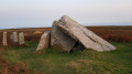
Zennor Quoit and Trendrine Hill
 2.65 mi
+236 ft
-249 ft
1h 25
Easy
Departure from Zennor (Cornwall)
2.65 mi
+236 ft
-249 ft
1h 25
Easy
Departure from Zennor (Cornwall)
This easy circular walk leads to a beautiful ruined megalithic burial chamber and continues to Trendrine Hill viewpoint.
St Erth to Trencrom Hill
4.48 mi
+551 ft
-554 ft
2h 30
Moderate
Departure from St. Erth (Cornwall)
A circular walk to Trencrom Hill, perhaps best taken on a clear day, to enjoy the views. But equally a nice walk any other time.
Hayle Bird Sanctuary, around the Carnsew Pool, and the Mill Pond
 3.14 mi
+43 ft
-52 ft
1h 30
Easy
Departure from Hayle (Cornwall)
3.14 mi
+43 ft
-52 ft
1h 30
Easy
Departure from Hayle (Cornwall)
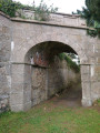
The Hayle Estuary Nature Reserve offers the opportunity to see migratory birds, and is also a starting point for a reasonably level walk, with estuary views. Walking around Carnsew Pool, an amazing piece of Victorian engineering, which helps keep the Hayle harbour from silting up. Then, through a part of the town to the Mill pond, with old ruins to explore, and the pond. The walk then leads through a memorial garden, a high point at Hayle, which was an Iron Age Hill Fort, before leading back to the start.
Zennor Head, Tregerthen and Trevean from Zennor village
 6.22 mi
+692 ft
-686 ft
3h 30
Moderate
Departure from Zennor (Cornwall)
6.22 mi
+692 ft
-686 ft
3h 30
Moderate
Departure from Zennor (Cornwall)
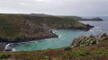
This circular walk from the lovely village of Zennor explores the coast path (with several ascents and descents in rocky paths) and uses also paths inland during the return route.
King George V Memorial Walk, the Dunes, and Phillack
 3.08 mi
+112 ft
-115 ft
1h 30
Easy
Departure from Hayle (Cornwall)
3.08 mi
+112 ft
-115 ft
1h 30
Easy
Departure from Hayle (Cornwall)
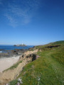
A gentle circular walk along the King George V Memorial Walk, through some of Hayle's historic past. Walking along sandy paths through the dunes, seeing three miles of golden sand of St Ives Bay, with St Ives on the left and Godrevey Lighthouse on the opposite headland. Then heading inland, passing the old part of Phillack with the church, black brick buildings, and the Bucket of Blood Inn, with its unusual name.
For more walks, use our search engine .
The GPS track and description are the property of this route's author. Please do not copy them without permission.

