
Cap Gaspé and Bout du Monde

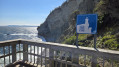
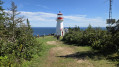
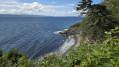
This walk takes place in Forillon National Park, at the north-eastern tip of the Gaspé Peninsula. After a walk through woodland and along the coast, you’ll be able to admire the pretty Cap Gaspé lighthouse and the spectacular Pointe du Bout du Monde.

Details

105730217
Creation:
Last update:
Last review:
  • Walking
    Activity: Walking
  • ↔
    Distance: 4.81 mi
  • ◔
    Average duration: 2h 50 
  • ▲
    Difficulty: Easy

  • ⚐
    Back to start: Yes
  • ↗
    Ascent: + 712 ft
  • ↘
    Descent: - 725 ft

  • ▲
    Highest point: 325 ft
  • ▼
    Lowest point: 23 ft

Photos

Description of the walk

The hike starts from the Anse aux Amérindiens car park, at the end of Boulevard de Grande Grève, which can be reached via the park’s southern entrance.

There are two routes to Cap Gaspé: a gravel track and a footpath. The route described here takes the footpath out and the gravel track back.

(S/E) At the end of the car park, follow the gravel track for about a hundred metres.

(1) Then take the footpath that descends to the right. It winds through the forest until it rejoins the gravel track.

(2) Follow the track to the right for about 600 metres until you come to a footpath branching off to the right.

(3) Turn right onto a path that descends towards the sea. Follow the coastline, passing two viewing points. Finally, head back up towards the track.

(4) Cross the track and take the path opposite. It climbs quite steeply at first, then follows a flatter ridge. It then descends to the Cap Gaspé lighthouse.

(5) Take the path on the left behind the lighthouse. After a fairly steep but short descent, you’ll reach the Bout du Monde.

(6) Follow the path back up to the lighthouse.

(5) Take the gravel track behind the lighthouse.

(4) Carry on straight ahead along the track (ignore the paths you took on the way there).

(3) Carry on along the track.

(2) Stay on the track which leads back to the starting car park (S/E).

Waypoints

  1. S/E : mi 0 - alt. 102 ft - Car park - Anse aux Amérindiens
  2. 1 : mi 0.09 - alt. 89 ft - Northern junction of the northern circular loop
  3. 2 : mi 0.33 - alt. 131 ft - Southern junction of the northern circular loop
  4. 3 : mi 0.99 - alt. 157 ft - Northern junction of the central circular loop
  5. 4 : mi 1.44 - alt. 89 ft - Southern junction of the central circular loop
  6. 5 : mi 2.31 - alt. 246 ft - Cap Gaspé
  7. 6 : mi 2.54 - alt. 62 ft - Le Bout du Monde (Cap Gaspé)
  8. S/E : mi 4.81 - alt. 98 ft - Car park - Anse aux Amérindiens

Notes

Entry to the park costs 10 Canadian dollars, but was free when we visited (summer 2026).

There is no water along the route. Toilets are available at Cap Gaspé (5).

For more walks, use our search engine .

The GPS track and description are the property of this route's author. Please do not copy them without permission.
