Arlod–Villes Circular Loop

A short, leisurely walk through fields or woods.

Details

578554
Creation:
Last update:
Last review:
  • Walking
    Activity: Walking
  • ↔
    Distance: 3.97 mi
  • ◔
    Average duration: 2h 10 
  • ▲
    Difficulty: Easy

  • ⚐
    Back to start: Yes
  • ↗
    Ascent: + 354 ft
  • ↘
    Descent: - 354 ft

  • ▲
    Highest point: 1,903 ft
  • ▼
    Lowest point: 1,549 ft

Description of the walk

In Arlod, take the Route de Mussel to park in the car park.
(S/E) Continue straight ahead along the Route de Mussel, which forms part of theGR®9 and GR®509 trailsas well as theGRP® Grand Tour de la Valserine. You’ll reach the Champ Bottu crossroads.

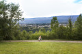
(1) Turn left across the fields, following the path that zigzags through them.

(2) Facing the D991, turn left and continue south-east towards Villes.

(3) Before reaching Villes, cross the fields just after the Maillet field to head towards the road at Pré Faisant.

(4) Take the path on the left, pass under the power lines and head for the Roman bridge.

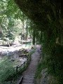
(5) Cross the Poet stream via this bridge. Continue straight ahead through the woods to reach the car park (S/E).

Waypoints

  1. S/E : mi 0 - alt. 1,549 ft - Route de Mussel car park
  2. 1 : mi 1.01 - alt. 1,719 ft - Champ Bottu crossroads
  3. 2 : mi 1.57 - alt. 1,877 ft - On the left, opposite the D991
  4. 3 : mi 2.2 - alt. 1,886 ft - On the left after the Maillet field
  5. 4 : mi 2.89 - alt. 1,663 ft - Path through the woodland
  6. 5 : mi 3.3 - alt. 1,552 ft - Roman Bridge
  7. S/E : mi 3.97 - alt. 1,549 ft - Route de Mussel car park

Notes

Between (2 and 3) you are exposed to the elements in the event of rain (as this is a path leading to the fields, it can sometimes be muddy).

Worth a visit

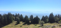
Between (2) and (3), you’ll have a wonderful view of the Southern Jura and the Alps.

Always be cautious and plan ahead when you're outdoors. Visorando and the author of this route cannot be held responsible for any accidents occurring on this route.

The GR® and PR® markings are the intellectual property of the Fédération Française de Randonnée Pédestre.

Reviews and comments

4.5 / 5
Based on 2 reviews

Reliability of the description
4.5 / 5
Ease of following the route
5 / 5
Route interest
4 / 5
Krapoboug
Krapoboug

Overall rating : 4.3 / 5

Date of your route : Apr 20, 2019
Reliability of the description : ★★★★☆ Good
Ease of following the route : ★★★★★ Very good
Route interest : ★★★★☆ Good

An easy walk that still takes over two hours and really works your glutes… Ideal for a weekend stroll to unwind.

Machine-translated

gego
gego

Overall rating : 4.7 / 5

Date of your route : Mar 26, 2018
Reliability of the description : ★★★★★ Very good
Ease of following the route : ★★★★★ Very good
Route interest : ★★★★☆ Good

A lovely little walk with some lovely views, despite the altitude being on the low side for the region.

Machine-translated

Other walks in the area

For more walks, use our search engine .

The GPS track and description are the property of this route's author. Please do not copy them without permission.