


Bewl 15 Mile
Details
Creation:
Last update:
-
 Activity: Walking
 -
 Distance: 15.27 mi
 -
 Average duration: 7h 35
 -
 Difficulty: Not specified
 -
-
 Back to start: Yes
 -
 Ascent: + 643 ft
 -
 Descent: - 666 ft
 -
-
 Highest point: 420 ft
 -
 Lowest point: 174 ft
-
 Country:
United Kingdom
Country:
United Kingdom
-
 City:
Wadhurst
City:
Wadhurst -
 Start/End: N 51.063684° / E 0.345024°
 -


 Hour-by-hour weather


Waypoints
- S/E : mi 0 - alt. 413 ft - Start on
- 1 : mi 0.45 - alt. 312 ft - Keep right
- 2 : mi 0.74 - alt. 240 ft - Turn slight left
- 3 : mi 0.76 - alt. 240 ft - Turn slight right
- 4 : mi 1.51 - alt. 243 ft - Turn left
- 5 : mi 1.56 - alt. 253 ft - Keep right
- 6 : mi 1.62 - alt. 243 ft - Turn slight left
- 7 : mi 2.63 - alt. 276 ft - Turn left onto Hook Hill Lane
- 8 : mi 2.8 - alt. 367 ft - Turn sharp right onto Bewlbridge Lane
- 9 : mi 3.29 - alt. 295 ft - Turn right
- 10 : mi 3.52 - alt. 269 ft - Keep left
- 11 : mi 3.53 - alt. 269 ft - Keep left
- 12 : mi 3.61 - alt. 246 ft - Keep left
- 13 : mi 3.88 - alt. 177 ft - Keep right
- 14 : mi 6.26 - alt. 246 ft - Turn right onto Rosemary Lane
- 15 : mi 6.4 - alt. 253 ft - Turn right
- 16 : mi 8.37 - alt. 246 ft - Turn right
- 17 : mi 9.82 - alt. 246 ft - Turn sharp right
- 18 : mi 10.66 - alt. 253 ft - Turn left onto Lower Hazelhurst
- 19 : mi 11.42 - alt. 390 ft - Turn sharp right onto Birchetts Green Lane
- 20 : mi 11.83 - alt. 259 ft - Keep right onto Birchetts Green Lane
- 21 : mi 12.57 - alt. 390 ft - Turn slight right onto Ward's Lane
- 22 : mi 13.15 - alt. 387 ft - Turn left
- 23 : mi 13.31 - alt. 354 ft - Turn left
- 24 : mi 14.53 - alt. 240 ft - Turn sharp left
- 25 : mi 15.27 - alt. 413 ft - Turn right onto Blacksmith's Lane
- S/E : mi 15.27 - alt. 417 ft
Other walks in the area
Circular country in Groombridge
 Visorando Member
 9.88 mi
+659 ft
-633 ft
5h 05
9.88 mi
+659 ft
-633 ft
5h 05
 Moderate
 Departure from Wealden (East Sussex)
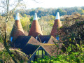
Unspoilt nature, country and forest footpaths in all directions, stile gates and turnstiles, a little tarmac to connect them, a very scattered settlement, streams and rather wet areas: this is what the hike mainly consists of.The English countryside is home to many architectural treasures, such as stone churches with square bell towers, typical farms with pointed cones topped with a white turret, castles and huge estates combining (former) farms and dwellings.At the end, the walk takes a small section of the old railway line that connected Groombridge to Hartfield and Crawley. Transformed into a cycle path called Forest Way, this route is the British equivalent of the Belgian RAVeL or the French Voie Verte, with the advantage of not yet (2025) having been concreted or asphalted.
Tonbridge - Southborough loop
10.86 mi
+755 ft
-755 ft
5h 40
Moderate
Departure from Tonbridge and Malling (Kent)
From the parkland close to the centre of Tonbridge, up onto Bidborough Ridge and on to Southborough Common, Returning along a hidden valley, through the park of Somerhill Schools and along the river Medway to the town centre.
Hever & Markbeech from Chiddingstone
 5.85 mi
+341 ft
-348 ft
3h 00
5.85 mi
+341 ft
-348 ft
3h 00
 Easy
Departure from Chiddingstone (Kent)
Easy
Departure from Chiddingstone (Kent)
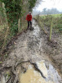
A lovely Kent walk that starts from the beautiful village of Chiddingstone and continues to Hever where you can visit the Castle. The route then turns south to Markbeech from where a return to the start is made.
Shipbourne - Greensand Way - Ightham Mote - Carter's Hill - Underriver
 7.44 mi
+620 ft
-630 ft
4h 00
Moderate
Departure from Shipbourne (Kent)
7.44 mi
+620 ft
-630 ft
4h 00
Moderate
Departure from Shipbourne (Kent)
A circular route offering a mix of scenic contrasts and adventure. The outward leg includes a rewarding climb to a short but highly rated stretch of the Greensand Way, where you’ll be treated to spectacular views from the Greensand Ridge, looking out across the Weald of Kent and even into East Sussex on a clear day.
Just over halfway round, a strategically placed pub stop offers the perfect break. The return leg brings you back through peaceful, picturesque countryside—typical of the farmed landscapes of the Kentish Weald—with plenty of open space and rural charm.
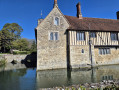
A short detour to Ightham Mote, a beautifully preserved 14th-century moated manor house (National Trust), adds a splash of history to the route. Even a brief look may tempt you back for a full visit another time.
Shipbourne is an ideal start and end point, with ample parking and excellent food and drink at The Chaser Inn, which serves meals all day on weekends—perfect for a relaxed post-walk lunch or early dinner.
Bore Place to Bough Beech Reservoir
 Tourism professional3.77 mi
+226 ft
-203 ft
1h 55
Easy
Departure from Chiddingstone (Kent)
Tourism professional3.77 mi
+226 ft
-203 ft
1h 55
Easy
Departure from Chiddingstone (Kent)
This circular walk guides the keen wildlife watcher and enthusiast to some of the best local spots to see special species like the nightingale. The farmland of Bore Place extends almost to Bough Beech Reservoir where it meets the nature reserve. Well-connected areas of good habitat encourage plants, fungi and animals to survive and thrive.
Bore Place - Green Trail
1.42 mi
+52 ft
-52 ft
0h 40
Easy
Departure from Chiddingstone (Kent)
The Bore Place farm walks weave their way through the fields and woodlands of the 500-acre organic dairy farm, offering panoramic views across this Area of Outstanding Natural Beauty. The trails start and finish at the Bore Place car park and are waymarked by colour-coded directional discs and tall oak posts with painted lines at the top.
Bore Place to Little Brown Jug Pub
4.94 mi
+118 ft
-131 ft
2h 25
Easy
Departure from Chiddingstone (Kent)
This is a circular walk but is described in two sections, so you can choose to just walk to or from the Little Brown Jug, rather than doing the whole loop. Nothing beats the promise of a cosy pub after a bracing walk in the Kent countryside. This gentle walk boasts the choice of two pubs within an hour on foot of Bore Place, using the network of public footpaths and bridleways. The walk takes in classic Low Weald landscape with its patchwork of arable fields and grazing pastures.
Bore Place to Greensand Way
 7.57 mi
+486 ft
-502 ft
3h 55
Easy
Departure from Chiddingstone (Kent)
7.57 mi
+486 ft
-502 ft
3h 55
Easy
Departure from Chiddingstone (Kent)
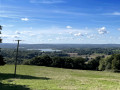
This circular walk leads you up onto the Greensand Way where breathtaking views await. From here it loops round, passing the picturesque 14th-century Wickhurst Manor through the village of Sevenoaks Weald and across rolling farmland before returning to the start point.
For more walks, use our search engine .
The GPS track and description are the property of this route's author. Please do not copy them without permission.

