


#Ben Wyvis From Wyvis Lodge
Details
Creation:
Last update:
–
–
-
 Activity: Walking
 -
 Distance: 12.68 mi
 -
 Average duration: 8h 35
 -
 Difficulty: Not specified
 -
-
 Back to start: Yes
 -
 Ascent: + 3,192 ft
 -
 Descent: - 3,222 ft
 -
-
 Highest point: 3,117 ft
 -
 Lowest point: 722 ft
-
 Country:
United Kingdom
Country:
United Kingdom
-
 City:
Highland
City:
Highland -
 Start/End: N 57.723769° / W 4.551172°
 -


 Hour-by-hour weather


Waypoints
- S/E : mi 0 - alt. 755 ft
- 1 : mi 1.71 - alt. 843 ft - Keep left
- 2 : mi 4.82 - alt. 3,117 ft - Keep right
- 3 : mi 4.88 - alt. 3,117 ft - Turn sharp right
- 4 : mi 7.85 - alt. 3,117 ft - Keep right
- S/E : mi 12.68 - alt. 755 ft
Other walks in the area
Fyrish Monument
 Tourism professional
 4.42 mi
+876 ft
-876 ft
2h 50
4.42 mi
+876 ft
-876 ft
2h 50
 Moderate
 Departure from Highland
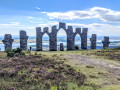
A circular route to the 18th century arches of the Fyrish Monument. After a short distance my route leaves the busy Jubilee Path to make a gradual ascent up the shoulder of Cnoc Fyrish. The monument itself is a true work of art and forms a significant part of local history. My return route takes you through an area of mature forestry teeming with wildlife.
Rogie Falls circular, Contin
 Association / Club / Walk leader
 0.91 mi
+121 ft
-121 ft
0h 30
0.91 mi
+121 ft
-121 ft
0h 30
 Easy
Departure from Highland
Easy
Departure from Highland
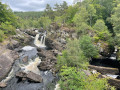
This gentle walk brings you through the woodlands, up and down hills to get views over the magnificent Rogie Falls and a suspension bridge across the Black Water river.
Black water and Rogie Falls circular
 3.44 mi
+476 ft
-453 ft
2h 00
Moderate
Departure from Highland
3.44 mi
+476 ft
-453 ft
2h 00
Moderate
Departure from Highland
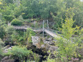
Walk along Black Water river and explore Rogie Falls walking through the pine and heather Torrachilty Forest.
Torrachilty Forest circular
 1.24 mi
+230 ft
-226 ft
0h 45
Moderate
Departure from Highland
1.24 mi
+230 ft
-226 ft
0h 45
Moderate
Departure from Highland
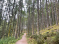
Walk along Black Water river and explore the pine and heather Torrachilty Forest.
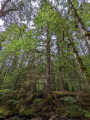
Tall Trees, Reelig Glen
 0.98 mi
+138 ft
-138 ft
0h 35
Easy
Departure from Highland
0.98 mi
+138 ft
-138 ft
0h 35
Easy
Departure from Highland
An easy circular walk along the Moniack Burn. Reelig Glen is home to some of the tallest trees in Britain and as you walk through this mossy woodland, you can't help but feel small compared to the massive fir and spruce trees towering above you. Information boards dotted along the trail offer ID opportunities and some fun facts.
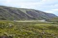
Glen Orrin from Strathconon
 8.43 mi
+1,549 ft
-1,542 ft
5h 15
8.43 mi
+1,549 ft
-1,542 ft
5h 15
 Difficult
Departure from Highland
Difficult
Departure from Highland
A fantastic circular walk starting at Inverchoran Bridge in the Strathconon Estate, from where you will head into the scenic and remote Glen Orrin to Luipmaldrig bothy. The return section is via a spectacularly scenic hill pass.
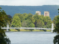
Nessie in Inverness
 Visorando Member
 2.87 mi
+26 ft
-26 ft
1h 20
Easy
Departure from Highland
2.87 mi
+26 ft
-26 ft
1h 20
Easy
Departure from Highland
Nessie, the Loch Ness monster, has never been sighted in Inverness, where the River Ness flows into the sea.But Nessie has been honoured there on one of the Ness Islands, which the Ness Walk takes you to explore.A very pleasant little stroll along the river in a town of little interest, apart from the odd historic building such as the cathedral or the castle, a few lovely footbridges and pedestrian bridges over the River Ness, and countless churches.
For more walks, use our search engine .
The GPS track and description are the property of this route's author. Please do not copy them without permission.

