


BCM24
Details
Creation:
Last update:
–
–
-
 Activity: Walking
 -
 Distance: 26.28 mi
 -
 Average duration: 12h 20
 -
 Difficulty: Not specified
 -
-
 Back to start: No
 -
 Ascent: + 305 ft
 -
 Descent: - 377 ft
 -
-
 Highest point: 197 ft
 -
 Lowest point: 0 ft
-
 Country:
United Kingdom
Country:
United Kingdom
-
 City:
Belfast
City:
Belfast -
 Start: N 54.594507° / W 5.84125°
 -
 End: N 54.589285° / W 5.917897°
 -


 Hour-by-hour weather


Waypoints
- S : mi 0 - alt. 79 ft
- E : mi 26.28 - alt. 7 ft
Other walks in the area
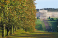
Stormont woodland and fitness trail - Dundonald / Belfast
 Tourist office
 2.72 mi
+285 ft
-276 ft
1h 30
2.72 mi
+285 ft
-276 ft
1h 30
 Easy
Departure from Belfast
Easy
Departure from Belfast
A walk through attractive woodland and parkland with many interesting features including Parliament Buildings. Only five miles out of the city, Stormont Woodland Walk and Fitness Trail, is a great place to walk, run and relax.
Loop River - In Cregagh Glen - Belfast
1.85 mi
+128 ft
-7 ft
1h 00
Easy
Departure from Belfast
This linear Walk follow the Loop River up to Cregagh Glen. You’ll come across all sorts of wildlife and greenery to bring your walk to life.
Orange Field - CC Greenway, Belfast
1.52 mi
+98 ft
-7 ft
0h 45
Easy
Departure from Belfast
This linear Walk follows Connswater Community (CC) Greenway along Knock River in Orangefield. You’ll come across all sorts of wildlife and greenery to bring your walk to life.
Victoria Park to Braniel - CC Greenway, Belfast
2.99 mi
+115 ft
-7 ft
1h 30
Easy
Departure from Belfast
This linear walk follows the Connswater Community (CC) Greenway along the course of three rivers that splits into two different routes – following the route along the Knock River to Marsh-wiggle Way and Braniel.
Stop at C.S. Lewis Square for some refreshments in EastSide Visitor Centre and explore the seven sculptures by Irish artist Maurice Harron inspired by the characters from The Lion, the Witch and the Wardrobe, before continuing your journey through Belfast’s own wildlife corridor.
Victoria Park to Creagahn Glen - CC Greenway, Belfast
3.35 mi
+148 ft
-3 ft
1h 40
Easy
Departure from Belfast
This linear walk follows the Connswater Community (CC) Greenway along the course of three rivers that splits into two different routes – following the Loop River up to Cregagh Glen.Stop off at C.S. Lewis Square for some refreshments in EastSide Visitor Centre and explore the seven sculptures by Irish artist Maurice Harron inspired by the characters from The Lion, the Witch and the Wardrobe, before continuing your journey through Belfast’s own wildlife corridor.
Victoria Park to Dixon Playing Fields - CC Greenway, Belfast
2.55 mi
+39 ft
-16 ft
1h 10
Easy
Departure from Belfast
This linear walk follows the Connswater Community (CC) Greenway along the course of three rivers that splits into two different routes – Victoria Park along the Connswater River following the route along the Knock River.Stop off at C.S. Lewis Square for some refreshments in EastSide Visitor Centre and explore the seven sculptures by Irish artist Maurice Harron inspired by the characters from The Lion, the Witch and the Wardrobe, before continuing your journey through Belfast’s own wildlife corridor.
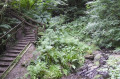
Cregagh Glen and Lisnabreeny
 2.68 mi
+433 ft
-433 ft
1h 35
Easy
Departure from Castlereagh
2.68 mi
+433 ft
-433 ft
1h 35
Easy
Departure from Castlereagh
This route follows an attractive glen into the Castlereagh Hills with superb views over the city from the top. This is an Ulster Scots walk. Part of the ‘Danders Aroon’ series, the East Belfast Ulster Scots Walk (also known as Cregagh Glen and Lisnabreeny) is a beautiful walk with rich heritage that you can learn about as you take a stroll.This East Belfast walk will be a challenging climb for many.
For more walks, use our search engine .
The GPS track and description are the property of this route's author. Please do not copy them without permission.

