Ballyroney Lackan Bog

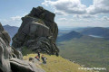
A superb walk encompassing a variety of landscapes. Here the Upper River Bann wends it way around farmed drumlin hills set in a lowland basin of extensive birch and moss on its journey from the Mourne Mountains to Lough Neagh. Ballyroney Lake supports a variety of wintering waterfowl including mute swan, whooper swan, mallard, teal, tufted duck and coot. It is one of the most important sites in Ireland for dragonflies.

Details

30099347
Creation:
Last update:
Last review:
  • Walking
    Activity: Walking
  • ↔
    Distance: 3.97 mi
  • ◔
    Average duration: 1h 50 
  • ▲
    Difficulty: Easy

  • ⚐
    Back to start: Yes
  • ↗
    Ascent: + 26 ft
  • ↘
    Descent: - 26 ft

  • ▲
    Highest point: 292 ft
  • ▼
    Lowest point: 249 ft

Description of the walk

Start : Grass verge at side of Lackan Road before the road junction (Flush road and Lackan Road)

(S/E) From the junction, walk around 100 m along the Lackan Road towards Ballyroney (North-West). Look out for the wooden sign ‘The Green Road’ which points into the first lane on the right (North-East).

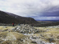
(1) Continue along this agricultural lane until you meet a wooden gate and stile. Crossing the stile follow the raised bog rampart across the bog. Turf was cut by hand from the bog in the past and this path was used as means of getting access to the bog. Please keep to the waymarked path. The bog rampart can be very uneven and potholed with animal burrowing, watch your step! Follow the rampart to its end at an agricultural field.

Cross the field towards another stile at Dickson’s Hill Road.

(2) Turn left (North-West) into Dickson’s Hill Road and continue to its junction with the Dromara Road (B7).

(3) Turn left (West) and walk around 750 m with due care and attention to the next road on the left ‘High Road’. This is a narrow road beside a house on the left just before Ballyroney Lake.

(4) Follow the road as it skirts around Lackan Bog to its junction with the Lackan Road.

(5) Take left onto Lackan Road to return to the starting point. (S/E)

Waypoints

  1. S/E : mi 0 - alt. 276 ft - X-roads (Lackan/Flush and Crabtree Roads)
  2. 1 : mi 0.07 - alt. 285 ft - The Green Road
  3. 2 : mi 1.24 - alt. 269 ft - Dickson’s Hill Road
  4. 3 : mi 1.51 - alt. 256 ft - Dromara Road
  5. 4 : mi 1.97 - alt. 292 ft - High Road
  6. 5 : mi 3.14 - alt. 259 ft - Lackan Road
  7. S/E : mi 3.97 - alt. 276 ft - X-roads (Lackan/Flush and Crabtree Roads)

Notes

Start : Grass verge at side of Lackan Road before the road junction (Flush road and Lackan Road)

Drive to the start and parking: The village of Ballyroney is located between Rathfriland and Dromara off the B7. At Ballyroney take Lackan Road (signed for Castlewellan). Continue for approx. 1.5 miles to first X-roads (Lackan/Flush and Crabtree Roads). Park with consideration on grass verge at side of Lackan Road before X-roads. Coming from Ballyroney Crabtree Road is the road to the right (up the hill).

Terrain : Rough lanes and roads

Public Transport : Translink

Facilities : Shops and facilities in Rathfriland (approx. 1.5 mile) Small shop at Ballyward (approx. 2.5 miles)

Dog Policy : Dogs are allowed. Must be under control at all times.

Find more information and walk ideas at Walk NI here.

Worth a visit

Other walks in the area

For more walks, use our search engine .

The GPS track and description are the property of this route's author. Please do not copy them without permission.