


Admiral City Of Newport Half Marathon 2023
Details
Creation:
Last update:
–
–
-
 Activity: Walking
 -
 Distance: 13.17 mi
 -
 Average duration: 6h 10
 -
 Difficulty: Not specified
 -
-
 Back to start: No
 -
 Ascent: + 171 ft
 -
 Descent: - 171 ft
 -
-
 Highest point: 92 ft
 -
 Lowest point: -3 ft
-
 Country:
United Kingdom
Country:
United Kingdom
-
 City:
Stow Hill
City:
Stow Hill -
 Start: N 51.586139° / W 2.990913°
 -
 End: N 51.584653° / W 2.986743°
 -


 Hour-by-hour weather


Waypoints
- S : mi 0 - alt. 30 ft
- 1 : mi 0.88 - alt. 30 ft - Left Turn onto SDR Bridge
- 2 : mi 1.43 - alt. 26 ft - Left onto Corporation Road
- 3 : mi 2.72 - alt. 23 ft - Left onto Clarence Place
- 4 : mi 2.93 - alt. -3 ft - U-turn at end of Newport Bridge
- 5 : mi 3.28 - alt. 23 ft - Left onto Caerleon Road
- 6 : mi 3.99 - alt. 66 ft - left down Bank Street
- 7 : mi 4.14 - alt. 39 ft - Right onto Stockton Road
- 8 : mi 4.37 - alt. 33 ft - bear right for Stockton Close, straight on up narrow path
- 9 : mi 4.58 - alt. 56 ft - Right onto Haisbro Avenue
- 10 : mi 4.62 - alt. 69 ft - left onto Caerleon Road
- 11 : mi 6.16 - alt. 39 ft - sharp left turn onto path through Festival Field
- 12 : mi 6.4 - alt. 49 ft - Across Broadway, slight left to pick up path on right
- 13 : mi 6.6 - alt. 49 ft - Right on Cold Bath Road, then left onto path
- 14 : mi 8.18 - alt. 52 ft - Left on Pillmawr Road then left again off road and onto river pathway
- 15 : mi 8.98 - alt. 26 ft - Leave path and forward onto Albany Road
- 16 : mi 9.05 - alt. 26 ft - around roundabout, left up onto Heidenheim Drive and left heading towards Newport
- 17 : mi 10.15 - alt. 26 ft - Sharp left off Usk Way, then right onto river path.
- 18 : mi 10.42 - alt. 20 ft - left over pedestrian bridge
- 19 : mi 10.52 - alt. 23 ft - right onto southbound river pathway
- 20 : mi 11.7 - alt. 26 ft - right onto Corporation road, then right onto SDR bridge
- 21 : mi 12.26 - alt. 30 ft - right onto Usk Way - then right onto East Dock Road
- 22 : mi 12.44 - alt. 30 ft - left onto river pathway heading towards city centre and finish.
- E : mi 13.17 - alt. 13 ft
Other walks in the area
Fourteen Locks
 Visorando Member2.99 mi
+344 ft
-371 ft
1h 40
Visorando Member2.99 mi
+344 ft
-371 ft
1h 40
 Moderate
Departure from Rogerstone (Newport)
Moderate
Departure from Rogerstone (Newport)
A refreshing walk following the surfaced towpaths of the Monmouthshire and Brecon Canal with some steep steps,
stiles and uneven field paths further along requiring sturdy footwear.
Lodge Hill
 3.11 mi
+463 ft
-443 ft
1h 50
Moderate
Departure from Caerleon (Newport)
3.11 mi
+463 ft
-443 ft
1h 50
Moderate
Departure from Caerleon (Newport)
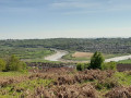
Lodge Hill Circular Walk in Caerleon. Mostly rural paths with some stiles and kissing gates. Some steep sections. Spectacular views from the high ground over the River Usk and the City of Newport. Look out for the distinct Lodge Hill Circular Walk Waymark Disc.
Gwent Levels
9.30 mi
+16 ft
-16 ft
4h 15
 Easy
Departure from Nash (Newport)
Easy
Departure from Nash (Newport)
NewportWetlands Reserve is a nationally important haven for wildlife and is a designated National Nature Reserve. There is an amazing variety of wild birds, wildlife and flora.
An exhilarating mostly level walk on hard surface paths around the reserve. Generally flat rural footpaths with stiles and gates to negotiate as you leave the reserve. Walkers are encouraged to find an alternative route between point 2 and 3 during the nesting season.
Rhiwderin
4.26 mi
+689 ft
-669 ft
2h 35
Easy
Departure from Graig (Newport)
Mostly rural paths, woodland tracks with some steep climbs, stiles and gates to negotiate. Enjoy great views over the rolling countryside around Machen. Look out for the distinct Rhiwderin Circular Walk Waymark Disc.
Llanwern Hill
 3.11 mi
+161 ft
-177 ft
1h 35
Moderate
Departure from Bishton (Newport)
3.11 mi
+161 ft
-177 ft
1h 35
Moderate
Departure from Bishton (Newport)
An exhilarating walk with some steep inclines and declines requiring sturdy footwear but there are fine views along the way.
Langstone-Penhow
8.94 mi
+1,171 ft
-1,171 ft
5h 10
Easy
Departure from Langstone (Newport)
Mostly rural paths with some stiles, kissing gates and steep climbs with fantastic views over Wentwood and surrounding countryside.
Look out for the distinct Langstone-Penhow Circular Walk Waymark Disc.
Castleton
7.00 mi
+364 ft
-377 ft
3h 30
Moderate
Departure from Marshfield (Newport)
Mostly rural paths with some stiles and kissing gates with spectacular views over the Gwent Levels and Severn Estuary. Roadside parking in Castleton.
Look out for the distinct Castleton Circular Walk Waymark Disc.
Michaelstone-y-Fedw
5.59 mi
+351 ft
-341 ft
2h 55
Moderate
Departure from Michaelston-y-Vedw (Newport)
Michaelstone-y-Fedw Circular Walk. Rural footpaths through woodland and pasture with some steep sections.
Stiles and gates to negotiate. Look out for the distinct Michaelstone-y-Fedw Circular Walk Waymark Disc.
For more walks, use our search engine .
The GPS track and description are the property of this route's author. Please do not copy them without permission.

