


Rothesay to Rhubodach (West Island Way)
For full details visit gillianswalks.com (walk 257)
This walk is part of a multi-day hike: West Island Way
Details
Creation:
Last update:
-
 Activity: Walking
 -
 Distance: 8.67 mi
 -
 Duration calculated by the app: 6h 39
 -
 Difficulty: Moderate
 -
-
 Back to start: No
 -
 Ascent: + 1,135 ft
 -
 Descent: - 1,135 ft
 -
-
 Highest point: 860 ft
 -
 Lowest point: 3 ft
-
 Country:
United Kingdom
Country:
United Kingdom
-
 City:
North Ayshire
City:
North Ayshire -
 Start: N 55.837803° / W 5.053073°
 -
 End: N 55.920298° / W 5.15847°
 -


 Hour-by-hour weather


Waypoints
- S : mi 0 - alt. 20 ft
- 1 : mi 1.48 - alt. 243 ft - Kissing gate
- 2 : mi 1.93 - alt. 243 ft - Left at big metal gate
- 3 : mi 2.08 - alt. 262 ft - Gate
- 4 : mi 2.36 - alt. 299 ft - Trees down - detour around
- 5 : mi 3.09 - alt. 52 ft - Down roadside pavement
- 6 : mi 3.64 - alt. 59 ft - Keep right at fork, signpost Hilton
- 7 : mi 3.92 - alt. 276 ft - Right, through gate and along boardwalk
- 8 : mi 4.97 - alt. 794 ft - Stile
- 9 : mi 6.35 - alt. 531 ft - Stile
- E : mi 8.67 - alt. 13 ft
Other walks in the area
Rothesay Town
 Visorando Member
 1.71 mi
+154 ft
-148 ft
0h 55
1.71 mi
+154 ft
-148 ft
0h 55
 Easy
Departure from North Ayshire
Easy
Departure from North Ayshire
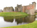
This is a short circular route which has a steep incline halfway through. It links the main areas of interest in Rothesay with a woodland and seafront stroll allowing views across Rothesay Bay.
Toward Point and Toward Quay, Cowal Peninsula
 3.86 mi
+49 ft
-49 ft
1h 50
Easy
Departure from Argyll and Bute
3.86 mi
+49 ft
-49 ft
1h 50
Easy
Departure from Argyll and Bute
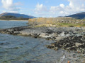
This walk connects the highlights of Toward on the Cowal Peninsula in Argyle and Bute. It includes a coastal walk, ruins, a lighthouse and small quay. The views along the coast are breath-taking.
Millport Inner Circuit, Isle of Cumbrae
 Tourism professional
 6.97 mi
+528 ft
-545 ft
3h 40
Easy
Departure from North Ayshire
6.97 mi
+528 ft
-545 ft
3h 40
Easy
Departure from North Ayshire
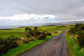
Starting at the ferry slip on the Isle of Cumbrae, you will head uphill to the Glaid Stone, the island’s highest point, before descending into Millport. From here you walk back via the quiet Ferry Road. Along the way enjoy the views across to the Isle of Bute, Isle of Arran, Little Cumbrae and the hills of Ayrshire. You will pass several small lochs, a mineral well and the Cathedral of the Isles (Britain’s smallest cathedral). Not forgetting the famous Crocodile Rock!
Knock Hill Circular from Largs
 8.05 mi
+840 ft
-823 ft
4h 25
Moderate
Departure from North Ayshire
8.05 mi
+840 ft
-823 ft
4h 25
Moderate
Departure from North Ayshire
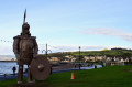
By combining the High and Low route options of the Ayrshire Coastal Path at Largs, you can create this circular route to the top of Knock Hill (268m / 879 ft) and back again. Enjoy panoramic views across the Firth of Clyde to the Cowal Peninsula, southern Highlands, Isle of Cumbrae and Arran, as well as down into the town of Largs itself.
Largs to Skelmorlie via Knock Hill
 10.76 mi
+1,030 ft
-1,014 ft
5h 50
Moderate
Departure from North Ayshire
10.76 mi
+1,030 ft
-1,014 ft
5h 50
Moderate
Departure from North Ayshire
Beginning at Largs Marina this route takes you the length of the promenade before heading inland and uphill across boggy ground towards Knock Hill. From the trig point on a clear day your efforts will be rewarded with beautiful views across the Clyde towards the isles of Cumbrae, Bute and Arran, as well as the Argyll hills and Cowal Peninsula. From here you head for Skelmorlie - the official end point of the Ayrshire Coastal Path, passing the Secret Bunker and Skelmorlie Castle en route.
Kaim Hill, Clyde Muirshiel Regional Park
5.76 mi
+1,312 ft
-1,309 ft
4 hrs
 Very difficult
Departure from North Ayshire
Very difficult
Departure from North Ayshire
This circular route offers outstanding views of the Firth of Clyde – on a clear day the views to Great Cumbrae, Wee Cumbrae, Arran and Ailsa Craig, make it well worth the walk to the summit. Whatever the weather there are fascinating Neolithic rock markings and remains of an old millstone quarry.
Fairlie Glens and Waterfalls Circular
 4.76 mi
+607 ft
-614 ft
2h 45
Moderate
Departure from North Ayshire
4.76 mi
+607 ft
-614 ft
2h 45
Moderate
Departure from North Ayshire
On a clear day the views from this route are simply outstanding: the islands of Cumbrae & Arran and the pink sandy beaches at Fairlie and Hunterston. A variety of woodland paths, tracks and grassy hillsides lead you gently uphill past the remains of Fairlie Castle and along the base of Black Hill. The return section follows the Fairlie Moor Road and then the Ayrshire Coastal Path. There is the opportunity to visit some hidden waterfalls along the route.
Loch Thom, Clyde Muirshiel Regional Park
5.45 mi
+194 ft
-200 ft
2h 40
Easy
Departure from Inverclyde
Circumnavigate Inverclyde’s largest loch with fine views across the Parks moorlands and hills. First known as the Great Reservoir or Little Caspian, it was later renamed in honour of the engineer who designed the Greenock Cut, Robert Thom.
For more walks, use our search engine .
The GPS track and description are the property of this route's author. Please do not copy them without permission.

