


Fereneze Braes from Barrhead
More info at https://gillianswalks.com/2024/09/04/fereneze_braes/
Details
Creation:
Last update:
-
 Activity: Walking
 -
 Distance: 4.89 mi
 -
 Duration calculated by the app: 3h 04
 -
 Difficulty: Moderate
 -
-
 Back to start: Yes
 -
 Ascent: + 558 ft
 -
 Descent: - 541 ft
 -
-
 Highest point: 696 ft
 -
 Lowest point: 167 ft
-
 Country:
United Kingdom
Country:
United Kingdom
-
 City:
East Renfrewshire
City:
East Renfrewshire -
 Start/End: N 55.803598° / W 4.39744°
 -


 Hour-by-hour weather


Waypoints
- S/E : mi 0 - alt. 167 ft
- 1 : mi 0.79 - alt. 499 ft - Turn right at fork
- 2 : mi 1.04 - alt. 568 ft - Keep left
- 3 : mi 1.06 - alt. 568 ft - Left to come off golf course
- 4 : mi 1.14 - alt. 591 ft - Go through kissing gate then turn right
- 5 : mi 1.27 - alt. 584 ft - Turn left off main track
- 6 : mi 1.43 - alt. 640 ft - Kissing gate - access to viewpoint
- 7 : mi 1.68 - alt. 692 ft - Cairn
- 8 : mi 1.94 - alt. 636 ft - Boardwalk
- 9 : mi 2.14 - alt. 663 ft - Go through gate, continue in same direction betwee
- 10 : mi 2.43 - alt. 633 ft - Turn left along fence
- 11 : mi 2.62 - alt. 656 ft - Continue straight on at crossroads
- 12 : mi 3.07 - alt. 443 ft - Turn right at end of path
- 13 : mi 3.28 - alt. 305 ft - Turn left on road
- S/E : mi 4.89 - alt. 167 ft
Other walks in the area
Duncarnock Fort (The Craigie) from Neilston
 Tourism professional
 4.84 mi
+305 ft
-315 ft
2h 30
4.84 mi
+305 ft
-315 ft
2h 30
 Easy
Easy
 Departure from East Renfrewshire
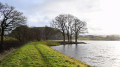
Duncarnock Fort (known locally as The Craigie) is a craggy hill (204 m / 669 ft) which stands invitingly on the banks of Glanderston Dam. Pausing on the summit of what was formerly an iron age fort, take a moment to wonder about it’s history and all that may have happened here many years ago! On a clear day, just as Mary Queen of Scots is rumoured to have done, you will enjoy panoramic views over greater Glasgow extending to the Campsies in the north.
Lochgoin Circuit, Whitelee Windfarm
 7.87 mi
+276 ft
-276 ft
3h 50
Easy
Departure from East Renfrewshire
7.87 mi
+276 ft
-276 ft
3h 50
Easy
Departure from East Renfrewshire
An easy 7 mile circuit around Whitelee Windfarm’s Lochgoin Reservoir. The route is way-marked meaning that navigation is simple and underfoot is a mixture of loose stones and grass. Look out for Dunwan Dam and take a detour to Blackwood Hill Viewpoint, from which on a clear day you will be able to see as far as the Isle of Arran and Ben Lomond.
Greggs, Parade, Drygate circuit
 Visorando Member2.38 mi
+79 ft
-85 ft
1h 10
Easy
Departure from Glasgow
Visorando Member2.38 mi
+79 ft
-85 ft
1h 10
Easy
Departure from Glasgow
An easy urban circuit around Dennistoun starting from Greggs on Duke Street. Along Alexandra Parade to the Royal then down towards Drygate. Back on to Duke street past the brewery to complete the circuit.
Parkhill Wood, Castle Semple Country Park
 Association / Club / Walk leader
 2.41 mi
+226 ft
-253 ft
1h 20
Moderate
Departure from Renfrewshire
2.41 mi
+226 ft
-253 ft
1h 20
Moderate
Departure from Renfrewshire
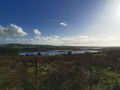
A pulse raising woodland walk suitable for those interested in increasing their heart rate!
Kenmure Hill, Clyde Muirshiel Regional Park
 6.04 mi
+276 ft
-279 ft
3h 00
Moderate
Departure from Renfrewshire
6.04 mi
+276 ft
-279 ft
3h 00
Moderate
Departure from Renfrewshire
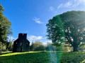
Climb the iconic Temple hill to see the remnants of the 18th Century Georgian designed landscape. Fabulous views across the historic Castle Semple estate and rural Renfrewshire.
Johnshill Loop, Clyde Muirshiel Regional Park
2.61 mi
+200 ft
-187 ft
1h 20
Easy
Departure from Renfrewshire
A circular walk exploring Castle Semple Country Park’s Lochshore, Parkhill Wood and a wildflower meadow in Johnshill Field before returning through Lochwinnoch village.
Geilsland and Spiers Old School
0.81 mi
+23 ft
-23 ft
0h 25
Easy
Departure from North Ayshire
A short circular woodland walk through Geilsland Country Estate and Spiers Old School Grounds.
Stewarton to Dunlop
 7.27 mi
+289 ft
-207 ft
3h 35
Easy
Departure from East Ayrshire
7.27 mi
+289 ft
-207 ft
3h 35
Easy
Departure from East Ayrshire
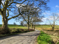
A lovely peaceful walk between the two villages of Stewarton and Dunlop. After a short section through Lainshaw Woods the remainder of the walk uses quiet single track roads before an optional de-tour through the Millennium Woodland Nature Park in Dunlop. There are a few hills on this route, the reward being stunning views across to the Isle of Arran, Ailsa Craig and north to Ben Lomond if it is a clear day!
For more walks, use our search engine .
The GPS track and description are the property of this route's author. Please do not copy them without permission.

